
List of municipalities in Sussex County, New Jersey facts for kids

Sussex County, located in New Jersey, is home to twenty-four different local areas called municipalities. Think of a municipality as a town or a local government area. These areas are set up in different ways, according to New Jersey's laws. In Sussex County, you'll find one town, eight boroughs, and fifteen townships.
In 2010, a big count of people called the Federal decennial census showed that 149,265 people lived in Sussex County. This was a small increase from the 144,166 people counted in 2000. The number of people living in these areas can be very different. For example, Vernon Township is the largest with 23,943 residents, while Walpack Township is much smaller with only 16 residents. The size of these areas also varies a lot, from Branchville Borough, which is tiny at about 0.6 square miles, to Vernon Township, which is huge at about 70.59 square miles.
Sussex County was first created on June 8, 1753. It was formed from the northern and western parts of Morris County. Back then, it included the land that is now both Sussex County and Warren County (which was created later in 1824). This original large county was bordered by the Delaware River, the Musconetcong River, the New York-New Jersey border, and a line from Lake Hopatcong.
In 1753, Sussex County had four main "precincts" (which were like large districts): Walpack, Greenwich, Hardwick, and Newtown. Over time, these large precincts were divided again and again. This is how the 24 municipalities we see today in Sussex County, and 22 in Warren County, were formed.
A special law on November 20, 1824, officially created Warren County. It took the southern half of Sussex County. This division meant that some parts of Hardwick Township and Walpack Township became new areas in Warren County.
Another old boundary line, called the Lawrence Line, was drawn in 1743. This line is still used today as part of the borders for four Sussex County municipalities. It was created to settle a long-standing argument about how to divide New Jersey into two parts: West Jersey and East Jersey. This line separates Walpack Township from Sandyston Township, and Stillwater Township from Hampton Township.
List of Municipalities
Here is a list of the municipalities in Sussex County:
| Municipality | Type | When it became a municipality | Created from | Area (sq mi) | Population (2010) |
|---|---|---|---|---|---|
| Andover Borough | Borough | March 25, 1904 by law |
Andover Township | 1.47 square miles (3.8 km2) | 606 |
| Andover Township | Township | April 11, 1864 by law |
Newton Township | 20.68 square miles (53.6 km2) | 6,319 |
| Branchville Borough | Borough | March 9, 1898 by law |
Frankford Township | 0.6 square miles (1.6 km2) | 841 |
| Byram Township | Township (council–manager) |
April 9, 1798 by law |
Newton Township | 22.26 square miles (57.7 km2) | 8,350 |
| Frankford Township | Township | April 10, 1797 by law |
Newton Township | 35.44 square miles (91.8 km2) | 5,565 |
| Franklin Borough | Borough | April 23, 1913 by law and vote |
Hardyston Township | 4.57 square miles (11.8 km2) | 5,045 |
| Fredon Township | Township | February 24, 1904 by law |
from Andover, Green, Hampton and Stillwater townships | 18.00 square miles (46.6 km2) | 3,437 |
| Green Township | Township | December 27, 1824 by law |
Hardwick and Independence townships |
16.26 square miles (42.1 km2) | 3,601 |
| Hamburg Borough | Borough | April 24, 1920 by law and vote |
Hardyston Township | 1.165 square miles (3.02 km2) | 3,277 |
| Hampton Township | Township | April 11, 1864 by law |
Newton Township | 25.30 square miles (65.5 km2) | 5,196 |
| Hardyston Township | Township (Special Charter) |
February 25, 1762 by royal charter |
Newton Township | 32.64 square miles (84.5 km2) | 8,213 |
| Hopatcong Borough | Borough | March 24, 1898 by law |
Byram Township | 12.25 square miles (31.7 km2) | 15,147 |
| Lafayette Township | Township | April 14, 1845 by law |
Frankford and Newton townships | 18.05 square miles (46.7 km2) | 2,538 |
| Montague Township | Township | March 26, 1759 by colonial courts |
Walpack Township | 45.38 square miles (117.5 km2) | 3,847 |
| Newton | Town (council–manager) |
April 11, 1864 by law |
Newton Township | 3.17 square miles (8.2 km2) | 7,997 |
| Ogdensburg Borough | Borough | March 31, 1914 by law and vote |
Sparta Township | 2.33 square miles (6.0 km2) | 2,410 |
| Sandyston Township | Township | February 26, 1762 by royal charter |
Walpack Township | 43.26 square miles (112.0 km2) | 1,998 |
| Sparta Township | Township (council–manager) |
April 14, 1845 by law |
Byram, Frankford, Hardyston, and Newton townships | 38.97 square miles (100.9 km2) | 19,722 |
| Stanhope Borough | Borough | March 24, 1904 by law |
Byram Township | 2.19 square miles (5.7 km2) | 3,610 |
| Stillwater Township | Township | December 27, 1824 by law |
Hardwick Township | 28.39 square miles (73.5 km2) | 4,099 |
| Sussex Borough | Borough | October 14, 1891 by vote |
Wantage Township | 0.62 square miles (1.6 km2) | 2,130 |
| Vernon Township | Township (council–manager) |
April 8, 1793 by law |
Hardyston Township | 70.59 square miles (182.8 km2) | 23,943 |
| Walpack Township | Township | c. 1731 | unincorporated wilderness | 24.70 square miles (64.0 km2) | 16 |
| Wantage Township | Township | May 30, 1754 by colonial courts |
Newton Township | 67.48 square miles (174.8 km2) | 11,358 |
Former Municipalities
Some municipalities that once existed in Sussex County no longer do. They were either divided into new areas or merged.
| Municipality | When it became a municipality | When it stopped existing | Area (approximate) | Notes |
|---|---|---|---|---|
| Newton Township | March 27, 1751 by colonial courts |
April 11, 1864 by division |
approx. 360 square miles (930 km2) | This area was created from New Jersey's wild lands. It was one of the first four large districts that formed Sussex County in 1753. From 1754 to 1864, it was divided many times to create 9 new municipalities. It was the original area for 18 of Sussex County's current 24 municipalities. It stopped existing after its final division in 1864, which created the Town of Newton, Andover Township, and Hampton Township. |
See also
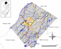
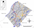
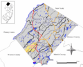
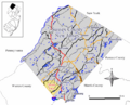
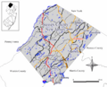
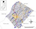
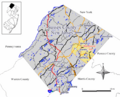
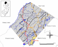
Images for kids
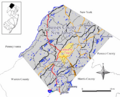
-
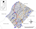
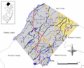
Map of Andover Borough
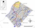
-
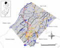
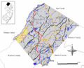
Map of Andover Township
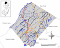
-
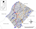
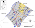
Map of Branchville Borough
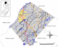
-
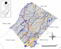
Map of Byram Township
-
Map of Frankford Township
-
Map of Franklin Borough
-
Map of Fredon Township
-
Map of Green Township
-
Map of Hamburg Borough
-
Map of Hampton Township
-
Map of Hardyston Township
-
Map of Hopatcong Borough
-
Map of Lafayette Township
-
Map of Montague Township
-
Map of Newton
-

Map of Ogdensburg Borough
-
Map of Sandyston Township
-
Map of Sparta Township
-
Map of Stanhope Borough
-
Map of Stillwater Township
-
Map of Sussex Borough
-
Map of Vernon Township
-
Map of Walpack Township
-
Map of Wantage Township


