Hamburg, New Jersey facts for kids
Quick facts for kids
Hamburg, New Jersey
|
||
|---|---|---|
|
Borough
|
||
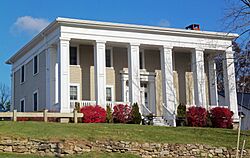
Lawrence Mansion in Hamburg, New Jersey
|
||
|
||
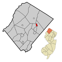
Map of Hamburg in Sussex County. Inset: Location of Sussex County in New Jersey.
|
||
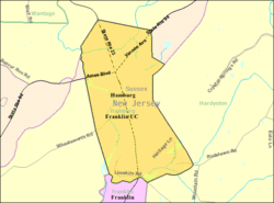
Census Bureau map of Hamburg, New Jersey.
|
||
| Country | ||
| State | ||
| County | ||
| Incorporated | April 24, 1920 | |
| Named for | Hamburg, Germany | |
| Government | ||
| • Type | Borough | |
| • Body | Borough Council | |
| Area | ||
| • Total | 1.17 sq mi (3.03 km2) | |
| • Land | 1.15 sq mi (2.96 km2) | |
| • Water | 0.02 sq mi (0.06 km2) 2.05% | |
| Area rank | 491st of 565 in state 22nd of 24 in county |
|
| Elevation | 538 ft (164 m) | |
| Population
(2020)
|
||
| • Total | 3,266 | |
| • Estimate
(2023)
|
3,331 | |
| • Rank | 437th of 565 in state 16th of 24 in county |
|
| • Density | 2,853.1/sq mi (1,101.6/km2) | |
| • Density rank | 228th of 565 in state 2nd of 24 in county |
|
| Time zone | UTC−05:00 (Eastern (EST)) | |
| • Summer (DST) | UTC−04:00 (Eastern (EDT)) | |
| ZIP Code |
07419
|
|
| Area code(s) | 973 | |
| FIPS code | 3403729220 | |
| GNIS feature ID | 885241 | |
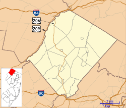
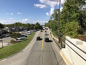
Hamburg is a small town, called a borough, located in Sussex County, in the state of New Jersey. In 2020, about 3,266 people lived here. By 2023, the population grew a little to about 3,331 people.
Contents
History of Hamburg
Hamburg has an interesting history that goes back a long time. In 1753, the area that is now Hamburg was part of a larger place called New Town. Later, in 1762, it became part of Hardyston Township.
Over the years, the boundaries changed a few times. In 1793, Hamburg was part of Vernon Township. Then, in 1852, it moved back to Hardyston Township. Finally, on March 19, 1920, Hamburg officially became its own borough. This happened after people voted for it on April 24, 1920. The borough was named after the city of Hamburg, Germany.
About Hamburg's Location
Hamburg is a small place. It covers about 1.17 square miles (3.03 square kilometers). Most of this area is land, and a small part is water.
Hamburg is surrounded by other towns in Sussex County. It shares borders with Franklin and Hardyston Township.
People of Hamburg
| Historical population | |||
|---|---|---|---|
| Census | Pop. | %± | |
| 1880 | 412 | — | |
| 1890 | 519 | 26.0% | |
| 1930 | 1,160 | — | |
| 1940 | 1,116 | −3.8% | |
| 1950 | 1,305 | 16.9% | |
| 1960 | 1,532 | 17.4% | |
| 1970 | 1,820 | 18.8% | |
| 1980 | 1,832 | 0.7% | |
| 1990 | 2,566 | 40.1% | |
| 2000 | 3,105 | 21.0% | |
| 2010 | 3,277 | 5.5% | |
| 2020 | 3,266 | −0.3% | |
| 2023 (est.) | 3,331 | 1.6% | |
| Population sources: 1880–1890 1930 1940–2000 2000 2010 2020 |
|||
The number of people living in Hamburg has changed over the years. In 2010, there were 3,277 people. These people lived in 1,364 homes. About 884 of these homes were families.
Most people in Hamburg are White (about 91%). There are also people who are Black or African American, Native American, and Asian. About 7% of the population is Hispanic or Latino.
About 22.5% of the people are under 18 years old. The average age in Hamburg is about 38.9 years old.
Education in Hamburg
Students in Hamburg attend public schools.
Hamburg School District
Younger students, from kindergarten through eighth grade, go to the Hamburg School. In the 2018–19 school year, there were 243 students and about 29 teachers. This means there were about 8 students for every teacher.
Wallkill Valley Regional High School
For high school, students from Hamburg go to Wallkill Valley Regional High School. This high school also serves students from Franklin Borough, Hardyston Township, and Ogdensburg Borough. In the 2018–19 school year, the high school had 604 students and 56 teachers. This means there were about 10 students for every teacher.
Getting Around Hamburg
Hamburg has several roads that help people get around. There are about 11 miles of roads in total. Most of these roads are taken care of by the town itself.
Two main roads, Route 23 and Route 94, go through Hamburg.
For public transportation, Hamburg has a bus service called Sussex County Skylands Ride Service. This service provides buses to nearby towns like Newton, Sparta, and Sussex.
Local Wineries
Hamburg is home to a local winery.
Famous People from Hamburg
Many interesting people have lived in or are connected to Hamburg. Here are a few:
- Joseph E. Edsall (1789–1865) was a politician who served in the United States House of Representatives.
- Daniel Haines (1801–1877) was a politician and lawyer who became the Governor of New Jersey.
- Robert Hamilton (1809–1878) also served in the United States House of Representatives.
- Heather Maloney (born 1985) is a singer-songwriter.
- Andrew J. Rogers (1828–1900) was another person who served in the United States House of Representatives.
- Joseph Sharp (around 1709–1776) was an important iron maker. He started an iron works that made the area known as Sharpsborough.
See also
 In Spanish: Hamburg (Nueva Jersey) para niños
 | Jackie Robinson |
 | Jack Johnson |
 | Althea Gibson |
 | Arthur Ashe |
 | Muhammad Ali |


