Wallkill River facts for kids
Quick facts for kids Wallkill River |
|
|---|---|
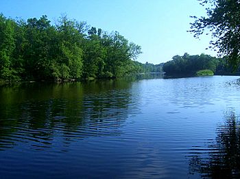
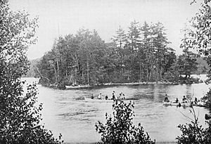
Islands in the river near Walden, NY
|
|
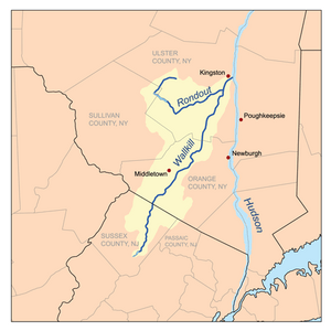
The combined watersheds of the Wallkill and Rondout Creek
|
|
| Native name | Twischsawkin |
| Country | United States |
| State | New York, New Jersey |
| Counties | Ulster, NY, Orange, NY, Sussex, NJ |
| Cities | New Paltz, NY, Walden, NY, Montgomery, NY, Sparta, NJ |
| Physical characteristics | |
| Main source | Lake Mohawk, New Jersey Sparta, Sussex County, NJ 720 ft (220 m) 41°01′58″N 74°38′38″W / 41.03278°N 74.64389°W |
| River mouth | Rondout Creek Rifton, Ulster County, NY 0 ft (0 m) 41°51′13″N 74°02′55″W / 41.85361°N 74.04861°W |
| Length | 88 mi (142 km) |
| Basin features | |
| Basin size | 785 sq mi (2,030 km2) |
| Tributaries |
|
The Wallkill River is a river that flows through New Jersey and New York. It starts at Lake Mohawk, New Jersey in Sparta, New Jersey. From there, it flows about 88 miles (142 km) generally north. The river eventually joins Rondout Creek in New York. The combined waters then flow into the Hudson River near Kingston.
The Wallkill River is quite special because it flows north. This is unusual since two much larger rivers nearby, the Hudson and the Delaware River, both flow south. Another interesting fact is that the Wallkill River flows into a creek. This happens because the river is held back by a dam just before it meets the Rondout Creek. This creates a small body of water called Sturgeon Pool.
Contents
The Wallkill River's Journey
The Wallkill River flows through a wide valley located between the main Appalachian Mountains and the New York-New Jersey Highlands. This valley is very good for agriculture. It is part of a larger area called the Great Appalachian Valley.
The river begins its journey by draining the eastern part of Sussex County, New Jersey. It then flows through the Wallkill River National Wildlife Refuge near the New Jersey and New York border. Most of the river in New Jersey is calm enough for canoeing.
As the river enters New York, it flows through the "Black Dirt Region" in Warwick. This area used to be called the "Drowned Lands" because it was often flooded. The river's water is used a lot here for farming.
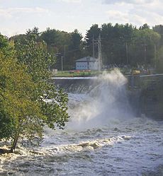
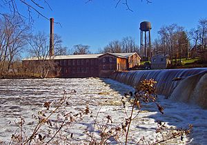
Further north, the river gives its name to the town of Wallkill in Orange County. It then gains more water as it passes by Orange County Airport, Montgomery, and Walden. In Walden, dams were built long ago to create power for local businesses. The largest dam there is still used by New York State Electric and Gas today.
The Wallkill River briefly forms the border between Orange and Ulster counties. It then flows past Wallkill, another community named after the river. The beautiful Shawangunk Ridge can be seen as the river winds past the Ulster County Fairgrounds and New Paltz. Here, the river's floodplain (the flat land next to it that can flood) becomes much wider before it reaches the Rondout Creek.
The Wallkill River often crosses political borders instead of forming them. In New Jersey, it divides several townships. In New York, it briefly separates Orange and Ulster counties. In southern Orange County, it divides towns like Minisink and Wawayanda from Warwick and Goshen. Parts of the villages of Montgomery and New Paltz are also bordered by the river.
Two school districts are named after the river: Wallkill Valley Regional School District in New Jersey and Wallkill Central in New York. The Valley Central also gets its name indirectly from the river.
A Look Back: Wallkill River History
Long ago, Native Americans called the river Twischsawkin. They found at least three ancient rock shelters in the area. The river and its valley were important to them not just for good farmland, but also for their natural resources. The area had a lot of flint and chert, which Native Americans used to make spear points and arrowheads.
When European settlers arrived, they first named the river the Palse River, after New Paltz. Later, they realized the river went much further. So, they named it after the Waal river in their home country, the Netherlands. Dutch settlers moved down the river from the Hudson Valley in the 1600s, followed by the British.
The settlers quickly saw that the "Drowned Lands" had great potential for farming. People started trying to change the river's path to create more farmland as early as 1760. It took 66 years for a canal to successfully drain the land. This made enough land available for profitable farming.
Around that time, businesses also began to use the river's power. Jacob Walden built his mill in the village that would later be named after him. For many decades, mill owners in the Black Dirt Region argued with farmers. This conflict was even called the "Muskrat and Beaver Wars." Millers needed the water to flow freely for their mills, while farmers wanted to keep it diverted for their crops. In 1871, the farmers finally won. Any new industries were then built in Montgomery and Walden, where railroads were nearby.
In Ulster County, people used to visit the Springtown area of New Paltz in the late 1800s and early 1900s. They came to the Wallkill River for fun and to escape the summer heat. Many of the large old homes on Springtown Road were once boarding houses for these visitors.
In August 1955, the river experienced its biggest flood ever. This happened when hurricanes Connie and Diane brought very heavy rain. More recently, in April 2007, heavy rain from a nor'easter caused the river and its smaller streams to flood. This led to many road closures and forced people to leave their homes in the flood plain in central Orange County.
Keeping the Wallkill River Clean
Over the past few decades, many groups have worked hard to clean up the Wallkill River.
Around the year 2000, a group called the Wallkill River Task Force was created. It included people from both Ulster and Orange counties. This group brought together farmers, business owners, and regular citizens. They worked with government and conservation agencies to protect the Wallkill River and the land around it.
One important result of the Task Force's work was a plan for conserving and managing the river. Another group, Riverkeeper, has a water-quality program. They test water samples from many places along the river. Citizen-scientists, who are volunteers, help them with this important work.
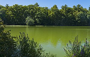
In late summer 2016, the Wallkill River Watershed Alliance and Riverkeeper found a large blue-green algae bloom. This type of algae can be harmful to people and pets. They warned the public about it. After samples were tested, New York's Department of Environmental Conservation confirmed that it was a harmful algae bloom with high levels of toxins. Riverkeeper then asked government officials to find out what was causing these algae blooms.
Wallkill River's Feeder Streams
The Wallkill River has many smaller streams that flow into it. In New York alone, there are 69 of these feeder streams, and 30 of them have names.
Here are some of the named streams, listed from south to north (moving downriver):
- Wildcat Brook
- Clove Brook
- West Branch Papakating Creek
- Neepaulakating Creek
- Papakating Creek
- Beaver Run
- Pochuck Creek
- Wawayanda Creek
- Rutgers Creek
- Monhagen Brook
- Quaker Creek
- Masonic Creek
- Mannayunk Kill
- Muddy Kill
- Tin Brook
- Dwaar Kill
- Shawangunk Kill
- Plattekill Creek
- Saw Mill Brook
- Tributary 13/Mill Brook
- Kleine Kill
 | DeHart Hubbard |
 | Wilma Rudolph |
 | Jesse Owens |
 | Jackie Joyner-Kersee |
 | Major Taylor |


