Montgomery (village), New York facts for kids
Quick facts for kids
Montgomery, New York
|
||
|---|---|---|
|
||
|
||
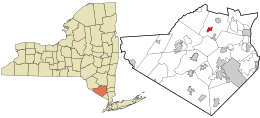
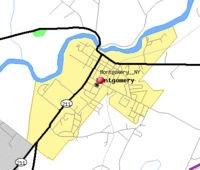
Location in Orange County and the state of New York.
|
||
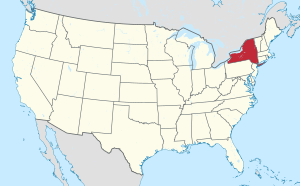
Location of New York in the United States
|
||
| Country | United States | |
| State | New York | |
| County | Orange | |
| Incorporated as a village | 1810 | |
| Named for | Richard Montgomery | |
| Area | ||
| • Total | 1.45 sq mi (3.75 km2) | |
| • Land | 1.41 sq mi (3.64 km2) | |
| • Water | 0.04 sq mi (0.11 km2) | |
| Elevation | 380 ft (120 m) | |
| Highest elevation
(Water tower off Purple Martin Road)
|
455 ft (139 m) | |
| Lowest elevation
(Along river)
|
340 ft (100 m) | |
| Population
(2020)
|
||
| • Total | 3,834 | |
| • Density | 2,726.88/sq mi (1,053.11/km2) | |
| Time zone | UTC-5 (EST) | |
| • Summer (DST) | UTC-4 (EDT) | |
| ZIP Code |
12549
|
|
| Area code(s) | 845 | |
| FIPS code | 36-48142 | |
| GNIS feature ID | 0957558 | |
| Website | Village of Montgomery, NY | |
Montgomery is a small village in Orange County, New York, United States. It's about 60 miles northwest of New York City and 90 miles southwest of Albany. This charming community is a historic and cultural spot in the Hudson Valley area. Over the last 30 years, it has grown into a suburb for people working in the larger New York metropolitan area.
In 2020, about 3,834 people lived here. The village is named after General Richard Montgomery, a hero from the American Revolution. The Village of Montgomery is located inside the larger Town of Montgomery.
Contents
Village History
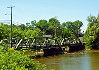
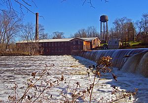
The village was first called Ward's Bridge. This name came from James Ward, one of the first settlers. He built and ran a grist mill (a mill for grinding grain) in the area in the mid-1700s. A bridge over the Wallkill River near his mill was named after him. Even today, this bridge carries Route NY-17K into the village.
Geography of Montgomery
The village of Montgomery covers about 1.5 square miles (3.8 square kilometers). Most of this area is land (1.4 square miles or 3.6 square kilometers). The rest is water (0.1 square mile or 0.2 square kilometers).
The Wallkill River forms the northern edge of Montgomery. Most of the water in the village comes from this river. The village is completely surrounded by the Town of Montgomery.
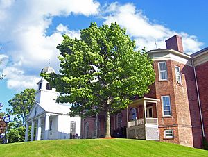
The village stretches southwest from the river for almost two miles. Its main area, called downtown, is located around its historic center. This includes the Bridge Street and Union Street-Academy Hill areas. Clinton Street, one block south of Ward Street (NY-17K), has many shops and restaurants.
Further east, you can find larger businesses near the old Wallkill Valley Railroad (WVRR) tracks. These tracks are still used for freight trains today. Away from downtown, the streets are mostly homes, including newer houses. There are also some undeveloped areas at the north and south ends of the village. The southern part has active farms.
To the west of downtown, near the river, is Veteran's Memorial Park. This area is the lowest part of the village. The land generally rises gently from the river. The highest point in the village is a 455-foot (139-meter) hill. It is marked by a water tower at the corner of Purple Martin Road and Cardinal Drive.
Getting Around Montgomery
Route 17K goes east to Newburgh and west to Bloomingburg. In Bloomingburg, it connects to NY 17. The main intersection in Montgomery is where Route 17K meets Union Street. This is the only traffic light in the village. Union Street is also the start of NY-211, which goes southwest to Middletown.
Just south of the village, NY-416 branches off from Route 211. This road leads to Goshen via NY-207.
Interstate 84 is close to the southeast of Montgomery. You can reach it from Exit 5 by taking Route 17K or Goodwill Road east to NY 208. From there, it's about a six-mile drive to the New York State Thruway (Interstate 87). The Thruway is the closest major north-south highway. New York City is about 58 miles south of Newburgh on the Thruway.
The closest passenger rail station is Campbell Hall. It's about 7 miles southwest of Montgomery. This station is on Metro-North's Port Jervis Line. It offers commuter rail service to the Hoboken Terminal in New Jersey. Many people also use the Beacon station, which is 17 miles east of Montgomery, to travel to Midtown Manhattan.
Orange County Airport (KMGJ) is just south of the village. For commercial flights, Stewart International Airport is located outside Newburgh. It's a short drive east via I-84.
Population and People
| Historical population | |||
|---|---|---|---|
| Census | Pop. | %± | |
| 1870 | 960 | — | |
| 1880 | 935 | −2.6% | |
| 1890 | 1,024 | 9.5% | |
| 1900 | 973 | −5.0% | |
| 1910 | 941 | −3.3% | |
| 1920 | 900 | −4.4% | |
| 1930 | 884 | −1.8% | |
| 1940 | 844 | −4.5% | |
| 1950 | 1,063 | 25.9% | |
| 1960 | 1,312 | 23.4% | |
| 1970 | 1,533 | 16.8% | |
| 1980 | 2,316 | 51.1% | |
| 1990 | 2,696 | 16.4% | |
| 2000 | 3,636 | 34.9% | |
| 2010 | 3,814 | 4.9% | |
| 2020 | 3,834 | 0.5% | |
| U.S. Decennial Census | |||
In 2000, there were 3,636 people living in Montgomery. There were 1,304 households and 971 families. The population density was about 2,616 people per square mile (1,010 per square kilometer).
About 39.8% of households had children under 18 living with them. Most households (60.7%) were married couples. About 28.9% of the population was under 18 years old. The average age in the village was 35 years.
The average income for a household was $52,407. For families, it was $59,952. About 7.0% of the population lived below the poverty line.
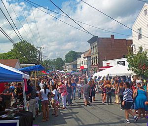
General Montgomery Day Celebration
Since 1989, the village has celebrated its annual General Montgomery Day. This event takes place on the Saturday after Labor Day. The day starts with a parade along Union Street to the village hall. There is also a 8-kilometer (5-mile) run.
Downtown streets are closed for the event. Vendors and local groups set up tents. Many visitors come from all over the Hudson Valley. Some years, as many as 30,000 people have attended! The day ends with fireworks in the evening at Pleasure Ground park.
Fire Protection Services
Montgomery has an all-volunteer Fire Department. It has been serving the community since 1810. It is the oldest volunteer fire department in Orange County. The department was started on March 6, 1810.
The Fire Department protects the people of the Village of Montgomery and parts of the Town of Montgomery. This covers almost 8,000 citizens. Their response area includes three large schools and the Wallkill River. They also cover many lakes, ponds, and the Orange County Airport.
The Montgomery Fire Department operates from one fire station at 136 Ward Street. They respond to many types of emergencies. These include vehicle accidents, medical calls, fires, and rescue incidents. They have several vehicles, including two engines, one ladder truck, and a heavy rescue vehicle.
Education in Montgomery
The village is part of the Valley Central School District (Montgomery).
See also
 In Spanish: Montgomery (villa) para niños
 | Calvin Brent |
 | Walter T. Bailey |
 | Martha Cassell Thompson |
 | Alberta Jeannette Cassell |


