Old Mine Road facts for kids
Quick facts for kids Old Mine Road |
|
|---|---|
| Lua error in Module:Infobox_road/map at line 15: attempt to index field 'wikibase' (a nil value). | |
| Route information | |
| Length | 104 mi (167 km) |
| Component highways |
|
| Major junctions | |
| South end | Columbia, NJ |
| North end | Kingston, NY |
| Location | |
| States: | New Jersey, New York |
| Highway system | |
The Old Mine Road is a special road in New Jersey and New York. People say it's one of the oldest roads in the USA that's still used today! It's about 104 miles (167 km) long.
This historic road goes from the Delaware Water Gap National Recreation Area all the way up to Kingston, New York.
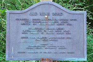
For a long time, people believed that Dutch miners built this road in the 1600s. The story was that they used it to carry copper from the Pahaquarry Copper Mine in New Jersey to Esopus, New York (a Dutch settlement) along the Hudson River. But today, many historians think this old story isn't quite true.
Dutch families did start settling along parts of the road in the late 1600s, especially near Kingston. The northern part of the road follows a path similar to the old Delaware and Hudson Canal. The southern part runs along the Delaware River in northwestern New Jersey.
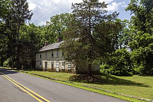
Today, much of the Old Mine Road in New York has been updated and is now part of US 209. But in New Jersey, the road still feels very old and rural. It goes through the Delaware Water Gap National Recreation Area. You can still see many old homes, farms, and churches that show the area's Dutch history.
Contents
History of Old Mine Road
Early People: Paleo-Indians and Lenape
About 13,000 years ago, a huge sheet of ice called the Wisconsin Glacier started to melt. As the land warmed up, new plants and big animals moved into the area.
The very first people to live here were called Paleo-Indians. They were hunter-gatherers, meaning they moved around a lot to find food. Scientists have found some of their old campsites along the Delaware River. The oldest one found so far dates back to 8900 BC.
Later, thousands of years ago, the Lenape Native Americans settled in this area. They were also hunter-gatherers, but they moved their camps with the seasons. They had villages, like one on Minisink Island, and trails along the Delaware River. These trails helped them travel and find places to hunt and fish.
Where Did the Road Come From?

The Old Mine Road probably started as a trail used by Paleo-Indians thousands of years ago. Later, the Lenape used these same trails. They were important for moving around and reaching hunting and fishing spots.
While the area near the Delaware Water Gap became connected to Kingston, New York by a road in the late 1600s, it wasn't fully developed until the early 1700s.
Many historians now believe the Dutch didn't build the Old Mine Road in the 1600s for mining. Here's why:
- There were several wars between the Dutch and Native Americans in the mid-1600s. It would have been too dangerous to build a road through the wilderness.
- The Dutch didn't have many people in the 1600s. Building a long road through thick forests would have needed many workers.
- No signs of Dutch mining camps have ever been found at the Pahaquarry Mine or along the road.
- Old maps from the 1700s don't show a road going to Pahaquarry. They show Native American trails that Europeans later used.
- The copper ore at Pahaquarry was very low quality. It would have been too hard and expensive to dig it out and carry it on rough roads with 17th-century tools. The Dutch already bought copper from Sweden.
So, it's very unlikely the Dutch built the Old Mine Road or mined copper at Pahaquarry.
Early Settlements and Forts
The first European settlement in this area was near what is now Port Jervis, New York. A blacksmith bought land from the Lenape people there in 1698. The Lenape valued his metalworking skills. After that, more English settlers bought land in the region.
During the French and Indian Wars in the mid-1700s, people built eight fortified houses along the Delaware River. These were like small forts to protect settlers. They were about eight miles apart, stretching from Phillipsburg to Port Jervis. The trails connecting these forts followed the eastern side of the Delaware River.
The Tocks Island Dam Story
In 1955, a huge hurricane caused terrible flooding along the Delaware River. Because of this, the US Army Corps of Engineers wanted to build a dam at Tocks Island. The dam was meant to stop future floods.
The U.S. government bought land from many people in the area. They used a process called condemnation, where the government can buy private land for public use. About 15,000 people had to leave their homes and summer cottages.
However, many local residents protested the dam. They didn't want to leave their homes. Eventually, elected officials, like the Governor of New Jersey, joined the protests. Because of all the opposition, the dam was never built.
In 1965, President Johnson signed a law creating the Delaware Water Gap National Recreation Area. The land that had been bought for the dam was then used for this new recreation area in 1978.
Old Mine Road Today
Today, Old Mine Road is a paved, two-lane road. It runs from the Delaware Water Gap up to Port Jervis. You can find a campground at Worthington State Forest along the way.
As you drive, you'll see farms with cornfields in some places. Other parts of the road go through forests or open fields. When you reach Port Jervis, the Old Mine Road becomes part of U.S. Route 209, which continues north toward Kingston.
 | Stephanie Wilson |
 | Charles Bolden |
 | Ronald McNair |
 | Frederick D. Gregory |


