Phillipsburg, New Jersey facts for kids
Quick facts for kids
Phillipsburg, New Jersey
|
||
|---|---|---|
|
Town
|
||
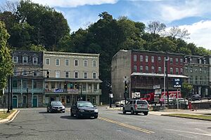
Union Square
|
||
|
||
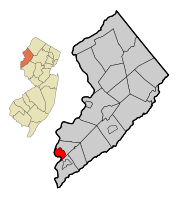
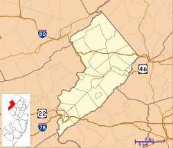
Location of Phillipsburg in Warren County highlighted in red (right). Inset map: Location of Warren County in New Jersey highlighted in orange (left).
|
||
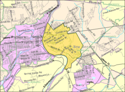
Census Bureau map of Phillipsburg, New Jersey
|
||
| Country | ||
| State | ||
| County | Warren | |
| Incorporated | March 8, 1861 | |
| Named for | William Phillips | |
| Government | ||
| • Type | Faulkner Act (mayor–council) | |
| • Body | Town Council | |
| Area | ||
| • Total | 3.31 sq mi (8.58 km2) | |
| • Land | 3.19 sq mi (8.26 km2) | |
| • Water | 0.12 sq mi (0.31 km2) 3.66% | |
| Area rank | 324th of 565 in state 19th of 22 in county |
|
| Elevation | 299 ft (91 m) | |
| Population
(2020)
|
||
| • Total | 15,249 | |
| • Estimate
(2023)
|
15,328 | |
| • Rank | 171st of 565 in state 1st of 22 in county |
|
| • Density | 4,778.8/sq mi (1,845.1/km2) | |
| • Density rank | 121st of 565 in state 1st of 22 in county |
|
| Time zone | UTC−05:00 (Eastern (EST)) | |
| • Summer (DST) | UTC−04:00 (Eastern (EDT)) | |
| ZIP Code |
08865
|
|
| Area code(s) | 908 exchanges: 213, 387, 454, 859, 995 | |
| FIPS code | 3404158350 | |
| GNIS feature ID | 0885350 | |
| School district | Phillipsburg School District | |
Phillipsburg is a town in New Jersey, located right along the Delaware River. It is the largest town in Warren County. Phillipsburg is also part of a larger area called the Lehigh Valley, which includes cities like Allentown and Bethlehem.
In 2020, about 15,249 people lived in Phillipsburg. This was a small increase from 2010. The town is about 19 miles northeast of Allentown, Pennsylvania. It is also about 79 miles north of Philadelphia and 70 miles west of New York City.
The Norfolk Southern Railway's Lehigh Line runs through Phillipsburg. This railway used to be a main route for other important railroads. It crosses the Delaware River into Easton. Another railway, the Belvidere Delaware Railroad, also connected Phillipsburg to places like Trenton and Philadelphia.
Contents
- Phillipsburg's Past: A Transportation Hub
- Where is Phillipsburg? Geography and Climate
- Phillipsburg's People: Population Changes
- Phillipsburg's Economy: Past and Present
- How Phillipsburg is Governed: Local Government
- Learning in Phillipsburg: Education
- Getting Around Phillipsburg: Transportation
- Famous People from Phillipsburg
- See also
Phillipsburg's Past: A Transportation Hub
Phillipsburg started as a quiet farming village. But in the 1800s, it became a very important center for transportation and shipping. This change began with the Morris Canal, which opened in 1831. The canal connected Phillipsburg directly to New York City, about 107 miles away.
Soon after, other transportation projects arrived. The Central Railroad of New Jersey built a connection here. Phillipsburg also linked up with the Delaware Canal and the Lehigh Canal across the river in Easton. By 1853, the Lehigh Valley Railroad connected with the Central Railroad of New Jersey. All these connections helped Phillipsburg grow very quickly.
On March 8, 1861, Phillipsburg officially became a town. This happened by a special law from the New Jersey Legislature. The town was named after William Phillips, who was one early settler in the area.
Where is Phillipsburg? Geography and Climate
Phillipsburg covers about 3.31 square miles (8.58 square kilometers). Most of this area is land, with a small part being water.
Some smaller communities and places within Phillipsburg include Delaware Park and Warren Heights. Pohatcong Mountain is a ridge about 6 miles long that stretches from Phillipsburg northeast towards Washington, New Jersey.
Phillipsburg shares borders with Lopatcong Township and Pohatcong Township in Warren County. Across the Delaware River, it borders Easton, Pennsylvania, and Williams Township in Pennsylvania.
Phillipsburg's Weather: Climate Overview
Phillipsburg has a varied climate. Here are the average high and low temperatures for each month:
| Climate data for Phillipsburg, NJ | |||||||||||||
|---|---|---|---|---|---|---|---|---|---|---|---|---|---|
| Month | Jan | Feb | Mar | Apr | May | Jun | Jul | Aug | Sep | Oct | Nov | Dec | Year |
| Mean daily maximum °F (°C) | 37 (3) |
41 (5) |
50 (10) |
61 (16) |
72 (22) |
80 (27) |
85 (29) |
83 (28) |
76 (24) |
65 (18) |
54 (12) |
42 (6) |
62.166 (16.76) |
| Mean daily minimum °F (°C) | 20 (−7) |
21 (−6) |
28 (−2) |
37 (3) |
47 (8) |
57 (14) |
62 (17) |
60 (16) |
52 (11) |
41 (5) |
32 (0) |
24 (−4) |
40 (4) |
Phillipsburg's People: Population Changes
The number of people living in Phillipsburg has changed over the years.
| Historical population | |||
|---|---|---|---|
| Census | Pop. | %± | |
| 1870 | 5,932 | — | |
| 1880 | 7,181 | 21.1% | |
| 1890 | 8,644 | 20.4% | |
| 1900 | 10,052 | 16.3% | |
| 1910 | 13,903 | 38.3% | |
| 1920 | 16,923 | 21.7% | |
| 1930 | 19,255 | 13.8% | |
| 1940 | 18,314 | −4.9% | |
| 1950 | 18,919 | 3.3% | |
| 1960 | 18,502 | −2.2% | |
| 1970 | 17,849 | −3.5% | |
| 1980 | 16,647 | −6.7% | |
| 1990 | 15,757 | −5.3% | |
| 2000 | 15,166 | −3.8% | |
| 2010 | 14,950 | −1.4% | |
| 2020 | 15,249 | 2.0% | |
| 2023 (est.) | 15,328 | 2.5% | |
| Population sources: 1870–1920 1870 1880–1890 1890–1910 1910–1930 1940–2000 2000 2010 2020 |
|||
Phillipsburg's Population in 2010
In 2010, Phillipsburg had 14,950 people living in 5,925 households. About 30.7% of households had children under 18. The average household had 2.51 people.
The population was made up of different groups:
- 83.44% White
- 7.49% Black or African American
- 1.53% Asian
- 3.92% from other races
- 3.39% from two or more races
- 11.82% were Hispanic or Latino (of any race)
The median age in Phillipsburg was 37.1 years old. About 25.8% of the population was under 18.
Phillipsburg's Economy: Past and Present
Phillipsburg's economy was once very strong because it was a major transportation and manufacturing center. Ingersoll Rand, a large company, opened a factory here in 1903. It employed many people, reaching a peak of 5,000 workers.
The town's location where the Delaware River and Lehigh River meet was key. The Morris Canal connected Phillipsburg to the New York City area. Other canals like the Lehigh Canal and Delaware Canal also helped connect the town to more places. Many important freight railways also served the area.
Railroads that Served Phillipsburg
Phillipsburg was served by five major railroads:
- Central Railroad of New Jersey (CNJ)
- Lehigh and Hudson River Railway (L&HR)
- Lehigh Valley Railroad (LVRR)
- Delaware, Lackawanna and Western Phillipsburg Branch (DL&W)
- Pennsylvania Railroad Belvidere Division (PRR)
Economic Changes and Growth
Most of the manufacturing jobs left Phillipsburg when Ingersoll Rand closed its operations in 2000.
However, parts of Phillipsburg are now an Urban Enterprise Zone (UEZ). This program helps encourage businesses to create jobs. Shoppers in these zones can pay a lower sales tax rate. Phillipsburg became a UEZ in 1994, and this status is set to expire in October 2025.
New businesses have started to open in Phillipsburg.
Phillipsburg's Railways Today
Today, a tourist railroad called the Belvidere & Delaware River Railroad operates on old tracks. It offers fun excursions. Norfolk Southern Railway still uses some of the old tracks for industrial purposes.
NJ Transit has been studying if they can bring back commuter train service to Phillipsburg. This would connect the town to the Raritan Valley Line.
Phillipsburg is also home to the Phillipsburg Railroad Historians museum. They have many items from railroad history, including old cabooses and a miniature railroad.
How Phillipsburg is Governed: Local Government
Phillipsburg is run by a Mayor-Council system. This means it has a Mayor and a five-member Town Council. The Mayor and Council members are elected by the people. Council members serve four-year terms.
As of 2022, the Mayor of Phillipsburg is Todd M. Tersigni. The Town Council members are Harry L. Wyant, Lee M. Clark, Keith A. Kennedy, Peter Marino, and Randy S. Piazza Jr.
In 2018, Phillipsburg had the lowest average property tax bill in Warren County.
Phillipsburg's Mayors Through History
Here are some of the people who have served as Mayor of Phillipsburg:
| Mayor | Term begins | Term ends | Notes |
|---|---|---|---|
| Charles Sitgreaves | 1861 | 1862 | First mayor. He was also a military leader and served in the state government. |
| Irwin W. Schultz | 1884 | 1885 | A local lawyer who served one year. |
| John H. Griffith | 1887 | 1894 | Was a city doctor before becoming mayor. |
| Vernon D. Best | 1953 | 1954 | |
| William M. Norton | 1954 | 1958 | A successful businessman from the Norton Oil Co. |
| Arthur Paini | 1958 | 1960 | A member of the Democratic Party. |
| James A. Bianchi | 1979 | 1980 | Served as a city councilman before becoming mayor. |
| Gloria Decker | 1992 | 1996 | Was a leader in Warren County. She switched political parties while in office. |
| Thomas W. Corcoran | 1996 | 2000 | A Democrat and a veteran of World War II and the Korean War. |
| Harry Wyant Jr. | 2000 | 2016 | A Republican who served as mayor for 16 years. |
| Stephen Ellis | 2016 | 2020 | A Democrat who graduated from Phillipsburg High School. |
| Todd M. Tersigni | 2020 | Incumbent | A Republican who also graduated from Phillipsburg High School. |
Phillipsburg's Political Representation
Phillipsburg is part of New Jersey's 7th Congressional District. It is also in New Jersey's 23rd state legislative district.
New Jersey's Seventh Congressional District is represented by Leonard Lance (R, Clinton Township). New Jersey is represented in the United States Senate by Cory Booker (D, Newark, term ends 2021) and Bob Menendez (D, Paramus, 2019). For the 2016–2017 session (Senate, General Assembly), the 23rd Legislative District of the New Jersey Legislature is represented in the State Senate by Michael J. Doherty (R, Washington Township, Warren County) and in the General Assembly by John DiMaio (R, Hackettstown) and Erik Peterson (R, Franklin Township, Hunterdon County). Warren County is governed by a three-member Board of County Commissioners, who are chosen at-large on a staggered basis in partisan elections with one seat coming up for election each year as part of the November general election. At an annual reorganization meeting held in the beginning of January, the board selects one of its members to serve as Commissioner Director and other as Deputy Director. As of 2022[update], Warren County's Commissioners are Commissioner Director Jason J. Sarnoski (R, Lopatcong Township; term as commissioner and commissioner director ends December 31, 2022) Commissioner Deputy Director Lori Ciesla (R, Lopatcong Township; term as commissioner ends 2024, term as deputy director ends 2022), and James R. Kern III (R, Pohatcong Township; 2025). Constitutional officers of Warren County are County Clerk Holly Mackey (R, Alpha; 2022), Sheriff James McDonald Sr. (R, Phillipsburg; 2022) and Surrogate Kevin O'Neill (R, Hackettstown; 2025).
How Phillipsburg Votes: Political Trends
As of March 2011, Phillipsburg had 7,681 registered voters. About 32.5% were Democrats, 19.7% were Republicans, and 47.7% were not affiliated with a major party.
In the 2012 presidential election, Barack Obama (Democrat) received more votes than Mitt Romney (Republican) in Phillipsburg. In the 2016 election, Donald Trump (Republican) received more votes than Hillary Clinton (Democrat). In 2020, Joe Biden (Democrat) received more votes than Donald Trump.
| Year | Republican | Democratic | Third party | |||
|---|---|---|---|---|---|---|
| No. | % | No. | % | No. | % | |
| 2024 | 2,826 | 49.81% | 2,752 | 48.51% | 95 | 1.67% |
| 2020 | 2,781 | 47.56% | 2,948 | 50.42% | 118 | 2.02% |
| 2016 | 2,352 | 49.81% | 2,077 | 43.99% | 293 | 6.20% |
| 2012 | 1,751 | 40.48% | 2,487 | 57.49% | 88 | 2.03% |
| 2008 | 1,983 | 41.55% | 2,673 | 56.01% | 116 | 2.43% |
| 2004 | 2,324 | 48.40% | 2,412 | 50.23% | 66 | 1.37% |
In the 2013 election for Governor of New Jersey, Chris Christie (Republican) received more votes than Barbara Buono (Democrat) in Phillipsburg.
Learning in Phillipsburg: Education
The Phillipsburg School District serves public school students from pre-kindergarten through 12th grade. This district is one of the "SDA districts" in New Jersey. This means the state helps cover the costs for school building and renovation projects.
As of the 2020–21 school year, the district had 3,877 students and 329 teachers. This means there were about 11.8 students for every teacher.
The schools in the district include:
- Early Childhood Learning Center (Pre-K–K)
- Phillipsburg Primary School (grades 1–2)
- Phillipsburg Elementary School (grades 3–5)
- Phillipsburg Middle School (grades 6–8)
- Phillipsburg High School (grades 9–12)
The Phillipsburg High School sports teams, called the Stateliners, have a long-standing rivalry with Easton Area High School in Pennsylvania. Their Thanksgiving Day game celebrated its 100th anniversary in 2006. In 2009, the 1993 teams played again in a special "Gatorade REPLAY Game" to decide a tie game. Phillipsburg won that game 27–12.
Phillipsburg High School also serves students from nearby towns. These include Alpha, Bloomsbury, Greenwich Township, Lopatcong Township, and Pohatcong Township.
Students in Warren County can also attend special schools. These include Ridge and Valley Charter School (K–8) and Warren County Technical School (9–12). Special education services are also provided by the Warren County Special Services School District.
Saints Philip & James School is a private school in Phillipsburg. It was founded in 1875 and serves students from pre-kindergarten through eighth grade.
Getting Around Phillipsburg: Transportation
Transportation History
Phillipsburg has always been a major transportation center. This is because it sits where the Delaware River and the Lehigh River meet. From the 1830s to the 1920s, the Morris Canal ended here. This canal connected Phillipsburg by water to the Port of New York and New Jersey. It also linked to the Lehigh Canal across the Delaware River.
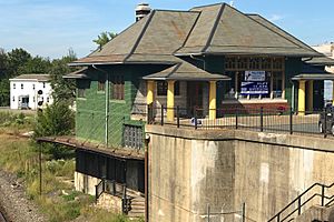
Five major railroads used to meet in Phillipsburg. These included the Central Railroad of New Jersey (CNJ) and the Pennsylvania Railroad (PRR). Phillipsburg Union Station served the CNJ and DL&W railroads.
Today, the old CNJ tracks are part of the Lehigh Line, owned by Norfolk Southern Railway. The PRR line in Phillipsburg is now the Belvidere and Delaware River Railway.
Roads and Highways
As of 2010, Phillipsburg had about 59.21 miles of roads. Most of these roads are maintained by the town itself.
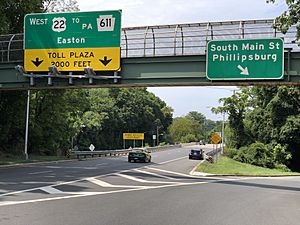
Major highways that go through Phillipsburg include U.S. Route 22 and Route 122. Interstate 78 also passes through a small part of the town. The closest exit for Interstate 78 is in nearby Pohatcong.
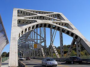
Phillipsburg is connected to Pennsylvania by three bridges across the Delaware River:
- The Easton–Phillipsburg Toll Bridge (which carries U.S. Route 22)
- The Northampton Street Bridge (also known as the "Free Bridge")
- The Interstate 78 Toll Bridge (which carries Interstate 78)
All these bridges are managed by the Delaware River Joint Toll Bridge Commission.
Public Transportation
NJ Transit provides bus service in Phillipsburg on routes 890 and 891. There is also a bus line that goes down Route 57 to Washington Township.
Air Travel
For air travel, Phillipsburg is closest to Lehigh Valley International Airport in Allentown, Pennsylvania. This airport is about 16 miles west of Phillipsburg. A larger airport, Newark Liberty International Airport, is about 59 miles to the east. It serves the New York City area.
Famous People from Phillipsburg
Many notable people have connections to Phillipsburg. They were either born there, lived there, or are closely associated with the town.
- Walter E. Bachman (1880–1958), a college football player and coach.
- Charlie Berry (1860–1940), a professional baseball player.
- Charlie Berry (1902–1972), a professional baseball player and umpire.
- William F. Birch (1870–1946), a former Member of Congress.
- Ned Bolcar (born 1967), a former football linebacker for the Seattle Seahawks and Miami Dolphins.
- Tom Brennan (born 1949), a sportscaster and former basketball coach.
- Tim Brewster (born 1960), a former football coach for the Minnesota Golden Gophers.
- Harold Curry (1932–2022), a lawyer and politician.
- Ted Dailey (1908–1992), an NFL player for the Pittsburgh Pirates football team.
- D. C. Drake (born 1957), a former professional wrestler.
- Wayne Dumont (1914–1992), a former New Jersey Senate Majority Leader.
- Fiona (born 1961), a rock music singer-songwriter and actress.
- James Cullen Ganey (1899–1972), a federal judge.
- Dan Gray (born 1956), a former NFL defensive tackle.
- John R. Guthrie (1921–2009), a four-star general in the United States Army.
- David Hajdu (born 1955), a music critic and author.
- Terry Kitchen, a folk singer.
- Frederick Kroesen (1923–2020), a United States Army officer.
- J. Robert Lennon (born 1970), a novelist.
- Hilda Madsen (1910–1981), an artist and dog breeder.
- Jayne Mansfield (1933–1967), a famous actress from the 1950s.
- Brandon Scott Mason (born 1986), a journalist and former football player.
- Martin O. May (1922–1945), a Medal of Honor recipient from World War II.
- Olivia Miles (born 2003), a college basketball player for the Notre Dame Fighting Irish.
- Helen Stevenson Meyner (1929–1997), a politician who served in Congress.
- Robert B. Meyner (1908–1990), a former governor of New Jersey.
- Charles E. Myers (1925–2016), a Director for Air Warfare in the Pentagon.
- Lou Reda (born circa 1925–2017), a documentary filmmaker.
- Jim Ringo (1931–2007), a professional football player for the Green Bay Packers.
- Sheetal Sheth (born 1976), an actress.
- Charles Sitgreaves (1803–1878), a politician and former mayor of Phillipsburg.
- Matthew Tirrell (born 1950), a chemical engineer.
- Bill Walsh (1927–2012), a football center for the Pittsburgh Steelers.
- Christina Wilson (born 1979), a chef and winner of Hell's Kitchen season 10.
- Yvonne Zima (born 1989), an actress who appeared on ER.
See also
 In Spanish: Phillipsburg (Nueva Jersey) para niños
 | Victor J. Glover |
 | Yvonne Cagle |
 | Jeanette Epps |
 | Bernard A. Harris Jr. |


