
Cheesequake State Park facts for kids
Quick facts for kids Cheesequake State Park |
|||||||||||||||||||||||
|---|---|---|---|---|---|---|---|---|---|---|---|---|---|---|---|---|---|---|---|---|---|---|---|

Entrance sign leading into Cheesequake Park
|
|||||||||||||||||||||||
| Lua error in Module:Location_map at line 420: attempt to index field 'wikibase' (a nil value). | |||||||||||||||||||||||
| Type | State Park | ||||||||||||||||||||||
| Location | Old Bridge, New Jersey | ||||||||||||||||||||||
| Nearest city | Sayreville, New Jersey | ||||||||||||||||||||||
| Area | 1,610 acres (6.5 km2) | ||||||||||||||||||||||
| Elevation | 52 feet (16 m) | ||||||||||||||||||||||
| Etymology | Lenape: Chiskhakink (Cheseh-oh-ke, Chichequaas), meaning "upland," "upland village," or "at the land that has been cleared" | ||||||||||||||||||||||
| Operated by | New Jersey Department of Environmental Protection, New Jersey Division of Parks and Forestry | ||||||||||||||||||||||
| Visitors | 1,396,737 (in 2013) | ||||||||||||||||||||||
| Open | Year round | ||||||||||||||||||||||
| Status | Open | ||||||||||||||||||||||
| Camp sites | 53 sites plus 6 large group sites (available May 1-October 31) | ||||||||||||||||||||||
| Hiking trails | 5 trails, lengths range from 1.5 to 3.5 miles | ||||||||||||||||||||||
| Designation | Marine and Intertidal | ||||||||||||||||||||||
| Website | Cheesequake State Park | ||||||||||||||||||||||
|
|||||||||||||||||||||||


Cheesequake State Park is a large state park in New Jersey. It covers about 1,610 acres (6.5 square kilometers). You can find it in Old Bridge, which is in Middlesex County.
The park was created with money from the New Jersey Legislature in 1937. The state bought land, including a farm and an old mansion. More land was added over the next two years. The Civilian Conservation Corps, a group that helped develop public lands, worked on the park. Cheesequake State Park officially opened in June 1940. Today, the New Jersey Division of Parks and Forestry takes care of it. It is also part of the New Jersey Coastal Heritage Trail Route.
The name "Cheesequake" comes from the Lenape people. It has a few meanings. These include "upland," "upland village," or "at the land that has been cleared."
Contents
Exploring Cheesequake State Park's Nature
Cheesequake State Park is a special place. It has many different types of natural areas. This makes it a great spot to explore and learn about nature.
Wetlands and Waterways
The park has both freshwater and saltwater marshes. These are wet, grassy areas. A tidal estuary is also found here. This is where the Cheesequake Creek meets the larger Raritan Bay. These areas are home to many plants and animals that love water.
Forests and Unique Habitats
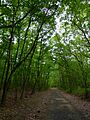
You can find hills covered with thick hardwood forests. There are also open fields and a white cedarswamp. A small part of the park is like the New Jersey Pine Barrens. This area has pine trees growing in sandy soil. It's a unique habitat to discover.
Hooks Creek Lake: Fishing Fun
The park is home to Hooks Creek Lake. This freshwater lake is about 10.6 acres (4.3 hectares) big. It's a popular spot for fishing. You might catch trout, largemouth bass, catfish, or sunfish here. You can also try Crabbing in the park's waterways.
Activities and Trails at Cheesequake State Park
Cheesequake State Park offers many fun things to do. There are activities for all seasons. You can explore the park's beauty on its trails or enjoy its facilities.


Visitor Center and Trails
The park has an interpretive center. Here, you can learn more about the park's nature and history. There are five marked trails for hiking and mountain biking. These trails go through the wooded hills. They also cross long wooden bridges over marshland.
Camping and Water Activities
If you love the outdoors, you can go camping here. The park has special camping areas. You need to make a reservation to stay overnight. In the summer, you can go swimming and boating. When winter comes, the park is great for sledding, cross-country skiing, and snowshoeing.
Getting to the Park
The Garden State Parkway goes through the park. However, there is no direct exit into the park from the parkway. A road goes under the parkway to connect the northern and southern parts of the park. You can even see some parts of the park, like a picnic area, from the parkway. If you're using public transport, the Aberdeen–Matawan station (for New Jersey Transit) is about two miles east of the park.
Images for kids
-
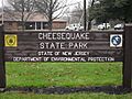
Entrance sign leading into Cheesequake Park
-
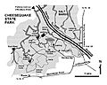
Map of Cheesequake State Park in Old Bridge, New Jersey
-
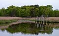
Cheesequake Creek
-
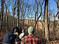
Hikers exploring the hardwood forest and marshes in the park
-
Museum Road in Cheesequake State Park
