
Ringwood, New Jersey facts for kids
Quick facts for kids
Ringwood, New Jersey
|
||
|---|---|---|
|
Borough
|
||

|
||
|
||

Map of Ringwood in Passaic County. Inset: Location of Passaic County highlighted in the State of New Jersey.
|
||

Census Bureau map of Ringwood, New Jersey
|
||

Ringwood, New Jersey
Location in Passaic County, New Jersey

Ringwood, New Jersey
Location in New Jersey

Ringwood, New Jersey
Location in the United States
|
||
| Country | ||
| State | ||
| County | ||
| Incorporated | March 22, 1918 | |
| Government | ||
| • Type | Faulkner Act (council–manager) | |
| • Body | Borough Council | |
| Area | ||
| • Total | 28.50 sq mi (73.80 km2) | |
| • Land | 25.59 sq mi (66.28 km2) | |
| • Water | 2.90 sq mi (7.52 km2) 10.20% | |
| Area rank | 95th of 565 in state 2nd of 16 in county |
|
| Elevation | 282 ft (86 m) | |
| Population
(2020)
|
||
| • Total | 11,735 | |
| • Estimate
(2023)
|
11,451 | |
| • Rank | 215th of 565 in state 9th of 16 in county |
|
| • Density | 458.6/sq mi (177.1/km2) | |
| • Density rank | 444th of 565 in state 15th of 16 in county |
|
| Time zone | UTC−05:00 (Eastern (EST)) | |
| • Summer (DST) | UTC−04:00 (Eastern (EDT)) | |
| ZIP Code |
07456
|
|
| Area code(s) | 973 exchange: 962 | |
| FIPS code | 3403163150 | |
| GNIS feature ID | 0885370 | |

Ringwood is a small town, called a borough, located in Passaic County, New Jersey. In 2020, about 11,735 people lived there.
Ringwood is famous for Ringwood State Park. This park includes the beautiful New Jersey Botanical Garden at Skylands and the historic Ringwood Manor. It also has the Shepherd Lake Recreation Area, which is great for outdoor fun.
The Borough of Ringwood became an official town on February 23, 1918. It was formed from a part of Pompton Township. The town was named after an iron mining company that used to operate in the area.
Contents
History of Ringwood
Early Native American Settlers
Long ago, the Lenape people lived in the area that is now Ringwood. They were a Native American tribe who spoke an Algonquian language. They lived along the Delaware River and in the mountains. Some Lenape moved into the mountains to avoid European settlers.
Colonists called the local Lenape group the Ramapough. They named the Ramapo River and other places after them. Today, descendants of these people, along with Afro-Dutch migrants, are known as the Ramapough Mountain Indians. New Jersey recognized them as a Native American tribe in 1980.
Iron Mining in Ringwood
In the early 1700s, European settlers found iron in the Ringwood area. The Ogden family built an iron furnace there in 1742. By 1765, Peter Hasenclever made Ringwood the center of his large iron business. His company owned over 150,000 acres (607 square kilometers) of land in New Jersey, New York, and Nova Scotia.
Iron mining was very important in Ringwood from the 1700s until the Great Depression in the 1930s. You can still find old iron mines and pits in the area today. The London, Roomy, Peters, and Hope mines were all started by Peter Hasenclever's company.

Ringwood Manor and the Revolutionary War
Many famous ironmasters lived at Ringwood Manor from the 1740s to the late 1800s. During the American Revolutionary War, Robert Erskine managed the iron production from Ringwood. He also became George Washington's first mapmaker and Surveyor-General. Erskine created maps for the Continental Army. George Washington himself visited the Manor House several times.
The iron from Ringwood was used to make the famous Hudson River Chain. This chain was placed across the Hudson River to block British ships. Ringwood iron also helped make tools and hardware for the army. One of the last owners of the Manor was Abram S. Hewitt. He was an ironmaster, educator, and a U.S. Congressman. He also served as Mayor of New York City. Ringwood Manor is now a National Historic Landmark.
Geography and Climate
Ringwood covers about 28.5 square miles (73.8 square kilometers). About 2.9 square miles (7.5 square kilometers) of this area is water.
Lakes and Communities
Several small communities and lakes are found within Ringwood. These include Brushwood Pond, Cupsaw Lake, Skyline Lake, and Erskine. The town is divided by the Wanaque Reservoir, which supplies drinking water to many towns in northeastern New Jersey.
Neighboring Towns
Ringwood shares its borders with several other towns. In Passaic County, it borders Bloomingdale, Wanaque, and West Milford. In Bergen County, it borders Mahwah and Oakland. It also borders towns in New York State, like Tuxedo, Warwick, and Ramapo.
Weather in Ringwood
Ringwood has a climate with hot summers and cold winters. This is known as a humid continental climate.
| Climate data for Ringwood, New Jersey | |||||||||||||
|---|---|---|---|---|---|---|---|---|---|---|---|---|---|
| Month | Jan | Feb | Mar | Apr | May | Jun | Jul | Aug | Sep | Oct | Nov | Dec | Year |
| Mean daily maximum °F (°C) | 36 (2) |
40 (4) |
47 (8) |
60 (16) |
70 (21) |
79 (26) |
84 (29) |
82 (28) |
74 (23) |
63 (17) |
53 (12) |
42 (6) |
61 (16) |
| Mean daily minimum °F (°C) | 19 (−7) |
21 (−6) |
29 (−2) |
40 (4) |
49 (9) |
58 (14) |
64 (18) |
62 (17) |
54 (12) |
43 (6) |
35 (2) |
26 (−3) |
42 (5) |
| Average precipitation inches (mm) | 3.11 (79) |
2.99 (76) |
3.85 (98) |
4.21 (107) |
4.09 (104) |
4.64 (118) |
4.42 (112) |
4.41 (112) |
4.42 (112) |
4.49 (114) |
4.06 (103) |
3.92 (100) |
48.61 (1,235) |
Population and People
| Historical population | |||
|---|---|---|---|
| Census | Pop. | %± | |
| 1920 | 1,025 | — | |
| 1930 | 1,038 | 1.3% | |
| 1940 | 977 | −5.9% | |
| 1950 | 1,752 | 79.3% | |
| 1960 | 4,182 | 138.7% | |
| 1970 | 10,393 | 148.5% | |
| 1980 | 12,625 | 21.5% | |
| 1990 | 12,623 | 0.0% | |
| 2000 | 12,396 | −1.8% | |
| 2010 | 12,228 | −1.4% | |
| 2020 | 11,735 | −4.0% | |
| 2023 (est.) | 11,451 | −6.4% | |
| Population sources: 1920 1920–1930 1940–2000 2000 2010 2020 |
|||
In 2010, Ringwood had 12,228 people living there. Most residents (92.58%) were White. About 1.36% were Black or African American, and 1.24% were Native American. About 1.74% were Asian. People of Hispanic or Latino background made up 5.78% of the population.
The average age of people in Ringwood in 2010 was 42.1 years old. About 24.7% of the population was under 18.
Parks and Fun Activities
Ringwood offers many places for outdoor fun and learning.
- Ringwood State Park: This large park covers over 4,444 acres (1,798 hectares). It has four main areas: Ringwood Manor, Skylands Manor/NJ State Botanical Garden, Shepherd Lake, and Bear Swamp Lake.
- Tranquility Ridge Park: This county park has more than 2,000 acres (809 hectares) of woods. It was bought by the county to protect the land from being built on.
- The New Weis Center: This center focuses on environmental education, arts, and recreation. It is located on Snake Den Road.
- Spring Lake Day Camp: This is a summer camp for kids from kindergarten to 10th grade. It has been family-owned since 1989.
- The Highlands Natural Pool: This is a large, freshwater pool fed by a stream. It was created in 1935 by a group called The Nature Friends.
Schools and Education
Public Schools in Ringwood
Students in Ringwood from kindergarten through eighth grade attend schools in the Ringwood Public School District. In the 2020–21 school year, the district had about 1,045 students across four schools.
- Peter Cooper Elementary School: Grades K–3
- Robert Erskine Elementary School: Grades K–3
- Eleanor G. Hewitt Intermediate School: Grades 4–5
- Martin J. Ryerson Middle School: Grades 6–8
The Ringwood Educational Foundation helps support the public schools. They raise money for programs and events, like the annual Shepherd Lake 5K run.
High School Education
For high school, students in Ringwood attend Lakeland Regional High School in Wanaque. This high school serves students from both Ringwood and Wanaque. In the 2020–21 school year, Lakeland Regional High School had about 924 students.
Community Life
Ringwood has several private lake communities. Residents can join these communities, such as Cupsaw Lake, Erskine Lakes, or Skyline Lakes, often with annual fees.
St. Patrick's Day Parade
Every year on the third Saturday in March, Ringwood hosts its annual St. Patrick's Day Parade. This is the only St. Patrick's Day parade in Passaic County. Since 1990, the parade committee chooses a grand marshal and a "Citizen of the Year." These honored citizens are celebrated at a breakfast before the parade.
The parade features bagpipe bands, colorful floats, Irish step dancers, and the county sheriff's equestrian unit. Local police, fire, and ambulance departments also march. Girl Scout and Boy Scout troops, school groups, and sports teams join in the fun. The parade ends at the St. Catherine of Bologna Church Parish Center, where the celebration continues with live music.
Getting Around Ringwood
Roads and Highways
Ringwood has about 87.52 miles (140.85 kilometers) of roads. Most of these roads are maintained by the town itself. There are no major state or interstate highways directly in Ringwood.
_just_north_of_Passaic_County_Route_692_(Skyline_Drive)_in_Ringwood,_Passaic_County,_New_Jersey.jpg)
The main roads are County Route 511 (Greenwood Lake Turnpike) and County Route 692 (Skyline Drive). These roads connect to Interstate 287 in nearby towns. Ringwood did not have any traffic lights until 2013. The town still does not have sidewalks or street lights.
Public Transportation
You can find NJ Transit bus service at the Ringwood Park and Ride, next to the Ringwood Public Library.
- The 196 bus offers express service to Port Authority Bus Terminal in Midtown Manhattan, New York City.
- The 197 bus provides local service, including to the Willowbrook Mall.
Famous People from Ringwood
Many notable people have lived in or are connected to Ringwood:
- Robert Erskine (1735–1780): A Scottish inventor and an American officer during the American Revolutionary War.
- George Martin (born 1953): A former defensive end for the New York Giants football team.
- Sarah Pagano (born 1991): A long-distance runner.
- John Dyneley Prince (1868–1945): A linguist, diplomat, and politician.
- Kim Rosen (born around 1980): An audio mastering engineer.
- Eric Schubert (born 1962): A former American football placekicker for NFL teams.
- Darren Soto (born 1978): A Congressman from Florida.
Sister City
Ringwood, New Jersey, has a sister city relationship with another town named Ringwood.
 Ringwood, Hampshire, England
In 1976, the mayor of Ringwood, New Jersey, suggested this partnership. It was to celebrate the 750th anniversary of the market in Ringwood, England. Since then, officials from both towns have exchanged visits.
Images for kids
-
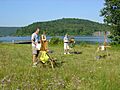
Plein air painters painting at Long Pond in Ringwood, NJ.
See also
 In Spanish: Ringwood (Nueva Jersey) para niños
