Wanaque, New Jersey facts for kids
Quick facts for kids
Wanaque, New Jersey
|
||
|---|---|---|
|
Borough
|
||
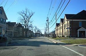
Downtown Wanaque along southbound Ringwood Avenue (CR 511)
|
||
|
||
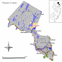
Location of Wanaque in Passaic County. Inset: Passaic County highlighted in the State of New Jersey.
|
||
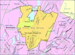
Census Bureau map of Wanaque, New Jersey
|
||
| Country | ||
| State | ||
| County | ||
| Incorporated | March 22, 1918 | |
| Government | ||
| • Type | Borough | |
| • Body | Borough Council | |
| Area | ||
| • Total | 9.32 sq mi (24.15 km2) | |
| • Land | 8.06 sq mi (20.88 km2) | |
| • Water | 1.26 sq mi (3.26 km2) 13.50% | |
| Area rank | 215th of 565 in state 5th of 16 in county |
|
| Elevation | 220 ft (70 m) | |
| Population
(2020)
|
||
| • Total | 11,317 | |
| • Estimate
(2023)
|
11,048 | |
| • Rank | 220th of 565 in state 10th of 16 in county |
|
| • Density | 1,403.0/sq mi (541.7/km2) | |
| • Density rank | 345th of 565 in state 13th of 16 in county |
|
| Time zone | UTC−05:00 (Eastern (EST)) | |
| • Summer (DST) | UTC−04:00 (Eastern (EDT)) | |
| ZIP Code |
07420 – Haskell
07465 – Wanaque |
|
| Area code(s) | 973 Exchanges: 248, 616, 831, 835, 839 | |
| FIPS code | 3403176730 | |
| GNIS feature ID | 0885431 | |
| Website | ||
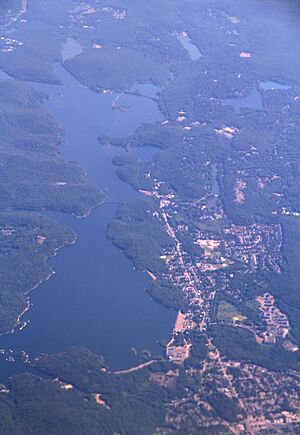
Wanaque (pronounced WAH-nah-kyoo or wah-NAH-kee) is a small town called a borough in Passaic County, New Jersey. In 2020, about 11,317 people lived there. This was a small increase from the 11,116 people counted in 2010.
Contents
History of Wanaque
Wanaque became its own borough on February 23, 1918. Before that, it was part of Pompton Township. The name Wanaque comes from a word used by the Lenni Lenape Native Americans. It means "land of sassafras," which is a type of tree.
Geography and Location
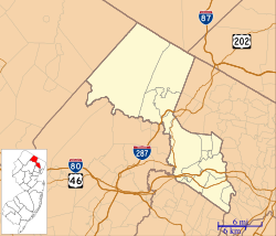
Wanaque covers about 9.33 square miles (24.15 square kilometers). Most of this area is land, but about 1.26 square miles (3.26 square kilometers) is water.
Communities within Wanaque
Several smaller communities and places are located inside Wanaque. These include:
- Haskell
- Lake Inez
- Lake Washington
- Meadow Brook Lake
- Midvale
- Ramapo Lake
- Rotten Pond
- Stephens Lake
- Upper Midvale
Both Wanaque and Haskell have their own ZIP Codes and post offices.
Neighboring Towns
Wanaque shares borders with several other towns:
- Bloomingdale
- Pompton Lakes
- Ringwood (all in Passaic County)
- Oakland in Bergen County
Climate in Wanaque
Wanaque experiences a climate with warm summers and cold winters. Here's a look at the average temperatures and rainfall.
| Climate data for Wanaque, New Jersey, 1991–2020 normals, extremes 1945–2020 | |||||||||||||
|---|---|---|---|---|---|---|---|---|---|---|---|---|---|
| Month | Jan | Feb | Mar | Apr | May | Jun | Jul | Aug | Sep | Oct | Nov | Dec | Year |
| Record high °F (°C) | 72 (22) |
75 (24) |
82 (28) |
95 (35) |
97 (36) |
100 (38) |
101 (38) |
101 (38) |
104 (40) |
90 (32) |
84 (29) |
74 (23) |
104 (40) |
| Mean daily maximum °F (°C) | 37.7 (3.2) |
40.5 (4.7) |
47.8 (8.8) |
59.5 (15.3) |
71.0 (21.7) |
79.4 (26.3) |
84.3 (29.1) |
82.8 (28.2) |
76.0 (24.4) |
64.2 (17.9) |
52.6 (11.4) |
42.6 (5.9) |
61.5 (16.4) |
| Daily mean °F (°C) | 28.8 (−1.8) |
30.3 (−0.9) |
38.4 (3.6) |
49.3 (9.6) |
60.2 (15.7) |
68.9 (20.5) |
74.2 (23.4) |
72.9 (22.7) |
66.0 (18.9) |
53.6 (12.0) |
43.6 (6.4) |
34.8 (1.6) |
51.8 (11.0) |
| Mean daily minimum °F (°C) | 19.9 (−6.7) |
20.0 (−6.7) |
29.0 (−1.7) |
39.0 (3.9) |
49.5 (9.7) |
58.3 (14.6) |
64.2 (17.9) |
62.9 (17.2) |
55.9 (13.3) |
43.0 (6.1) |
34.6 (1.4) |
26.9 (−2.8) |
41.9 (5.5) |
| Record low °F (°C) | −20 (−29) |
−13 (−25) |
−1 (−18) |
10 (−12) |
24 (−4) |
37 (3) |
44 (7) |
39 (4) |
29 (−2) |
20 (−7) |
12 (−11) |
−6 (−21) |
−20 (−29) |
| Average precipitation inches (mm) | 3.39 (86) |
2.71 (69) |
3.86 (98) |
4.17 (106) |
3.58 (91) |
5.13 (130) |
4.65 (118) |
4.57 (116) |
3.95 (100) |
4.37 (111) |
3.77 (96) |
4.05 (103) |
48.20 (1,224) |
| Average precipitation days (≥ 0.01 in) | 9.8 | 7.4 | 10.0 | 10.7 | 11.7 | 10.9 | 10.1 | 9.7 | 8.5 | 9.0 | 8.1 | 9.6 | 115.5 |
| Source 1: NOAA | |||||||||||||
| Source 2: National Weather Service | |||||||||||||
Population Changes Over Time
The number of people living in Wanaque has changed quite a bit over the years. Here's how the population has grown since 1920.
| Historical population | |||
|---|---|---|---|
| Census | Pop. | %± | |
| 1920 | 2,916 | — | |
| 1930 | 3,119 | 7.0% | |
| 1940 | 3,143 | 0.8% | |
| 1950 | 4,222 | 34.3% | |
| 1960 | 7,126 | 68.8% | |
| 1970 | 8,636 | 21.2% | |
| 1980 | 10,025 | 16.1% | |
| 1990 | 9,711 | −3.1% | |
| 2000 | 10,266 | 5.7% | |
| 2010 | 11,116 | 8.3% | |
| 2020 | 11,317 | 1.8% | |
| 2023 (est.) | 11,048 | −0.6% | |
| Population sources: 1920 1920–1930 1940–2000 2000 2010 2020 |
|||
Wanaque in 2010
In 2010, there were 11,116 people living in Wanaque. There were 4,018 households, and 3,026 of these were families. Most people (87.48%) were White. Other groups included Black or African American (3.07%), Asian (4.65%), and Native American (0.40%). About 9.67% of the population was Hispanic or Latino.
Education in Wanaque
Wanaque has its own school district called the Wanaque Borough Schools. This district teaches students from pre-kindergarten up to eighth grade.
Elementary and Middle Schools
The Wanaque school district has two schools:
- Haskell Elementary School: This school teaches 367 students from pre-kindergarten to 8th grade.
- Wanaque Elementary School: This school teaches 484 students from pre-kindergarten to 8th grade.
High School Education
For high school, students from Wanaque attend Lakeland Regional High School. This high school also serves students from the nearby town of Ringwood. Lakeland Regional High School is located in Wanaque. In the 2021-2022 school year, about 902 students attended the high school.
College Opportunities
Wanaque is also home to the Wanaque Academic Center, which is part of Passaic County Community College.
Getting Around Wanaque
Wanaque has many roads for cars and buses. As of 2010, there were about 36.45 miles of roads in the borough. Most of these roads are kept up by the town itself.
Major Roads and Highways
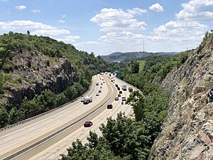
Interstate 287 is a big highway that goes through Wanaque for about 2.2 miles. You can get on or off I-287 at Exit 55. This exit is close to the intersection of Union and Ringwood Avenues.
Public Transportation Options
NJ Transit offers bus service for people who want to travel to and from Port Authority Bus Terminal in Midtown Manhattan. The bus route that serves Wanaque is the 197 route.
Famous People from Wanaque
Many interesting people have lived in or are connected to Wanaque:
- Kevin Carolan (born 1968): An actor and comedian.
- Bobby Czyz (born 1962): A boxer who was a world champion in two different weight classes.
- John McCutcheon (1879–1942): A politician who held important roles like the New Jersey State Comptroller.
- Bill Palatucci (born 1958): A lawyer who has served on important political committees.
- Ernestine Petras (born 1924): A baseball player who played in the All-American Girls Professional Baseball League.
- John Pfahl (1939–2020): A well-known photographer.
- Chris Port (born 1967): A former professional football player who played for the New Orleans Saints.
Fun Places to Visit
One special place in Wanaque is Elks Camp Moore.
Elks Camp Moore
Elks Camp Moore is a summer camp for children with special needs. It was started in 1971. The camp has many fun activities for kids, including:
- A swimming pool
- Three playgrounds
- A small playing field
- A recreation hall with other fun activities
Campers stay for one week, from Sunday to Saturday. Each week, 75 campers attend the camp, and each child has their own counselor. The camp is set up to be easy for children in wheelchairs to get around. It is located high on a mountain, looking over Route 287 in Haskell. Kids can attend the camp for free, thanks to funding from local New Jersey Elks lodges.
See also
 In Spanish: Wanaque para niños
 | DeHart Hubbard |
 | Wilma Rudolph |
 | Jesse Owens |
 | Jackie Joyner-Kersee |
 | Major Taylor |


