
Barnegat Light, New Jersey facts for kids
Quick facts for kids
Barnegat Light, New Jersey
|
||
|---|---|---|
|
Borough
|
||

|
||
|
||

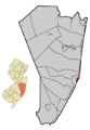
Location of Barnegat Light in Ocean County highlighted in red (right). Inset map: Location of Ocean County in New Jersey highlighted in orange (left).
|
||

Census Bureau map of Barnegat Light, New Jersey
|
||

Barnegat Light, New Jersey
Location in Ocean County, New Jersey

Barnegat Light, New Jersey
Location in New Jersey

Barnegat Light, New Jersey
Location in the United States
|
||
| Country | ||
| State | ||
| County | ||
| Incorporated | March 29, 1904 as Barnegat City | |
| Renamed | November 2, 1948 as Barnegat Light | |
| Named for | Dutch language "breaker's inlet" | |
| Government | ||
| • Type | Borough | |
| • Body | Borough Council | |
| Area | ||
| • Total | 1.20 sq mi (3.10 km2) | |
| • Land | 0.83 sq mi (2.15 km2) | |
| • Water | 0.37 sq mi (0.95 km2) 30.50% | |
| Area rank | 487th of 565 in state 22nd of 33 in county |
|
| Elevation | 3 ft (0.9 m) | |
| Population
(2020)
|
||
| • Total | 640 | |
| • Estimate
(2023)
|
652 | |
| • Rank | 548th of 565 in state 31st of 33 in county |
|
| • Density | 770.3/sq mi (297.4/km2) | |
| • Density rank | 411th of 565 in state 22nd of 33 in county |
|
| Time zone | UTC−05:00 (Eastern (EST)) | |
| • Summer (DST) | UTC−04:00 (Eastern (EDT)) | |
| ZIP Code |
08006
|
|
| Area codes | 609 exchanges: 361, 494 | |
| FIPS code | 3402903130 | |
| GNIS feature ID | 0885148 | |
| Website | ||

Barnegat Light is a small town, called a borough, located in Ocean County, New Jersey. In 2020, about 640 people lived there. This was a small increase from 2010.
It's right on the Atlantic Ocean, on a place called Long Beach Island. Barnegat Light is famous for the Barnegat Lighthouse, also known as 'Old Barney'. The town became 'Barnegat Light' in 1948. Before that, it was known as 'Barnegat City' since 1904.
Contents
Discovering Barnegat Light's Past
How Barnegat Light Got Its Name

In 1609, explorer Henry Hudson described the area around Barnegat Bay as a "great lake" with many sandbars. Later, in the 1610s, Dutch sailors named the inlet "barende-gat." This Dutch word meant a powerful inlet, like an "inlet of breakers."
Over time, as different groups controlled the land, "barende-gat" changed to "Barnegat." This name then spread to the bay, the mainland town, and finally, to this island town.
Early Days and the First Lighthouse
In the 1800s, Long Beach Island was known for its amazing wildlife, great fishing, and good weather for sailing. In 1801, a man named Bornt Slaght bought much of the northern tip of the island. He built the first house there, and later, one of New Jersey's first seaside hotels in 1821.
The first Barnegat Lighthouse was built in 1834. It was important for ships sailing to New York City. The lighthouse helped them find their way into New York Harbor. The nearby Barnegat Bay was also a safe place for ships. It allowed them to reach other ports where goods from the pine forests were traded.
The first lighthouse was 40 feet tall and painted white. But it wasn't built very well. Sailors complained its light was too weak. In 1857, it fell into the inlet. Luckily, a new, stronger lighthouse was built between 1857 and 1859.
The Brownsville Era
In 1854, John Maxon Brown bought a lot of land in what is now Barnegat Light. He also bought the hotel and renamed it the Ashley House. The Brown family owned so much of the town that people started calling the area "Brownsville."
The Brown family left the island in the 1870s after John M. Brown's son, a ship captain, was lost at sea. In 1872, the United States Life-Saving Service built a station here. This service helped rescue people from shipwrecks.
Becoming Barnegat City
In 1881, a group of investors formed the Barnegat City Improvement Company. They wanted to create a popular seaside resort, like Atlantic City. They planned streets, houses, hotels, a port, and even a railroad. They called their new resort "Barnegat City."
The town became a popular spot for sailors, fishermen, and hunters. They came from Philadelphia and New York City. At first, they traveled by train part of the way, then by steamboat across the bay. In 1886, a direct railroad line to the island made the trip easier.
Large hotels like the Oceanic Hotel and Sunset Hotel were built. The Oceanic Hotel even had to be moved in 1883 because the ocean was eroding the beach! In 1904, Barnegat City officially became its own borough.
Challenges and Changes
In 1914, a bridge for cars was built to the island. This made it easier for people to drive, but it also meant fewer people used the trains. Many businesses that relied on the railroad struggled.
Severe winter storms caused a lot of damage. In 1920, a storm eroded the shoreline right up to the lighthouse. The lighthouse keeper's house had to be moved. The Oceanic Hotel was torn down because it was too close to the water.
Train service to the north end of the island stopped in 1923. This was because of low ridership and high maintenance costs. The growth of cars also played a big role.
Disasters and New Beginnings
The 1930s brought more challenges. In 1932, the Sunset Hotel burned down. A year later, in 1933, the airship USS Akron crashed off Barnegat Light. This was a very sad event, and 73 people lost their lives. Airships from a nearby Navy base often used the Barnegat Lighthouse as a guide.
Despite the challenges, the fishing industry grew. In the 1920s, fishermen from Norway, Sweden, and Finland came to Barnegat City. They helped build a strong fishing community. Today, the docks are known as Viking Village. It's a place where you can buy fresh seafood and handmade goods.
Barnegat Light Today

In 1948, Barnegat City was renamed Barnegat Light. This was done to honor the famous lighthouse and to avoid confusion with a nearby town called Barnegat Township.
Storms like the Great Atlantic Hurricane of 1944 and the Ash Wednesday Storm of 1962 showed how important it was to protect the shoreline. In the 1930s and 1940s, rock jetties and dams were built. These structures helped stop the erosion and protect the town and the lighthouse.
Today, the jetty helps keep the shoreline stable. The United States Coast Guard also has a station here. Barnegat Light continues to be a popular place for tourism and fishing.
Where is Barnegat Light?
Barnegat Light is located on the northern tip of Long Beach Island. It covers about 1.2 square miles. The Atlantic Ocean is to its east, and Barnegat Bay is to its west. To the north is the Barnegat Inlet, and to the south is the neighborhood of Loveladies.
Who Lives in Barnegat Light?
| Historical population | |||
|---|---|---|---|
| Census | Pop. | %± | |
| 1910 | 70 | — | |
| 1920 | 69 | −1.4% | |
| 1930 | 144 | 108.7% | |
| 1940 | 225 | 56.3% | |
| 1950 | 227 | 0.9% | |
| 1960 | 287 | 26.4% | |
| 1970 | 554 | 93.0% | |
| 1980 | 619 | 11.7% | |
| 1990 | 675 | 9.0% | |
| 2000 | 764 | 13.2% | |
| 2010 | 574 | −24.9% | |
| 2020 | 640 | 11.5% | |
| 2023 (est.) | 652 | 13.6% | |
| Population sources: 1910–2000 1910–1920 1910 1910–1930 1940–2000 2010 2020 |
|||
In 2010, there were 574 people living in Barnegat Light. Most of the people were White. About 16% of the households had someone living alone who was 65 or older. The average age of people living in Barnegat Light was about 60 years old.
Learning in Barnegat Light
Local Schools
In 1903, the Barnegat City School was built. It was a one-room schoolhouse. Before that, children went to school in a small house. The one-room school closed in 1951. This was because more children were moving to the area.
Today, younger students (pre-kindergarten to sixth grade) attend schools in the Long Beach Island Consolidated School District. This district also serves students from nearby towns like Harvey Cedars and Surf City.
- The Ethel Jacobsen School in Surf City teaches students from pre-kindergarten to second grade.
- The Long Beach Island Grade School in Ship Bottom teaches students from third to sixth grade.
Middle and High School
Students in seventh through twelfth grades go to schools in the Southern Regional School District. This district serves several towns on Long Beach Island.
- Southern Regional Middle School teaches students in grades 7–8.
- Southern Regional High School teaches students in grades 9–12.
Both of these schools are located in Manahawkin.
Getting Around Barnegat Light
_between_29th_Street_and_28th_Street_in_Barnegat_Light,_Ocean_County,_New_Jersey.jpg)
Barnegat Light has about 11.5 miles of roads. The main road is County Route 607, also known as Central Avenue and Broadway. There are no major highways like Interstates or U.S. routes directly in the borough.
Public Transportation
You can get around using public transportation.
- Ocean County Ride offers bus service between Barnegat Light and Manahawkin.
- The LBI Shuttle runs along Long Beach Boulevard. It provides free service to many towns on Long Beach Island, including Barnegat Light. It runs every 5 to 20 minutes from 10:00 AM to 10:00 PM.
Barnegat Light's Weather
Barnegat Light has a Humid subtropical climate. This means it has hot, humid summers and mild winters. The average high temperature in July is about 82.6°F (28.1°C). In January, the average low temperature is around 26.8°F (-2.9°C). The area gets about 48 inches of rain each year.
Nature in Barnegat Light
The natural plants in Barnegat Light are mostly Cordgrass. This type of grass grows in coastal areas. The area is considered a Coastal Prairie.
Famous People from Barnegat Light
Many interesting people have connections to Barnegat Light:
- Matt Cook (born 1984) is an actor. He is known for his roles in TV shows like Clipped and Man with a Plan.
- Tom MacArthur (born 1960) was a member of the U.S. House of Representatives. He represented New Jersey from 2015 to 2019.
- Matt McAndrew (born 1990) is a singer-songwriter. He was the runner-up on Season 7 of the TV show The Voice.
Images for kids
-
Location of Barnegat Light in Ocean County highlighted in red (right). Inset map: Location of Ocean County in New Jersey highlighted in orange (left).
-

Census Bureau map of Barnegat Light, New Jersey
See also
 In Spanish: Barnegat Light para niños
