
Point Pleasant, New Jersey facts for kids
Quick facts for kids
Point Pleasant, New Jersey
|
||
|---|---|---|
|
Borough
|
||

Point Pleasant Borough Branch of the Ocean County Library
|
||
|
||

Map of Point Pleasant in Ocean County. Inset: Location of Ocean County highlighted in the State of New Jersey.
|
||

Census Bureau map of Point Pleasant, New Jersey
|
||

Point Pleasant, New Jersey
Location in Ocean County, New Jersey

Point Pleasant, New Jersey
Location in New Jersey

Point Pleasant, New Jersey
Location in the United States
|
||
| Country | ||
| State | ||
| County | ||
| Incorporated | May 19, 1920 | |
| Government | ||
| • Type | Borough | |
| • Body | Borough Council | |
| Area | ||
| • Total | 4.17 sq mi (10.79 km2) | |
| • Land | 3.49 sq mi (9.04 km2) | |
| • Water | 0.67 sq mi (1.74 km2) 16.16% | |
| Area rank | 292nd of 565 in state 15th of 33 in county |
|
| Elevation | 13 ft (4 m) | |
| Population
(2020)
|
||
| • Total | 18,941 | |
| • Estimate
(2023)
|
19,429 | |
| • Rank | 145th of 565 in state 11th of 33 in county |
|
| • Density | 5,425.7/sq mi (2,094.9/km2) | |
| • Density rank | 101st of 565 in state 2nd of 33 in county |
|
| Time zone | UTC−05:00 (Eastern (EST)) | |
| • Summer (DST) | UTC−04:00 (Eastern (EDT)) | |
| ZIP Code |
08742
|
|
| Area code(s) | 732 | |
| FIPS code | 3402959880 | |
| GNIS feature ID | 0885357 | |


Point Pleasant is a town, also called a borough, located on the Jersey Shore in Ocean County, New Jersey. It is a vibrant community that many people call home all year round.
In 2020, about 18,941 people lived here. Point Pleasant is south of the Manasquan River. It is also north and east of Beaverdam Creek and the Metedeconk River.
Point Pleasant became its own borough on April 21, 1920. This happened after people voted for it. It used to be part of Brick Township. Point Pleasant is different from Point Pleasant Beach, which is a separate town. The town gets its name from Point Pleasant Beach. That name comes from its spot at the top of the Barnegat Peninsula. This long strip of land separates Barnegat Bay from the Atlantic Ocean.
Contents
A Look Back: Point Pleasant's History
Around the year 1500, the area where Point Pleasant is now was a special meeting place. The Lenape Native Americans lived here. They called it the "Land of Tall Timber" because of its many trees.
About 1665, the first European settlers arrived. They were mostly fishermen, farmers, and people who built boats.
On February 15, 1850, Ocean County was created. It was separated from Monmouth County. The Point Pleasant area became part of Brick Township then. In 1920, Point Pleasant became independent from Brick Township. Its post office was called "West Point Pleasant" until 1956. Many older residents still use that name today.
The town's first mayor was Melville B. Parker. He took the job after J.H. Harvey, who was elected, decided not to serve. Point Pleasant was first known for logging, but this was never a huge part of its economy.
The Point Pleasant Canal
In 1925, the Manasquan River-Bay Head Canal was finished. This canal is an important part of the inland waterway system. It cuts Point Pleasant in half. The canal helps boats travel through. It is the most northern part of the Intracoastal Waterway. This waterway runs along the East Coast of the United States from New Jersey to Florida.
In 1964, Senator Clifford P. Case helped change the canal's name to the Point Pleasant Canal. There are two lift bridges over the canal. They are on Route 88 and Bridge Avenue. These bridges can open up to 300 times a day in summer. This allows boats to pass, as boats have the right-of-way.
Point Pleasant's Location
Point Pleasant covers about 4.17 square miles (10.79 km2). Most of this is land, about 3.49 square miles (9.04 km2). The rest, about 0.67 square miles (1.75 km2), is water.
The town has borders with several other places. To the north is the Manasquan River. To the east are Point Pleasant Beach and Bay Head. To the south is Beaver Dam Creek. To the west is Brick Township. It also borders Mantoloking in Ocean County and Brielle in Monmouth County.
Learning in Point Pleasant
The Point Pleasant School District serves students from pre-kindergarten through twelfth grade. The district has four schools. In the 2019–2020 school year, about 2,842 students were enrolled.
The schools are:
- Nellie F. Bennett Elementary School (Pre-K–5)
- Ocean Road School (K–5)
- Memorial Middle School (6–8)
- Point Pleasant Borough High School (9–12)
Saint Peter School is a private school that opened in 1923. It teaches students from kindergarten through eighth grade. This school is part of the Roman Catholic Diocese of Trenton. In 2016, Saint Peter School was named a National Blue Ribbon School. This award from the United States Department of Education celebrates schools that are excellent in academics.
Getting Around Point Pleasant
Roads and Highways
As of 2010, Point Pleasant had about 78 miles of roads. Most of these roads are taken care of by the town itself. Some are managed by Ocean County or the New Jersey Department of Transportation.
Important state highways include:
- Route 13: A short route mostly within the borough.
- Route 88: Travels through the borough and ends near Point Pleasant Beach.
- Route 70: Passes through the northwest part of the borough. It crosses the Manasquan River on the September 11th Memorial Bridge.
Public Transportation
NJ Transit offers bus service from Point Pleasant to Philadelphia on the 317 route.
Local bus service, called Ocean Ride, is also available. These routes include the OC3A Brick—Point Pleasant and the OC4 Lakewood—Brick Link.
Famous People from Point Pleasant
Many notable people have connections to Point Pleasant. Some were born here, and others lived here.
- Antonella Barba (born 1986), a singer who was on American Idol.
- Rachel Bolan (born 1966), the bass player and main songwriter for the band Skid Row.
- Peter Cancro, the CEO of Jersey Mike's Subs. He started working at a Jersey Mike's in Point Pleasant when he was 14.
- Caroline Casagrande (born 1976), a politician who was the youngest assemblywoman in New Jersey when elected in 2008.
- Andrew R. Ciesla (born 1953), a politician who served in the New Jersey Senate. (Born in Point Pleasant)
- Kirsten Dunst (born 1982), a well-known actress. (Born in Point Pleasant)
- Jeff Frazier (born 1982), a professional baseball player for the Detroit Tigers.
- Todd Frazier (born 1986), a retired major league baseball player.
- Frankie Hayes (1914–1955), a baseball catcher who played for 14 seasons.
- Jacqui Kapinowski (born 1962), a Paralympian who competed in wheelchair curling and rowing.
- James M. Murray, the 26th Director of the United States Secret Service. (Born in Point Pleasant)
- Eugene O'Neill (1888–1953), a famous playwright.
- Oona O'Neill (1925–1991), daughter of Eugene O'Neill and wife of Charlie Chaplin.
- Diamond Dallas Page (born 1956), a former professional wrestler. (Born in Point Pleasant)
- Christie Pearce (born 1975), a USA Soccer player.
- Kurt Pellegrino (born 1979), an MMA fighter.
- Soraya (1969–2006), a Grammy Award-winning musician. (Born in Point Pleasant)
Images for kids
-
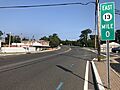
Route 13 eastbound in Point Pleasant
_just_west_of_Rue_Lido_and_Hollywood_Boulevard_in_Point_Pleasant,_Ocean_County,_New_Jersey.jpg)
See also
 In Spanish: Point Pleasant (Nueva Jersey) para niños
