Lavallette, New Jersey facts for kids
Quick facts for kids
Lavallette, New Jersey
|
||
|---|---|---|
|
Borough
|
||
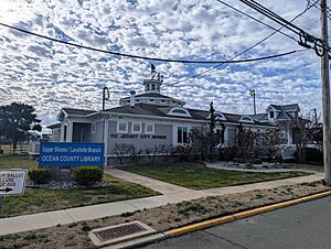
Upper Shores / Lavallette Branch of the Ocean County Library
|
||
|
||
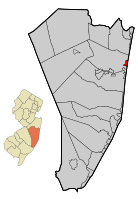
Location of Lavallette in Ocean County highlighted in red (right). Inset map: Location of Ocean County in New Jersey highlighted in orange (left).
|
||
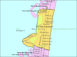
Census Bureau map of Lavallette, New Jersey
|
||
| Country | ||
| state | ||
| County | ||
| Incorporated | December 21, 1887 | |
| Named for | Elie A. F. La Vallette | |
| Government | ||
| • Type | Borough | |
| • Body | Borough Council | |
| Area | ||
| • Total | 0.96 sq mi (2.50 km2) | |
| • Land | 0.82 sq mi (2.11 km2) | |
| • Water | 0.15 sq mi (0.38 km2) 15.42% | |
| Area rank | 506th of 565 in state 26th of 33 in county |
|
| Elevation | 3 ft (0.9 m) | |
| Population
(2020)
|
||
| • Total | 1,787 | |
| • Estimate
(2023)
|
1,843 | |
| • Rank | 495th of 565 in state 23rd of 33 in county |
|
| • Density | 2,190.2/sq mi (845.6/km2) | |
| • Density rank | 281st of 565 in state 14th of 33 in county |
|
| Time zone | UTC−05:00 (Eastern (EST)) | |
| • Summer (DST) | UTC−04:00 (Eastern (EDT)) | |
| ZIP Code |
08735
|
|
| Area code(s) | 732 Exchanges: 793, 830, 854 | |
| FIPS code | 3402939390 | |
| GNIS feature ID | 885273 | |
Lavallette is a small town, called a borough, located right on the Jersey Shore in Ocean County, New Jersey. It sits on the Barnegat Peninsula, which is a long, thin strip of land that separates the Barnegat Bay from the big Atlantic Ocean.
In 2020, about 1,787 people lived in Lavallette. This number was a bit lower than in 2010.
Contents
History of Lavallette
Lavallette became an official borough on December 21, 1887. This happened after people in the area voted for it. It was created from parts of a larger area called Dover Township, which is now known as Toms River Township.
The borough was named after Elie A. F. La Vallette. He was one of the first rear admirals in the United States Navy. His son, Albert T. Lavallette, helped start the borough.
In 2008, New Jersey Monthly magazine said Lavallette was the 8th best place to live in New Jersey!
Where is Lavallette Located?
Lavallette is a small place, covering about 0.96 square miles (2.50 square kilometers). Most of this area is land, but a small part is water.
The borough is next to Toms River Township in Ocean County.
People in Lavallette
| Historical population | |||
|---|---|---|---|
| Census | Pop. | %± | |
| 1900 | 21 | — | |
| 1910 | 42 | 100.0% | |
| 1920 | 117 | 178.6% | |
| 1930 | 287 | 145.3% | |
| 1940 | 315 | 9.8% | |
| 1950 | 567 | 80.0% | |
| 1960 | 832 | 46.7% | |
| 1970 | 1,509 | 81.4% | |
| 1980 | 2,072 | 37.3% | |
| 1990 | 2,299 | 11.0% | |
| 2000 | 2,665 | 15.9% | |
| 2010 | 1,875 | −29.6% | |
| 2020 | 1,787 | −4.7% | |
| 2023 (est.) | 1,843 | −1.7% | |
| Population sources: 1900–2000 1900–1920 1900–1910 1910–1930 1940–2000 2000 2010 2020 |
|||
Population Changes Over Time
The population of Lavallette has changed a lot over the years. In 1900, only 21 people lived there! The number grew steadily, reaching its highest point in 2000 with 2,665 residents.
Since 2000, the population has decreased. In 2010, there were 1,875 people, and by 2020, it was 1,787.
Who Lives in Lavallette?
According to the 2010 census, most people in Lavallette were White (97.87%). A small number were Asian or from other backgrounds. About 2.99% of the population was Hispanic or Latino.
The average age of people in Lavallette in 2010 was 60.3 years old. Many residents were 65 or older (40.4%). About 11% of the population was under 18.
Fun Things to Do in Lavallette
Lavallette offers many fun activities, especially outdoors!
- Beaches: There are nine ocean beaches where you can swim. Two beaches are on the Barnegat Bay side.
- Water Sports: On the ocean, you can surf and fish. On Barnegat Bay, you can go fishing, crabbing, swimming, boating, sailing, and windsurfing.
- Land Sports: You can play tennis, bocce, shuffleboard, basketball, and go rollerblading.
- Events: The town also hosts band concerts, fireworks shows, and "Movies on the Bay" at the Centennial Gazebo and Gardens.
Schools in Lavallette
Lavallette School District
Students in Lavallette go to public school from kindergarten through eighth grade at Lavallette Elementary School. In the 2020–21 school year, this school had 156 students and about 16 teachers. This means there were about 9 or 10 students for every teacher.
High School Education
After eighth grade, students attend Point Pleasant Beach High School in Point Pleasant Beach. They go there as part of a special agreement with the Point Pleasant Beach School District. Students from nearby Bay Head and Mantoloking also attend this high school. In the 2020–21 school year, the high school had 382 students.
Getting Around Lavallette
Roads and Highways
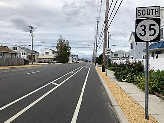
Lavallette has about 16.55 miles of roads. Most of these roads are kept up by the town itself. A main road, New Jersey Route 35, goes through Lavallette. It connects the town to other areas like Ortley Beach and Dover Beaches North.
Public Transportation
If you need public transport, Ocean Ride offers a local bus service called the OC10 Toms River Connection route.
Lavallette in Movies
The 2007 movie Greetings from the Shore was filmed and set right here in Lavallette! It's a coming-of-age romance story.
Weather in Lavallette
Lavallette has a humid subtropical climate. This means it has warm, humid summers and mild winters.
- Summers: Summers are usually warm, with average high temperatures in July around 83.5°F (28.6°C). Sometimes it can get very hot and humid. A cool sea breeze often blows in the afternoons.
- Winters: Winters are mild, with average high temperatures in January around 40.4°F (4.7°C). It can get very cold and windy sometimes.
- Rain and Snow: July is usually the wettest month, with lots of thunderstorms. On average, Lavallette gets about 18 to 24 inches (46 to 61 cm) of snow each winter, with February being the snowiest month.
| Climate data for Lavallette Beach, NJ (1981–2010 Averages) | |||||||||||||
|---|---|---|---|---|---|---|---|---|---|---|---|---|---|
| Month | Jan | Feb | Mar | Apr | May | Jun | Jul | Aug | Sep | Oct | Nov | Dec | Year |
| Mean daily maximum °F (°C) | 40.4 (4.7) |
42.9 (6.1) |
49.6 (9.8) |
59.3 (15.2) |
69.1 (20.6) |
78.3 (25.7) |
83.5 (28.6) |
82.3 (27.9) |
76.3 (24.6) |
65.6 (18.7) |
55.3 (12.9) |
45.3 (7.4) |
62.4 (16.9) |
| Daily mean °F (°C) | 32.7 (0.4) |
34.8 (1.6) |
41.2 (5.1) |
50.5 (10.3) |
60.3 (15.7) |
69.7 (20.9) |
75.1 (23.9) |
74.1 (23.4) |
67.6 (19.8) |
56.4 (13.6) |
47.0 (8.3) |
37.5 (3.1) |
54.0 (12.2) |
| Mean daily minimum °F (°C) | 25.1 (−3.8) |
26.7 (−2.9) |
32.8 (0.4) |
41.7 (5.4) |
51.4 (10.8) |
61.1 (16.2) |
66.7 (19.3) |
65.9 (18.8) |
58.8 (14.9) |
47.1 (8.4) |
38.7 (3.7) |
29.8 (−1.2) |
45.6 (7.6) |
| Average precipitation inches (mm) | 3.66 (93) |
3.06 (78) |
4.25 (108) |
3.90 (99) |
3.54 (90) |
3.66 (93) |
4.54 (115) |
4.50 (114) |
3.53 (90) |
3.74 (95) |
3.83 (97) |
3.93 (100) |
46.14 (1,172) |
| Average relative humidity (%) | 65.2 | 62.8 | 60.8 | 62.3 | 65.8 | 70.1 | 69.6 | 71.3 | 70.8 | 69.6 | 68.6 | 66.6 | 66.6 |
| Average dew point °F (°C) | 22.3 (−5.4) |
23.4 (−4.8) |
28.7 (−1.8) |
38.1 (3.4) |
48.8 (9.3) |
59.5 (15.3) |
64.5 (18.1) |
64.2 (17.9) |
57.8 (14.3) |
46.6 (8.1) |
37.2 (2.9) |
27.4 (−2.6) |
43.3 (6.3) |
| Source: PRISM | |||||||||||||
| Climate data for Sandy Hook, NJ Ocean Water Temperature (34 N Lavallette) | |||||||||||||
|---|---|---|---|---|---|---|---|---|---|---|---|---|---|
| Month | Jan | Feb | Mar | Apr | May | Jun | Jul | Aug | Sep | Oct | Nov | Dec | Year |
| Daily mean °F (°C) | 37 (3) |
36 (2) |
40 (4) |
46 (8) |
55 (13) |
62 (17) |
69 (21) |
72 (22) |
68 (20) |
59 (15) |
51 (11) |
43 (6) |
53 (12) |
| Source: NOAA | |||||||||||||
Nature in Lavallette
The natural plants in Lavallette are mostly Northern Cordgrass, which is a type of grass found in coastal areas. This forms a kind of Coastal Prairie.
Famous People from Lavallette
Many interesting people have lived in or are connected to Lavallette:
- William Fenn (1904–1980) – He was a cyclist who competed in the 1924 Summer Olympics.
- Joe Pesci (born 1943) – A well-known actor.
See also
 In Spanish: Lavallette para niños
 | Emma Amos |
 | Edward Mitchell Bannister |
 | Larry D. Alexander |
 | Ernie Barnes |


