Manchester Township, New Jersey facts for kids
Quick facts for kids
Manchester Township, New Jersey
|
||
|---|---|---|
|
Township
|
||
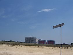
Historical marker commemorating the site of the Hindenburg disaster in Manchester Township
|
||
|
||
| Nickname(s):
The Great Pine City
|
||
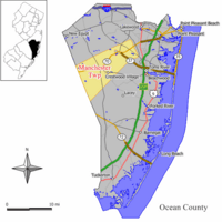
Location of Manchester Township in Ocean County highlighted in yellow (right). Inset map: Location of Ocean County in New Jersey highlighted in black (left).
|
||
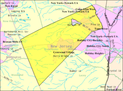
Census Bureau map of Manchester Township, New Jersey
|
||
| Country | ||
| State | ||
| County | ||
| Incorporated | April 6, 1865 | |
| Named for | Manchester, England | |
| Government | ||
| • Type | Faulkner Act (mayor–council) | |
| • Body | Township Council | |
| Area | ||
| • Total | 82.51 sq mi (213.70 km2) | |
| • Land | 81.42 sq mi (210.87 km2) | |
| • Water | 1.09 sq mi (2.83 km2) 1.32% | |
| Area rank | 9th of 565 in state 3rd of 33 in county |
|
| Elevation | 154 ft (47 m) | |
| Population
(2020)
|
||
| • Total | 45,115 | |
| • Estimate
(2023)
|
46,053 | |
| • Rank | 48th of 565 in state 5th of 33 in county |
|
| • Density | 554.1/sq mi (213.9/km2) | |
| • Density rank | 436th of 565 in state 28th of 33 in county |
|
| Time zone | UTC−05:00 (Eastern (EST)) | |
| • Summer (DST) | UTC−04:00 (Eastern (EDT)) | |
| ZIP Codes |
08733 and 08759
|
|
| Area code(s) | 732 | |
| FIPS code | 3402943140 | |
| GNIS feature ID | 0882077 | |
| Website | ||
Manchester Township is a community in Ocean County, New Jersey. It's known for being home to the Lakehurst Naval Air Station. This base was the site of the famous Hindenburg disaster on May 6, 1937. In 2020, about 45,115 people lived here.
Manchester Township officially became a township on April 6, 1865. It was formed from parts of what was then Dover Township (now Toms River Township). The township was named after Manchester, England. Later, on April 7, 1921, a part of Manchester Township became the separate town of Lakehurst.
Contents
Exploring Manchester Township's Geography
Manchester Township covers about 82.51 square miles (213.70 square kilometers). Most of this area, about 81.42 square miles (210.87 square kilometers), is land. The rest, about 1.09 square miles (2.83 square kilometers), is water.
Communities within Manchester Township
Several smaller communities are located inside Manchester Township. These include:
- Cedar Glen Lakes
- Cedar Glen West
- Crestwood Village
- Leisure Knoll
- Leisure Village West
- Pine Lake Park
- Pine Ridge at Crestwood
Other smaller areas include Beckerville, Whiting, and Keswick Grove. Whiting is the largest area within Manchester, both in size and population.
Neighboring Towns and Unique Features
Manchester Township shares borders with several other towns. These include Berkeley Township, Jackson Township, and Toms River Township in Ocean County. It also borders towns in Burlington County.
A cool fact about Manchester Township is that it completely surrounds the independent town of Lakehurst. This makes it one of 21 "doughnut towns" in New Jersey, where one town completely wraps around another!
Pine Lake Park, a large community here, is famous for its man-made lake, Pine Lake. This lake was built in the 1970s. The township is also part of the Toms River watershed, which means its water flows into the Toms River.
Population and People
| Historical population | |||
|---|---|---|---|
| Census | Pop. | %± | |
| 1870 | 1,102 | — | |
| 1880 | 1,057 | −4.1% | |
| 1890 | 1,057 | 0.0% | |
| 1900 | 1,033 | −2.3% | |
| 1910 | 1,112 | 7.6% | |
| 1920 | 1,034 | −7.0% | |
| 1930 | 1,009 | * | −2.4% |
| 1940 | 918 | −9.0% | |
| 1950 | 1,758 | 91.5% | |
| 1960 | 3,779 | 115.0% | |
| 1970 | 7,550 | 99.8% | |
| 1980 | 27,987 | 270.7% | |
| 1990 | 35,976 | 28.5% | |
| 2000 | 38,928 | 8.2% | |
| 2010 | 43,070 | 10.6% | |
| 2020 | 45,115 | 4.7% | |
| 2023 (est.) | 46,053 | 6.9% | |
| Population sources: 1870–2000 1870–1920 1870 1880–1890 1890–1910 1910–1930 1940–2000 2000 2010 2020 * = Lost territory in previous decade. |
|||
In 2020, the 2020 United States census counted 45,115 people living in Manchester Township. This was the highest population ever recorded for the township.
Back in 2010, the population was 43,070 people. Many households in Manchester Township have people living alone, especially those who are 65 years or older. In fact, over half of the population was 65 or older in 2010, making it a popular place for older adults to live.
Education in Manchester Township
The Manchester Township School District serves students from pre-kindergarten all the way through twelfth grade. The district has six schools in total. As of the 2020–21 school year, about 2,922 students were enrolled.
The schools in the district include:
- Manchester Township Elementary School (grades K–5)
- Ridgeway Elementary School (grades Pre-K–5)
- Whiting Elementary School (grades Pre-K–5)
- Manchester Township Middle School (grades 6–8)
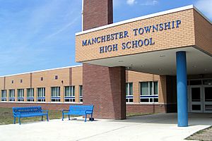
- Manchester Township High School (grades 9–12)
- Regional Day School (grades Pre-K–12), which helps students with special needs.
Students from the nearby town of Lakehurst also attend Manchester Township High School. This is part of a special agreement between the two school districts.
There is also a Catholic school, St. Mary Academy, located in Manahawkin, which serves students from kindergarten to 8th grade.
Local News and Media
If you want to know what's happening in Manchester Township, you can read the Asbury Park Press for daily news. The local radio station WOBM-FM also provides coverage. There's also a weekly newspaper called The Manchester Times, which covers Manchester and Lakehurst.
Getting Around Manchester Township
Manchester Township has many roads. About 168.51 miles of roads crisscross the area. The township itself takes care of most of these roads.
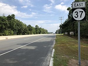
Major roads that go through Manchester Township include:
- Route 70
- Route 37
- County Route 530
- County Route 539
While there are no major highways directly in the township, you can easily reach big roads like the Garden State Parkway and Interstate 195 in nearby towns.
For public transportation, there's a local bus service called Ocean Ride. It has routes like OC1 Whiting and OC2 Manchester, which help people get around the area.
Famous People from Manchester Township
Many interesting people have lived in or are connected to Manchester Township:
- Joe Cinderella (1927–2012), a talented jazz guitarist.
- George A. Krol (born 1956), who used to be a United States Ambassador.
- Kevin Malast (born 1986), a former football player for NFL teams like the Chicago Bears.
- Shavar Reynolds Jr. (born 1998), a basketball player.
- Julia Scotti, a stand-up comedian.
- George Tuska (1916–2009), a well-known comic book artist.
- Andrew Valmon (born 1965), an Olympic gold medal-winning runner.
See also
 In Spanish: Municipio de Manchester (Nueva Jersey) para niños
 | Percy Lavon Julian |
 | Katherine Johnson |
 | George Washington Carver |
 | Annie Easley |


