
Lower New York Bay facts for kids
Lower New York Bay is a big part of New York Bay. It's located south of a narrow water passage called the Narrows. This passage is between Staten Island and Brooklyn. The bay opens right into the Atlantic Ocean at its southern end. This opening is between two sandy areas: Sandy Hook, New Jersey and Rockaway, Queens on Long Island.
A part of the bay between Staten Island and New Jersey is called Raritan Bay. This is where the Raritan River flows into the bay. Deep under the ocean, there's a huge underwater canyon called the Hudson Canyon. It's like an ancient riverbed of the Hudson River. This canyon was formed during the last ice age when sea levels were much lower. It stretches for hundreds of miles into the Atlantic Ocean. The nearby ocean area between New Jersey and Long Island is known as the New York Bight.


Contents
Exploring the Lower New York Bay's Past and Present
For a very long time, even before the Lenape people lived here, Lower New York Bay was full of life. It had a rich marine ecosystem, meaning lots of different fish and shellfish. This included many oyster, clam, and mussel beds.
In the 1900s, as more people moved to the area and industries grew, pollution became a big problem. The water quality in the bay got much worse. This made it hard for marine life to survive. Luckily, things started to get better after the Clean Water Act was passed in 1972. This law helped to clean up the water.
The main path for ships through Lower New York Bay is called the Ambrose Channel. It's 2,000 feet wide and dug to be 40 feet deep. This allows large ships to pass through safely. For many years, a special boat called the Lightship Ambrose marked the entrance to this channel. Later, a fixed structure called the Ambrose Light took its place.
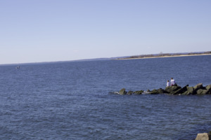
The bay area is also home to popular beaches. You can find them at Brighton Beach and Coney Island in Brooklyn. There are also beaches on Staten Island. Just outside the bay, facing the Atlantic Ocean, are the beaches of Sandy Hook and the Rockaways.

Guiding Ships: Lighthouses of the Bay
Many lighthouses were built to help ships find their way in and around Lower New York Bay. Some are on land, and others are right in the bay. The oldest one, at Sandy Hook, was built a very long time ago when the area was still a colony.
Here are some of the lighthouses:
- In New Jersey:
- Chapel Hill Rear Range Light
- Conover Beacon
- Great Beds Light
- Navesink Twin Lights
- Sandy Hook Light
- In New York:
- Coney Island Light
- New Dorp Light
- Princes Bay Light
- Staten Island Light
- Fort Wadsworth Light
- Inside Lower New York Bay:
- Romer Shoal Light
- West Bank Light
- Old Orchard Shoal Light
Islands of Lower New York Bay
There are two small islands in Lower New York Bay that were made by people. They are about a mile offshore from South Beach, Staten Island.
Hoffman Island
Hoffman Island was created in 1873. It was named after John Thompson Hoffman, who was once the Mayor of New York City and later the Governor of New York. This island is about 11 acres in size.
Swinburne Island
Swinburne Island is right next to Hoffman Island and is about 4 acres. It was named after Dr. John Swinburne, a famous military doctor during the American Civil War.
Islands' Role in History
In the early 1900s, both islands were used as a place to keep people separate if they were sick. This was called a quarantine station. Immigrants arriving at Ellis Island who had contagious diseases would stay here.
When World War II started, the islands became a training base for the United States Merchant Marine. This group trains sailors for merchant ships. Buildings called Quonset huts, which were built during this time, can still be seen on Swinburne Island.
Another important use for the islands during World War II was to help protect New York Bay. They were used as anchor points for huge antisubmarine nets. These nets stretched across the bay to keep enemy submarines out of the harbor. Today, both islands are part of the Gateway National Recreation Area, which is a park.
Other Notable Landforms
Fort Lafayette was once on a small island in the Narrows, near the Brooklyn shore. However, this island was removed when the Verrazano-Narrows Bridge was built. Coney Island, which used to be a separate island, is now connected to the rest of Long Island by land that was filled in. So, even though it's still called an island, it's actually a peninsula now.
