Lower Squankum, New Jersey facts for kids
Quick facts for kids
Lower Squankum, New Jersey
|
|
|---|---|

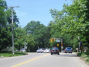
Approaching CR 547 on Herbertsville Road (CR 549) in Lower Squankum
|
|
| Country | |
| State | |
| County | Monmouth |
| Township | Howell |
| Elevation | 43 ft (13 m) |
| GNIS feature ID | 877973 |
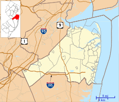
Lower Squankum is a small, special place in New Jersey. It's not a big city or a town with its own government. Instead, it's an "unincorporated community" within Howell Township. This means it's a recognized area, but it doesn't have its own separate local government. It's part of Monmouth County, in the U.S. state of New Jersey.
About Lower Squankum
Lower Squankum is located in the eastern part of Howell Township. It sits where several roads meet. These roads include Lakewood-Farmingdale Road, also known as County Route 547. You'll also find Herbertsville Road (CR 549) and Old Tavern Road (CR 21) here.
What's Nearby?
This community is close to some interesting places. It's near the edge of Allaire State Park, which is a great spot for outdoor activities. Also, it's south of Exit 31 of Interstate 195.
Historical Sites
In Lower Squankum, you can find reminders of the past. There are the remains of the Lower Squankum Mill. Mills like this used to grind grain. You can also find the Lower Squankum Friends Burial Site. These historical spots are located right in the middle of County Route 547 where the roads cross.


