Cooleys Corner, New Jersey facts for kids
Quick facts for kids
Cooleys Corner, New Jersey
|
|
|---|---|

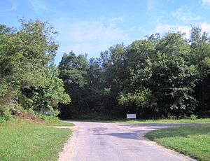
Site of the former intersection of Clarksburg and Imlaystown-Hightstown Roads
|
|
| Country | |
| State | |
| County | Monmouth |
| Township | Upper Freehold |
| Elevation | 118 ft (36 m) |
| GNIS feature ID | 875624 |
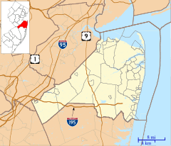
Cooleys Corner is a small, unnamed place in Upper Freehold Township, Monmouth County, New Jersey. It's known as an "unincorporated community." This means it's a group of homes or buildings that isn't officially a town or city with its own local government.
Exploring Cooleys Corner
Cooleys Corner is located inside the Assunpink Wildlife Management Area. This is a special protected area managed by the New Jersey Department of Environmental Protection. It helps to keep nature safe. The area stretches across parts of Monmouth and Mercer counties. It follows along the Assunpink Creek.
From Farms to Nature
Before the 1970s, Cooleys Corner was mostly farmland. It was found where two roads, Clarksburg Road and Imlaystown-Hightstown Road, met. In the 1970s, a big change happened. The Assunpink Lake was created. This lake transformed the landscape.
Today, some farmland still exists in the area. However, much of the land is now used by hunters. The main place to launch a boat onto Assunpink Lake is also located here. It's found along what used to be Imlaystown-Hightstown Road.
 | Lonnie Johnson |
 | Granville Woods |
 | Lewis Howard Latimer |
 | James West |


