
Lincroft, New Jersey facts for kids
Quick facts for kids
Lincroft, New Jersey
|
|
|---|---|

Entrance to Thompson Park in Lincroft
|
|

Location of Lincroft in Monmouth County highlighted in red (left). Inset map: Location of Monmouth County in New Jersey highlighted in orange (right).
|
|

Lincroft, New Jersey
Location in Monmouth County, New Jersey

Lincroft, New Jersey
Location in New Jersey

Lincroft, New Jersey
Location in the United States
|
|
| Country | |
| State | |
| County | Monmouth |
| Township | Middletown |
| Area | |
| • Total | 5.79 sq mi (15.01 km2) |
| • Land | 5.58 sq mi (14.46 km2) |
| • Water | 0.08 sq mi (0.21 km2) 3.78% |
| Elevation | 64 ft (14 m) |
| Population
(2020)
|
|
| • Total | 7,060 |
| • Density | 1,264.8/sq mi (488.32/km2) |
| Time zone | UTC−05:00 (Eastern (EST)) |
| • Summer (DST) | UTC−04:00 (Eastern (EDT)) |
| ZIP Code |
07738
|
| Area code(s) | 732/848 |
| FIPS code | 34-40320 |
| GNIS feature ID | 2390072 |
Lincroft is a community in New Jersey, USA. It is part of Middletown Township in Monmouth County. Lincroft is called a "census-designated place" (CDP). This means it is a specific area used for gathering population information.
In 2020, about 7,060 people lived in Lincroft. This was a 15.1% increase from the 6,135 people counted in 2010.
Contents
Geography of Lincroft
Lincroft covers an area of about 5.8 square miles (15 square kilometers). Most of this area is land. A small part, about 0.2 square miles (0.5 square kilometers), is water.
Who Lives in Lincroft?

| Historical population | |||
|---|---|---|---|
| Census | Pop. | %± | |
| 1990 | 6,193 | — | |
| 2000 | 6,255 | 1.0% | |
| 2010 | 6,135 | −1.9% | |
| 2020 | 7,060 | 15.1% | |
| Population sources: 2090-2010 2000 2010 2020 |
|||
Lincroft's Population in 2010
The 2010 census counted 6,135 people living in Lincroft. There were 2,102 households, which are groups of people living together. Most people (about 94.8%) were White. About 3.3% were Asian. People of Hispanic or Latino background made up about 3.6% of the population.
Many households (about 71.4%) were married couples. About 39.3% of households had children under 18 years old. The average household had almost 3 people.
About 26.7% of the people were under 18. About 16.9% were 65 or older. The average age in Lincroft was 44.2 years.
Schools in Lincroft

Lincroft is home to several different types of schools:
- Brookdale Community College: This is a college for students who have finished high school. It serves all of Monmouth County.
- Christian Brothers Academy: This is a private high school just for boys. It helps students get ready for college and focuses on Christian values.
- High Technology High School: This is a special school that teaches students about technology. It is located on the Brookdale Community College campus.
- Lincroft Elementary School: This is a public school for younger children, from kindergarten to 5th grade.
- Oak Hill Academy: This is a private school for students from kindergarten to 8th grade. It was started in 1981.
- St. Leo the Great School: This is a private Catholic school for students from kindergarten to 8th grade. It was recognized as a top school in 2012.
Historic Brookdale Farm
|
Brookdale Farm Historic District
|
|

Training Stable at Brookdale Farm
|
|
| Location | 805 Newman Springs Road |
|---|---|
| Area | 228 acres (92 ha) |
| NRHP reference No. | 100004105 |
| Significant dates | |
| Added to NRHP | November 9, 2020 |
Brookdale Farm is a historic area in Lincroft. It covers 228 acres (about 0.9 square kilometers). This farm was added to the National Register of Historic Places in 2020. It is important because of its history in farming, its buildings, and for entertainment from 1786 to 1932. The area includes 19 important buildings and one historic site.
-
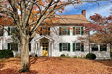
The Thomas Lloyd House
-

The Lloyd Barn (right) and Ten Mare Barn (left)


Getting Around Lincroft
You can get around Lincroft using New Jersey Transit local bus service on the 833 route. If you want to travel by train, the North Jersey Coast Line has a station nearby in Red Bank.
Famous People from Lincroft
Some well-known people have lived in or are connected to Lincroft:
- Sebastian Bach (born 1968): He is famous as the lead singer of the band Skid Row.
- Nicole Byer (born 1986): She is a popular comedian.
- Vincent Favale (born 1959): He helped start Comedy Central, a well-known TV channel.
- Bob Tucker (born 1945): He used to be a professional football player for the Minnesota Vikings and New York Giants.
See also
 In Spanish: Lincroft para niños
