Montrose, New Jersey facts for kids
Quick facts for kids
Montrose, New Jersey
|
|
|---|---|

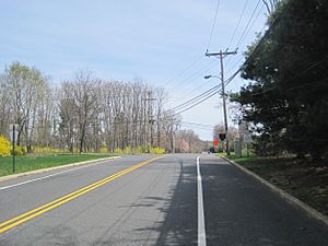
Dutch Lane Road approaching Boundary Road
|
|
| Country | |
| State | |
| County | Monmouth |
| Township | Colts Neck and Marlboro |
| Elevation | 157 ft (48 m) |
| Time zone | UTC−05:00 (Eastern (EST)) |
| • Summer (DST) | UTC−04:00 (EDT) |
| GNIS feature ID | 878453 |
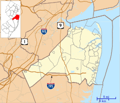
Montrose is a small, unincorporated community in New Jersey, United States. It is located in Monmouth County, right where Colts Neck and Marlboro townships meet. You can find it near the crossing of Dutch Lane Road and Boundary Road.
Before it was called Montrose, this area was known as "Barrentown." It was also once part of "Atlantic Township" before that name changed to "Colts Neck." The community got electricity in 1928. A fire department was started in 1926 to keep everyone safe. A mail delivery service to homes in the countryside began in 1905.
Contents
What Was Farming Like in Montrose?
The farms around Montrose were very important. They were known for producing many different things. Farmers here raised dairy cows for milk and horses. They also grew crops like potatoes and sweet peaches. In 1929, a local farmer named John Koster had a big greenhouse. He was famous for growing and selling beautiful flowers.
The Historic Montrose Schoolhouse
One of the most special places in Montrose is the old one-room Montrose Schoolhouse. It was built a very long time ago, even before 1786! This schoolhouse is located in the Colts Neck part of the community.
For many years, this building was more than just a school. It was a place where people met for community events. It was also used for religious gatherings. The last time children attended classes here was in 1922. The last person known to drive the school bus was James Danser.
Moving and Restoring the Schoolhouse
The schoolhouse was given to the Colts Neck Historical Society by George Illmensee before 1968. It had to be moved in 1967 because new houses were being built in the area. Its original spot was on Montrose Road and Cedar Drive. Moving and fixing up the schoolhouse cost about $1,006.57.
The Montrose Hunt Club
For many years, Montrose was a popular starting point for the Monmouth County Hunt. This was a group that went out hunting together. Sometimes, as many as 100 hunters would gather. They would often meet at the historic Montrose Schoolhouse before they began their hunt. The main animals they focused on hunting were foxes and rabbits.


