New Jersey Route 36 facts for kids
Quick facts for kids
Route 36 |
||||||||||
|---|---|---|---|---|---|---|---|---|---|---|
|
Route 36 highlighted in red; unsigned route 444S (route 444 Spur) highlighted in pink
|
||||||||||
| Route information | ||||||||||
| Maintained by NJDOT | ||||||||||
| Length | 24.4 mi (39.3 km) | |||||||||
| Existed | 1927–present | |||||||||
| Major junctions | ||||||||||
| West end |
|
|||||||||
|
||||||||||
| North end |
|
|||||||||
| Location | ||||||||||
| Counties: | Monmouth | |||||||||
| Highway system | ||||||||||
| New Jersey State Highway Routes Interstate and US
|
||||||||||
Route 36 is a major state highway in Monmouth County, New Jersey. It's about 24.4 miles (39.3 kilometers) long. Imagine the letter "C" turned backwards – that's the shape of Route 36!
The road starts in Eatontown, near the Garden State Parkway. From there, it heads east towards Long Branch. After Long Branch, it turns north and follows the beautiful Atlantic Ocean coastline all the way to Sea Bright. Finally, Route 36 turns west again, running south of the Raritan Bay. It ends in Keyport, where it connects with the Garden State Parkway and Route 35.
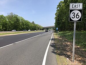
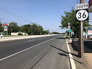
Route 36 changes quite a bit along its path. Some parts are wide, six-lane divided highways, while others are narrower, two-lane roads. It's signed as an east-west road between Eatontown and Long Branch, and then as a north-south road from Long Branch to Keyport. This highway was first created in 1927.
Contents
Exploring Route 36
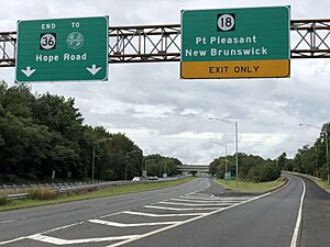
Route 36 begins in Eatontown. It starts as a four-lane divided highway near the Garden State Parkway. Soon after, you'll see ramps that connect to Route 18. The road then gets wider, becoming six lanes.
As you continue east, Route 36 passes by the Monmouth Mall. It then crosses Route 35 at what used to be a big traffic circle, but it's now a regular intersection. The road goes through areas with lots of shops and businesses.
Through West Long Branch and Long Branch
Route 36 enters West Long Branch. Here, it meets Route 71. The road then turns northeast. You'll pass the entrance to the famous Monmouth Park Racetrack.
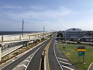
After this, Route 36 becomes a two-lane road. It enters Long Branch and is known as Joline Avenue. In Long Branch, the road heads towards the Atlantic Ocean. When it reaches the ocean, it turns north. Now, it's called Ocean Boulevard and becomes a four-lane divided road again, running right along the coast.
Along the Coastline to Sandy Hook
Route 36 continues along the ocean into Monmouth Beach. Here, it narrows back to two lanes and is called Ocean Avenue. It runs very close to the Sea Bright–Monmouth Beach Seawall, which protects the road from the ocean.
Next, the route enters Sea Bright. This area is a narrow strip of land between the Shrewsbury River and the Atlantic Ocean. Route 36 continues north along this peninsula. You'll reach an interchange that leads to Gateway National Recreation Area at Sandy Hook. This is a popular spot for beaches and history!
Turning West Towards Keyport
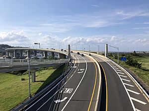
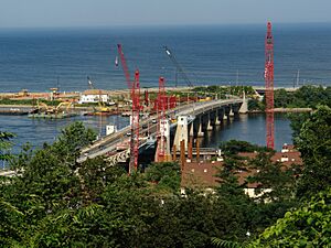
After Sandy Hook, Route 36 turns west. It crosses the Shrewsbury River on the four-lane Highlands–Sea Bright Bridge. This bridge takes you into Highlands. In Highlands, the road connects with Bay Avenue.
Route 36 continues west as a four-lane divided highway. It runs a short distance south of the Raritan Bay. The road then forms the border between Highlands and Middletown. It fully enters Middletown and is called Memorial Parkway.
Through Atlantic Highlands and Hazlet
The route then goes into Atlantic Highlands. Here, it crosses several local roads. It then goes back into Middletown.
Route 36 passes under Normandy Road, which connects parts of the Naval Weapons Station Earle. The road then loses the Memorial Parkway name. It forms the border between Hazlet and Keansburg.
Eventually, Route 36 fully enters Hazlet. It then forms the border between Hazlet and Union Beach. It even passes over Natco Lake. The road continues through Hazlet, passing a bus terminal and a shopping center with a "Park & Ride" lot.
Ending in Keyport
Finally, Route 36 enters Keyport. It crosses Broad Street. The route then reaches its end at an interchange. Here, it connects with Route 35 and the Garden State Parkway at Exit 117. Remember, the whole road is shaped like a backwards "C"!
How Route 36 Was Built
The part of Route 36 from Atlantic Highlands to Long Branch was once part of a longer road called the Jersey Coast Way. This old road went all the way from the Staten Island Ferry to Cape May.
Route 36 was officially created in 1927. It was planned to run between Keyport and Highlands. The original plan had the road going through the busy downtown areas of Keyport, Keansburg, and Atlantic Highlands. It also had many sharp turns, which made it difficult to drive.
Because of these problems, the route was changed in 1929. The new plan made Route 36 bypass the downtown areas and avoid the sharp curves. This made the road much safer and easier to use.
Extending the Route
In 1940, Route 36 was extended south to Route 35 in Eatontown. However, only a small part of this extension was built at first.
More parts of the road were added on October 17, 1972. The state took over control of Ocean Avenue and Joline Avenue from Monmouth County. Ocean Avenue ran between Long Branch and Sea Bright. Joline Avenue was in Long Branch.
After these takeovers, there was still a small gap in Route 36 in Long Branch. This gap was filled when Ocean Boulevard was completed in late 1983. This connected all the pieces of Route 36 together.
Between 2008 and 2011, the Highlands–Sea Bright Bridge was replaced. The old bridge could open to let boats pass. The new bridge is a fixed span, meaning it doesn't open. It's also 30 feet (9.1 meters) higher than the old one.
Route 36 in Movies
Route 36 has even appeared in movies! The "Marina Diner" from the 1997 film Chasing Amy is located along Route 36 in Belford. This diner is now called the King Arms II Diner.
Also, the "Quick Stop Groceries" and "RST Video" stores from the 1994 film Clerks are very close to Route 36. They are just north of the highway's intersection with Leonard Avenue in Leonardo. Both of these movies were made by Kevin Smith, who used to live in New Jersey.
 | Audre Lorde |
 | John Berry Meachum |
 | Ferdinand Lee Barnett |


