Robertsville, New Jersey facts for kids
Quick facts for kids
Robertsville, New Jersey
|
|
|---|---|

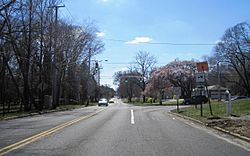
Tennent Road (CR 3) and Union Hill Road
|
|
| Country | |
| State | |
| County | Monmouth |
| Township | Marlboro |
| Area | |
| • Total | 5.91 sq mi (15.32 km2) |
| • Land | 5.90 sq mi (15.29 km2) |
| • Water | 0.01 sq mi (0.03 km2) 0.21% |
| Elevation | 164 ft (50 m) |
| Population
(2020)
|
|
| • Total | 11,399 |
| • Density | 1,931.05/sq mi (745.61/km2) |
| Time zone | UTC−05:00 (Eastern (EST)) |
| • Summer (DST) | UTC−04:00 (Eastern (EDT)) |
| Area code(s) | 732/848 |
| FIPS code | 34-63900 |
| GNIS feature ID | 02634200 |
Robertsville is a community in Monmouth County, New Jersey. It is part of Marlboro Township. The U.S. Census Bureau calls Robertsville a "census-designated place" (CDP). This means it's an area that the Census Bureau defines for collecting statistics. It is not an officially separate town with its own government. In 2020, about 11,399 people lived in Robertsville.
Contents
Robertsville's Location and Size
Robertsville is located in New Jersey. The total area of the community is about 5.93 square miles (15.36 square kilometers). Most of this area, about 5.92 square miles (15.33 square kilometers), is land. Only a small part, about 0.013 square miles (0.033 square kilometers), is water.
Who Lives in Robertsville?
| Historical population | |||
|---|---|---|---|
| Census | Pop. | %± | |
| 1980 | 8,461 | — | |
| 2010 | 11,927 | — | |
| 2020 | 11,399 | −4.4% | |
| Population sources: 1980 1990-2010 2010 |
|||
People and Families in 2010
In 2010, there were 11,297 people living in Robertsville. There were 3,792 households and about 3,231 families. The population density was about 1,909 people per square mile.
Most people in Robertsville were White (84.21%). There were also many Asian residents (11.7%) and some Black or African American residents (2.39%). About 4.05% of the population was Hispanic or Latino.
Many households in Robertsville had children under 18 (42.4%). Most households were married couples living together (77.3%). The average household had about 2.98 people.
The median age in Robertsville was 42.8 years. About 27.0% of the people were under 18 years old. About 12.7% were 65 years or older.
Schools in Robertsville
Children who live in Robertsville attend public schools as part of the Marlboro Township Public School District. The local elementary school for the area is Robertsville Elementary School.
Getting Around Robertsville
Several important roads pass through Robertsville. These include Tennent Road, which is also known as County Route 3. Newman Springs Road, or County Route 520, also goes through the area. The Route 18 freeway is another major road in Robertsville.
See also
 In Spanish: Robertsville (Nueva Jersey) para niños
 | Delilah Pierce |
 | Gordon Parks |
 | Augusta Savage |
 | Charles Ethan Porter |


