Lehighton, Pennsylvania facts for kids
Quick facts for kids
Lehighton, Pennsylvania
|
|||
|---|---|---|---|
|
Borough
|
|||
|
|||

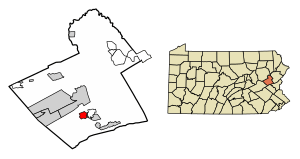
Location of Lehighton in Carbon County, Pennsylvania
|
|||
| Country | United States | ||
| State | Pennsylvania | ||
| County | Carbon | ||
| Area | |||
| • Total | 1.65 sq mi (4.28 km2) | ||
| • Land | 1.62 sq mi (4.20 km2) | ||
| • Water | 0.03 sq mi (0.07 km2) | ||
| Elevation | 570 ft (170 m) | ||
| Population
(2020)
|
|||
| • Total | 5,248 | ||
| • Density | 3,233.52/sq mi (1,248.41/km2) | ||
| Time zone | UTC-5 (EST) | ||
| • Summer (DST) | UTC-4 (EDT) | ||
| ZIP Code |
18235
|
||
| Area codes | 610 | ||
| FIPS code | 42-42472 | ||
Lehighton (/liˈhaɪtən/) is a small town, called a borough, in Carbon County, Pennsylvania, United States. It's part of Northeastern Pennsylvania. Lehighton is about 117 miles (188 km) west of New York City. It is also about 77.5 miles (125 km) northwest of Philadelphia.
Because of the strong water power from the Lehigh River, Lehighton became an important place for early American industries. The Lehigh Valley Railroad was a big employer for many years. However, after World War II, changes in the railroad and other industries caused many jobs to be lost. This also led to a decrease in the town's population.
In 2020, Lehighton had a population of 5,248 people. This is less than its highest population of 7,000 in 1940. Still, Lehighton is the largest borough in Carbon County. It remains an important business center for the county. The Lehigh River, which is about 109 miles (175 km) long, flows through Lehighton. It is a branch of the Delaware River.
Contents
History of Lehighton
When the first Europeans arrived, this area was a shared hunting ground. It was used by the Iroquoian Susquehannock and the Algonquian Lenape tribes. The Lenape were also known as the Delaware people. They often had disagreements with each other.
The Lenape people lived in areas like Delaware, New Jersey, Eastern Pennsylvania, and parts of New York. The Susquehannock tribe lived mainly along the Susquehanna River. Their lands stretched from New York down to the Chesapeake and Virginia's Shenandoah Valley.
The first European settlers in the Delaware Valley were the Dutch and Swedes. They found the land north of the Lehigh Gap was not heavily settled. It was likely used by traveling groups, especially the Susquehannock. During the Beaver Wars in the mid-1600s, the Susquehannocks took control of the Lenape tribe. Later, the Susquehannocks faced big challenges. A widespread illness killed many of them. Other tribes then took advantage of their weakness. This led to the Lenape people moving into southeastern and central Pennsylvania. However, all tribes were eventually moved westward as more European settlers arrived.
Lehighton was built on the site of an old German mission station. This station was called "Gnadenhütten" (which means "cabins of grace"). It was started in 1746 by Moravian Brethren missionaries from Bethlehem, Pennsylvania. They created it as a mission for the Lenape people.
During the French and Indian Wars in 1755, Native American allies of the French attacked the mission. They killed 11 missionaries in what is known as the Gnadenhütten massacre. The village was destroyed, and only four people survived.
In the 1800s, the Lehigh River provided water power for new industries. Lehighton had factories that made silk and lace. There was also a meat-packing house, a shirt factory, and places that made car parts. In 1900, about 4,629 people lived in Lehighton. By 1940, the population had grown to 6,615.
The arrival of the railroad made it easier to transport goods to big markets. For many years, the Lehigh Valley Railroad had a large repair center in Lehighton. This brought many jobs and helped the town's economy. Thousands of people worked there. But later, the railroad industry changed. The repair facilities moved, and many jobs were lost. This meant some people had to move away to find work.
Lehighton's downtown area became less busy after the Carbon Plaza Mall was built nearby. New homes were built outside the town center. This caused more businesses to leave downtown. After a difficult time, the downtown area is now improving. People are starting to appreciate its central location and historic buildings.
Geography of Lehighton
Lehighton is located in the southern part of Carbon County. It is in northeast Pennsylvania. The town is about 117 miles (188 km) west of New York City. It is also about 37 miles (60 km) south of Wilkes-Barre. The borough sits on the west bank of the Lehigh River. Its elevation ranges from 470 feet (143 m) near the river to 725 feet (221 m) in the northwest part of town.
The borough has a total area of 1.65 square miles (4.28 km²). About 1.62 square miles (4.20 km²) is land, and 0.03 square miles (0.07 km²) is water. Lehighton is about 3 miles (5 km) south of Jim Thorpe, which is the county seat. It is also about 7 miles (11 km) northwest of Palmerton. Lehighton is surrounded by Mahoning Township to the north, west, and south. Across the Lehigh River to the east are Weissport and Franklin Township.
Lehighton is a very green and hilly area. The town and its nearby communities are in the Ridge-and-Valley region of the Appalachian Mountains. The Appalachian Trail, a very long hiking path, is located south of town near Palmerton.
Climate in Lehighton
Lehighton experiences big changes in temperature throughout the year. Summers are warm to hot and often humid. Winters are cold, sometimes very cold. This type of weather is called a "Warm Summer Continental Climate" (Dfb).
Snowfall changes from year to year. Some winters have a moderate amount of snow. Other winters have many big snowstorms. On average, Lehighton gets about 50.4 inches (128 cm) of snow each year. January and February usually get the most snow. Rain falls throughout the year, with about 8 to 12 rainy days each month. The average yearly rainfall is about 43.5 inches (110.54 cm).
Summer usually lasts from late May to mid-September. High humidity typically only lasts for a day or two at a time. Winter runs from November through March. Its length and how cold it gets can vary a lot. Snow can fall anytime from mid-October to as late as April. Spring and autumn are both short and can change quickly. The beautiful autumn leaves usually last for two to three weeks. They are at their brightest in early to mid-October.
In January, winter daytime highs average 27.8°F (-2.3°C). The lows are around 13.9°F (-10.1°C). In July, summer daytime highs average 81.2°F (27.3°C). The lows are around 55.6°F (13.1°C).
| Climate data for Lehighton, Pennsylvania | |||||||||||||
|---|---|---|---|---|---|---|---|---|---|---|---|---|---|
| Month | Jan | Feb | Mar | Apr | May | Jun | Jul | Aug | Sep | Oct | Nov | Dec | Year |
| Record high °F (°C) | 66 (19) |
72 (22) |
80 (27) |
94 (34) |
93 (34) |
93 (34) |
100 (38) |
101 (38) |
95 (35) |
83 (28) |
76 (24) |
71 (22) |
101 (38) |
| Mean daily maximum °F (°C) | 34.8 (1.6) |
38.2 (3.4) |
47.9 (8.8) |
61.3 (16.3) |
70.5 (21.4) |
77.7 (25.4) |
82.5 (28.1) |
80.7 (27.1) |
73.6 (23.1) |
62.2 (16.8) |
50.6 (10.3) |
40.3 (4.6) |
60.0 (15.6) |
| Mean daily minimum °F (°C) | 19.5 (−6.9) |
20.3 (−6.5) |
27.8 (−2.3) |
37.9 (3.3) |
48.2 (9.0) |
57.5 (14.2) |
62.5 (16.9) |
60.6 (15.9) |
53.5 (11.9) |
42.1 (5.6) |
32.1 (0.1) |
24.7 (−4.1) |
40.4 (4.7) |
| Record low °F (°C) | −21 (−29) |
−17 (−27) |
−10 (−23) |
7 (−14) |
23 (−5) |
34 (1) |
36 (2) |
41 (5) |
29 (−2) |
17 (−8) |
0 (−18) |
−12 (−24) |
−21 (−29) |
| Average precipitation inches (mm) | 3.52 (89) |
2.97 (75) |
3.84 (98) |
3.83 (97) |
4.42 (112) |
4.49 (114) |
4.69 (119) |
4.66 (118) |
4.51 (115) |
3.90 (99) |
3.98 (101) |
4.08 (104) |
48.89 (1,241) |
| Average snowfall inches (cm) | 9.8 (25) |
10.1 (26) |
6.1 (15) |
0.5 (1.3) |
0.0 (0.0) |
0.0 (0.0) |
0.0 (0.0) |
0.0 (0.0) |
0.0 (0.0) |
0.2 (0.51) |
1.0 (2.5) |
5.2 (13) |
32.9 (83.31) |
| Average precipitation days (≥ 0.01 in) | 11.2 | 10.2 | 11.1 | 11.3 | 12.4 | 11.2 | 10.5 | 9.4 | 9.9 | 8.7 | 10.0 | 11.0 | 126.9 |
| Average snowy days (≥ 0.1 in) | 8.7 | 7.9 | 4.8 | 1.4 | 0 | 0 | 0 | 0 | 0 | 1.1 | 3.8 | 5.3 | 32.0 |
| Source: National Weather Service | |||||||||||||
People of Lehighton
| Historical population | |||
|---|---|---|---|
| Census | Pop. | %± | |
| 1850 | 267 | — | |
| 1870 | 1,485 | — | |
| 1880 | 1,937 | 30.4% | |
| 1890 | 2,959 | 52.8% | |
| 1900 | 4,629 | 56.4% | |
| 1910 | 5,316 | 14.8% | |
| 1920 | 6,102 | 14.8% | |
| 1930 | 6,490 | 6.4% | |
| 1940 | 6,615 | 1.9% | |
| 1950 | 6,565 | −0.8% | |
| 1960 | 6,318 | −3.8% | |
| 1970 | 6,095 | −3.5% | |
| 1980 | 5,826 | −4.4% | |
| 1990 | 5,914 | 1.5% | |
| 2000 | 5,537 | −6.4% | |
| 2010 | 5,500 | −0.7% | |
| 2020 | 5,248 | −4.6% | |
| Sources: | |||
In 2000, there were 5,537 people living in Lehighton. Most residents were White (98.32%). There were also smaller groups of African American, Native American, Asian, and Pacific Islander people. Some people identified with two or more races. About 1.67% of the population was Hispanic or Latino.
Many people in Lehighton have Irish roots. There are also many families with Italian, Polish, German, and Slovak heritage.
About 22.6% of the population was under 18 years old. About 21.1% were 65 years or older. The average age in Lehighton was 40 years.
Media and Entertainment
Lehighton is home to the Times News. This newspaper is published six days a week. It serves five different counties.
The Mahoning Drive-In Theater opened in Lehighton in 1949. Drive-in theaters became less popular in the 1970s and 1980s. But the Mahoning Drive-In has become popular again since 2014. This is because it mostly shows older cult films and B movies instead of new releases.
A local radio station, 1160 AM, started broadcasting in 1962 as WYNS. In 2005, its call letters changed to WBYN. The station stopped broadcasting in May 2021.
Getting Around Lehighton
As of 2007, Lehighton had about 21.24 miles (34.18 km) of public roads. The Pennsylvania Department of Transportation (PennDOT) maintained 4.01 miles (6.45 km) of these roads. The borough maintained the other 17.23 miles (27.73 km).
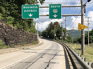
U.S. Route 209 is the main highway that goes through Lehighton. It follows First Street, Sergeant Stanley Hoffman Boulevard, Bankway, and Bridge Street. Pennsylvania Route 443 starts at US 209 and heads southwest. Pennsylvania Route 902 begins at PA 443. It goes north on Ninth Street and then west on Mahoning Street. Interstate 476, also known as the Pennsylvania Turnpike's Northeast Extension, passes east of Lehighton. You can get to it from US 209.
Carbon Transit provides bus service in Lehighton. Route 701 runs between Coaldale and Palmerton on Mondays, Wednesdays, and Fridays. Route 702 runs between Nesquehoning and Palmerton Monday through Friday. Fullington Trailways offers daily bus service to places in New York and Pennsylvania. Passenger train service ended in 1961. The Lehigh Valley Railroad, which used to be a major employer, stopped all passenger service.
Jake Arner Memorial Airport (22N) is located about 3 miles (5 km) west-southwest of town. It has a 3,000-foot (914 m) asphalt runway.
Lehighton in Art
Lehighton is shown in a mural called Lehighton. This mural was created by Franz Kline, a famous artist who grew up in the borough.
Notable People from Lehighton
- D. M. Balliet, former college football coach
- Mike Bugarewicz, NASCAR crew chief
- Kerry Getz, professional skateboarder
- Christian Hackenberg, former professional football player
- Franz Kline, artist
- Denny Seiwell, drummer for Paul McCartney and Wings
Images for kids
See also
 In Spanish: Lehighton para niños
 | George Robert Carruthers |
 | Patricia Bath |
 | Jan Ernst Matzeliger |
 | Alexander Miles |


