
Nesquehoning, Pennsylvania facts for kids
Quick facts for kids
Nesquehoning, Pennsylvania
|
|
|---|---|
|
Borough
|
|

Meeds Memorial United Methodist Church, July 2013
|
|

Location in Carbon County, Pennsylvania
|
|

Nesquehoning, Pennsylvania
Location in Pennsylvania

Nesquehoning, Pennsylvania
Location in the United States
|
|
| Country | United States |
| State | Pennsylvania |
| County | Carbon |
| Area | |
| • Total | 21.55 sq mi (55.81 km2) |
| • Land | 21.16 sq mi (54.81 km2) |
| • Water | 0.39 sq mi (1.01 km2) |
| Elevation | 830 ft (250 m) |
| Population
(2020)
|
|
| • Total | 3,336 |
| • Density | 157.64/sq mi (60.87/km2) |
| Time zone | UTC-5 (EST) |
| • Summer (DST) | UTC-4 (EDT) |
| ZIP code |
18240
|
| Area codes | 570 |
| FIPS code | 42-53088 |
Nesquehoning is a borough in Carbon County, Pennsylvania, United States. It is part of Northeastern Pennsylvania. In 2020, about 3,336 people lived there.
Nesquehoning started because of the anthracite coal mining industry. It became an official borough in 1963 (effective 1964). Before that, it was part of Mauch Chunk Township. The name Nesquehoning comes from a Native American language. People often think it means "narrow valley." However, experts in native languages say it means "at the black lick" or "at the dirty lick." This refers to places where deer or other animals would go to lick minerals from the ground.
Contents
History of Nesquehoning
- The old Nesquehoning High School was added to the National Register of Historic Places in 2003. This means it's an important historical building.
- The Grotto, Our Lady of Lourdes Shrine, is at the Shrine of St. Therese of Lisieux in New Columbus, Nesquehoning. It is also listed as a Traditional Cultural Property on the US National Register of Historic Places. This means it's a special place with cultural importance.
Where is Nesquehoning?
Nesquehoning is located at 40°52′5″N 75°49′27″W / 40.86806°N 75.82417°W. The borough covers about 21.6 square miles (55.8 square kilometers). Most of this area is land (21.2 sq mi or 54.8 sq km), and a small part is water (0.4 sq mi or 1.0 sq km).
Nesquehoning is about 3 miles (4.8 km) west of Jim Thorpe. It is also about 4 miles (6.4 km) northeast of Lansford. The town is about 830 feet (253 meters) above sea level.
Nesquehoning's Climate
Nesquehoning has a warm-summer humid continental climate. This means it has big differences in temperature between seasons. Summers are warm to hot and often humid. Winters are cold, and sometimes very cold. The average temperature in January is about 26.5°F (-3.1°C). In July, it's about 71.1°F (21.7°C). The area is in hardiness zone 6a, which helps gardeners know what plants can grow there.
| Climate data for Nesquehoning, Pennsylvania | |||||||||||||
|---|---|---|---|---|---|---|---|---|---|---|---|---|---|
| Month | Jan | Feb | Mar | Apr | May | Jun | Jul | Aug | Sep | Oct | Nov | Dec | Year |
| Mean daily maximum °C (°F) | 4 (39) |
4 (39) |
9 (49) |
16 (60) |
24 (75) |
29 (85) |
33 (92) |
31 (88) |
26 (79) |
18 (65) |
11 (51) |
4 (40) |
18 (64) |
| Mean daily minimum °C (°F) | −7 (19) |
−8 (17) |
−4 (25) |
1 (34) |
7 (45) |
12 (54) |
14 (58) |
14 (57) |
9 (49) |
3 (38) |
−1 (31) |
−6 (21) |
3 (37) |
| Average precipitation mm (inches) | 94 (3.7) |
76 (3) |
100 (4) |
100 (4.1) |
120 (4.8) |
120 (4.6) |
120 (4.7) |
110 (4.5) |
110 (4.5) |
97 (3.8) |
110 (4.5) |
97 (3.8) |
1,270 (49.9) |
| Source: Weatherbase | |||||||||||||
Neighborhoods of Nesquehoning
Nesquehoning has four main neighborhoods:
Nesquehoning Village
This area is in the southeastern part of the borough. The Nesquehoning Creek forms its northern edge. More than half of the people living in Nesquehoning call this neighborhood home.
New Columbus
This neighborhood is north of the Nesquehoning Creek, across from Nesquehoning Village. It's the second-largest neighborhood by population. New Columbus grew when the "Little Italy" section of Nesquehoning was moved here.
Old Hauto
Old Hauto is in the southwestern part of the borough. It's at the bottom of Nesquehoning Mountain. The Nesquehoning Creek and the old Nesquehoning Valley Railroad are to its north. There are two groups of houses here. One is the historic Old Hauto Village. The other is a newer housing area called Hauto Valley Estates, built in the late 1960s.
Lake Hauto
This neighborhood is a community by Lake Hauto. Lake Hauto is a private community. Even though people often think it's in Nesquehoning, most of the Lake Hauto community is actually in Rush Township, Schuylkill County.
Population Changes
| Historical population | |||
|---|---|---|---|
| Census | Pop. | %± | |
| 1880 | 957 | — | |
| 1890 | 1,655 | 72.9% | |
| 1970 | 3,338 | — | |
| 1980 | 3,346 | 0.2% | |
| 1990 | 3,364 | 0.5% | |
| 2000 | 3,288 | −2.3% | |
| 2010 | 3,349 | 1.9% | |
| 2020 | 3,336 | −0.4% | |
| Sources: | |||
In 2010, there were 3,349 people living in Nesquehoning. There were 1,440 households. About 25% of households had children under 18. The average household had 2.30 people. The median age was 41 years old.
By 2020, the population was 3,336 people. The median age was 38.0 years old. About 20% of the people were older than 65. About 19.4% were under 18 years old.
Economy and Jobs
Nesquehoning used to be home to KME Corp. This company was the biggest employer in the borough for many years. KME Corp made special fire trucks and other heavy-duty vehicles. At its busiest, KME employed about 1,000 people in Nesquehoning. This provided many jobs for the area. However, the company closed its factory in early 2022, and about 400 people lost their jobs.
ConEdison Development built one of Pennsylvania's largest solar energy plants in Nesquehoning. This plant was finished in 2012. It covers about 90 acres and has around 40,000 solar panels. It makes enough energy to power about 1,500 homes. The plant was made twice as big, with the second part starting in January 2020.
The Reading, Blue Mountain and Northern Railroad bought part of the old KME property in 2022. They are building a new passenger train station there. It is expected to open in the spring of 2024. They are also building shops to work on locomotives and rail cars.
Education in Nesquehoning
Students in Nesquehoning go to schools in the Panther Valley School District. Some students also attend Our Lady of the Angels elementary school (for grades K-8). Others go to Marian Catholic High School (for grades 9-12). These schools are located near Tamaqua, Pennsylvania.
Getting Around Nesquehoning
_just_south_of_Liberty_Road_in_Nesquehoning,_Carbon_County,_Pennsylvania.jpg)
As of 2020, Nesquehoning had about 29.15 miles (46.91 km) of public roads. The Pennsylvania Department of Transportation (PennDOT) takes care of about 14.50 miles (23.34 km) of these roads. The borough itself maintains the other 14.65 miles (23.58 km).
U.S. Route 209 is the most important highway in Nesquehoning. It runs through the southern and eastern parts of the borough. Pennsylvania Route 54 starts at US 209 and goes southwest. Pennsylvania Route 93 also starts at US 209 and goes northwest.
The Reading, Blue Mountain and Northern Railroad is building a passenger train station. It is planned to open on August 19, 2024, for the Iron Horse Ramble event.
Famous People from Nesquehoning
- Brandon Hackenberg (born 1997) – a soccer player
- Gene Snitsky (born 1970) – a professional wrestler
Images for kids
-
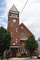
Meeds Memorial United Methodist Church, July 2013
-

Location in Carbon County, Pennsylvania
-
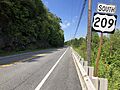
US 209 southbound in Nesquehoning
See also
 In Spanish: Nesquehoning para niños
