
Walnutport, Pennsylvania facts for kids
Quick facts for kids
Borough of Walnutport
|
|
|---|---|

Main Street in Walnutport, August 2015
|
|

Location of Walnutport in Northampton County, Pennsylvania (left) and of Northampton County in Pennsylvania (right)
|
|

Borough of Walnutport
Location in Pennsylvania

Borough of Walnutport
Location in the United States
|
|
| Country | |
| State | |
| County | Northampton |
| Borough | 1989 |
| Area | |
| • City | 0.83 sq mi (2.14 km2) |
| • Land | 0.75 sq mi (1.95 km2) |
| • Water | 0.07 sq mi (0.19 km2) |
| Elevation | 814 ft (248 m) |
| Population
(2020)
|
|
| • City | 2,067 |
| • Density | 2,748.67/sq mi (1,061.75/km2) |
| • Metro | 865,310 (US: 68th) |
| Time zone | UTC-5 (EST) |
| • Summer (DST) | UTC-4 (EDT) |
| ZIP Code |
18088
|
| Area code(s) | 610 and 484 |
| FIPS code | 42-80800 |
| Primary airport | Lehigh Valley International Airport |
| Major hospital | Lehigh Valley Hospital–Cedar Crest |
| School district | Northern Lehigh |
| Website | www.walnutportpa.org |
Walnutport is a small town, also called a borough, in Northampton County, Pennsylvania. It became an official borough in 1909. In 2022, about 1,918 people lived there.
Walnutport is located along the Lehigh River. It is part of the larger Lehigh Valley area. This area is home to over 860,000 people. Walnutport uses the ZIP Code 18088.
Contents
Exploring Walnutport's Location
Walnutport is found at coordinates 40.751554 degrees North and -75.595574 degrees West. According to the U.S. Census Bureau, the borough covers a total area of 0.8 square miles (2.1 square kilometers). Most of this area is land, about 0.75 square miles (1.9 square kilometers). A small part, 0.07 square miles (0.2 square kilometers), is water.
Walnutport is about 20 miles (32 km) north of Bethlehem. It is also 4 miles (6 km) south of Palmerton and 1 mile (1.6 km) east of Slatington. The town sits about 814 feet (248 meters) above sea level.
Getting Around Walnutport
_just_north_of_Main_Street_in_Walnutport,_Northampton_County,_Pennsylvania.jpg)
In 2009, Walnutport had about 12.35 miles (19.88 km) of public roads. The state's Department of Transportation (PennDOT) took care of 2.08 miles (3.35 km) of these roads. The borough itself maintained the remaining 10.27 miles (16.53 km).
Pennsylvania Route 145 is the main highway that goes through Walnutport. It runs north and south along the eastern side of the borough, following Best Avenue.
Walnutport's Population Over Time
In the year 2000, there were 2,043 people living in Walnutport. These people lived in 809 households, and 584 of these were families. The population density was about 2,727 people per square mile.
| Historical population | |||
|---|---|---|---|
| Census | Pop. | %± | |
| 1910 | 1,039 | — | |
| 1920 | 1,051 | 1.2% | |
| 1930 | 1,151 | 9.5% | |
| 1940 | 1,271 | 10.4% | |
| 1950 | 1,427 | 12.3% | |
| 1960 | 1,609 | 12.8% | |
| 1970 | 1,942 | 20.7% | |
| 1980 | 2,007 | 3.3% | |
| 1990 | 2,055 | 2.4% | |
| 2000 | 2,043 | −0.6% | |
| 2010 | 2,070 | 1.3% | |
| 2020 | 2,067 | −0.1% | |
| U.S. Decennial Census | |||
About 28.9% of households had children under 18. Most households (58.1%) were married couples. The average household had 2.46 people. The average family had 2.88 people.
The population was spread out by age. About 22% were under 18. About 17.3% were 65 or older. The average age in the borough was 40 years old.
Famous People from Walnutport
Walnutport has been home to several notable people:
- Ted Wieand - A former professional baseball player for the Cincinnati Reds.
- Maury Schleicher - A former professional football player for the Los Angeles / San Diego Chargers.
- Meredith Marakovits - An American sports reporter for the YES Network.
- Zach Mako - An American politician who serves in the Pennsylvania House of Representatives.
- Otto Orkin - A businessman who founded Orkin, Inc., a well-known pest control company.
Learning in Walnutport
The Northern Lehigh School District serves the students in Walnutport. Students in grades nine through 12 attend Northern Lehigh High School. This high school is located in nearby Slatington.
Images for kids
-
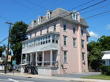
Presbyterian House
-
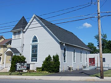
Christ Church UCC
-
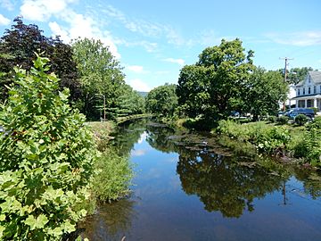
Lehigh Canal in Walnutport


See also
 In Spanish: Walnutport para niños
