Schuylkill County, Pennsylvania facts for kids
Quick facts for kids
Schuylkill County
|
||
|---|---|---|
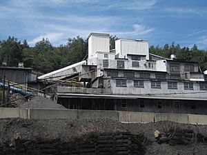
St. Nicholas Coal Breaker in Mahanoy City in July 2013
|
||
|
||
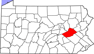
Location within the U.S. state of Pennsylvania
|
||
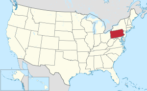 Pennsylvania's location within the U.S. |
||
| Country | ||
| State | ||
| Founded | March 1, 1811 | |
| Named for | Schuylkill River | |
| Seat | Pottsville | |
| Largest city | Pottsville | |
| Area | ||
| • Total | 783 sq mi (2,030 km2) | |
| • Land | 779 sq mi (2,020 km2) | |
| • Water | 4.2 sq mi (11 km2) 0.5%% | |
| Population
(2020)
|
||
| • Total | 143,049 | |
| • Density | 184/sq mi (71/km2) | |
| Time zone | UTC−5 (Eastern) | |
| • Summer (DST) | UTC−4 (EDT) | |
| Area code | 570 and 717 | |
| Congressional district | 9th | |
Schuylkill County (pronounced SKOOL-kil) is a county in the state of Pennsylvania. In 2020, about 143,049 people lived here. The main town and county seat is Pottsville. This county is part of the Northeast Pennsylvania region.
Schuylkill County is near the city of Pottsville. It shares borders with eight other counties. To the south are Berks and Lebanon counties. To the west are Dauphin and Northumberland counties. To the north are Columbia and Luzerne counties. And to the east are Carbon and Lehigh counties. The county is about 47 miles (76 km) west of Allentown. It is also about 97 miles (156 km) northwest of Philadelphia, Pennsylvania's largest city.
The county was created on March 1, 1811. It was formed from parts of Berks and Northampton counties. It was named after the Schuylkill River, which starts in the county. More land was added to the county in 1818 from Columbia and Luzerne counties.
Contents
History of Schuylkill County
Early Times: The 1700s
The land that is now Schuylkill County was bought in 1749. William Penn's family bought it from Native American tribes. These tribes included the Six Nations, Delaware, Shamokin, and Shawnee people.
In 1744, an early mill was built in the area. But it later burned down. Many German immigrants settled here in 1754. The first settlers in the southeastern part of the county were from Germany.
A log church was built in 1755. During this time, from 1755 to 1765, there were conflicts with Native American groups.
In 1790, a special type of coal called anthracite was found. Necho Allen discovered it near what is now Pottsville. Anthracite is a very efficient form of coal.
By 1795, people learned how to use anthracite coal. A blacksmith named Whetstone figured out how to use it for blacksmithing. Soon, many blacksmiths in the area used it. Coal became a very important industry and fuel source. It also provided many jobs in the 1800s and early 1900s.
Growth and Coal: The 1800s
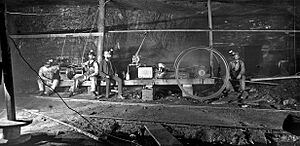

Schuylkill County was officially created on March 1, 1811. It was formed from parts of Berks and Northampton counties. More land was added in 1818. When it was first created, about 6,000 people lived in the county.
Orwigsburg was the first organized town. It was chosen as the county seat because it was good for industries. Later, people wanted to move the county seat to Pottsville. Pottsville had better connections for railroads and canals. So, in 1846, Pottsville became the new county seat.
In 1812, more coal was found. George Shoemaker and Necho Allen found it and tried to get people to use it. At first, many thought it wouldn't work. But then, some businesses successfully used it. This created a huge demand for coal.
The Schuylkill Navigation Company was started in 1815. This company built canals along the Schuylkill River. These canals helped transport goods. In 1822, the first coal was shipped on these canals. About 1,480 tons of coal were moved from the county.
The discovery of coal brought many people to Schuylkill County. People dreamed of becoming rich. Pottsville became a busy center for coal mining. New towns were planned, and mines were opened.
At first, coal mines were small and often family-owned. They didn't need much money to start. But after the Civil War, big companies took over. Railroads also became the main way to move coal. The amount of coal used grew a lot. For example, in 1839, about 30,290 tons were used. By 1873, this grew to over 1.7 million tons!
The many jobs in coal mining brought immigrants to the county. In the 1840s, many Irish people came. After the Civil War, people from Eastern Europe arrived. These included Poles, Hungarians, Lithuanians, and Ukrainians. By the late 1800s, thousands of Italians also came for mining jobs.
Modern Times: The 1900s and Beyond
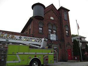
The coal mining industry produced the most coal in 1917. After that, it slowly declined. By the 1950s and 1960s, most underground mines closed. Surface mining became more common.
In 1934, there was a serious event in Kelayres. A parade was marching when shots were fired. Several people were hurt or killed.
Today, Schuylkill County still has coal mines. In 2024, there were four underground mines and 17 surface mines. Most of the coal produced now comes from areas that were mined before.
Businesses and Industries
Farming in Schuylkill County
Schuylkill County isn't just about coal. The first settlers were farmers and lumberjacks. In the fertile valleys, families have farmed for generations. They helped feed the people working in the mines and towns.
Farming changed over time. Small farms used to produce many different things. Later, they became more specialized. They started growing orchard products, trees, and plants. Poultry farming also became popular.
In 2012, the value of farm products sold was over $165 million. This ranked the county 9th in Pennsylvania. It is also one of the top counties in the U.S. for nursery plants and Christmas trees.
Railroad History
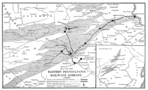
In the early 1800s, canals helped transport coal. The Union Canal and the Schuylkill Canal were important. But mountains made it hard to move coal by water in some areas.
So, railroads were built. Several railroads started in the late 1820s and early 1830s. They helped move coal to the canals and other markets. Some of these early railroads included:
- The Schuylkill Valley Railroad
- The Mill Creek Railroad
- The Mine Hill and Schuylkill Haven Railroad
- The Mount Carbon Railroad
- The Little Schuylkill Railroad
Eventually, railroads took over from canals. They became the main way to transport coal. At one point, Schuylkill County had over 1,000 miles (1,600 km) of railroad tracks. The largest railyard in the world was once located near Pottsville.
Green Energy: Renewable Power
Since the early 2000s, Schuylkill County has been using less coal for power. Instead, it has become a big producer of renewable energy. About 25% of the county's electricity now comes from green sources.
Wind power is the biggest source of renewable energy here. It makes up 80% of the county's green energy. Solar power and biomass (energy from plants and waste) make up the other 20%.
For example, the Locust Ridge wind turbines produce enough electricity for 37,500 homes. This shows how much the county has changed its energy production.
Textile Industry History
The textile industry became very important in the county in the early 1900s. Companies like Phillips & Jones Co. (now Phillips Van Heusen) started in Pottsville. They were once the county's largest employer. John E. Morgan Knitting Mills also became a major employer in Tamaqua.
After World War II, the textile industry grew even more. It started to be as big as the coal mining industry. Many women found jobs in textile factories. This industry grew because companies looked for workers outside of big cities like New York City. By 1940, Pennsylvania was the third-largest clothing maker in the U.S.
However, by the late 1900s, the textile industry began to leave the U.S. and move to other countries. By 2011, only a few textile manufacturers remained in Schuylkill County.
Geography of Schuylkill County
The U.S. Census Bureau says the county covers 783 square miles (2,028 km²). Most of this is land (779 sq mi or 2,018 km²). Only a small part is water (4.2 sq mi or 11 km²).
The Schuylkill River starts in this county. It flows through many towns and eventually into the Delaware River in Philadelphia. Other creeks like Swatara Creek and Mahanoy Creek also start here. They flow into the Susquehanna River. Some eastern parts of the county drain into the Lehigh River.
In the south, you'll find Blue Mountain and the Appalachian Trail. Broad Mountain also crosses the county.
Schuylkill County is in the Coal Region of northeastern Pennsylvania. Parts of the eastern county are in the Pocono Mountains. Because of this, some people from New York City and New Jersey have moved here. They commute to places like Manhattan, which can take up to two hours.
Climate
The county has four distinct seasons: spring, summer, fall, and winter. The average monthly temperature in Pottsville is about 27.3°F (-2.6°C) in January. In July, it's about 72.3°F (22.4°C).
Neighboring Counties
- Luzerne County (North)
- Carbon County (East)
- Lehigh County (Southeast)
- Berks County (South)
- Lebanon County (Southwest)
- Dauphin County (West)
- Northumberland County (West)
- Columbia County (Northwest)
Major Roads
 I-81
I-81 US 209
 PA 25
PA 25 PA 54
PA 54 PA 61
PA 61 PA 125
 PA 183
 PA 309
 PA 325
 PA 339
 PA 443
 PA 501
 PA 895
 PA 901
 PA 924
People of Schuylkill County: Demographics
| Historical population | |||
|---|---|---|---|
| Census | Pop. | %± | |
| 1820 | 11,339 | — | |
| 1830 | 20,744 | 82.9% | |
| 1840 | 29,053 | 40.1% | |
| 1850 | 60,713 | 109.0% | |
| 1860 | 89,510 | 47.4% | |
| 1870 | 116,428 | 30.1% | |
| 1880 | 129,974 | 11.6% | |
| 1890 | 154,163 | 18.6% | |
| 1900 | 172,927 | 12.2% | |
| 1910 | 207,894 | 20.2% | |
| 1920 | 217,754 | 4.7% | |
| 1930 | 235,505 | 8.2% | |
| 1940 | 228,331 | −3.0% | |
| 1950 | 200,577 | −12.2% | |
| 1960 | 173,027 | −13.7% | |
| 1970 | 160,089 | −7.5% | |
| 1980 | 160,630 | 0.3% | |
| 1990 | 152,585 | −5.0% | |
| 2000 | 150,336 | −1.5% | |
| 2010 | 148,289 | −1.4% | |
| 2020 | 143,049 | −3.5% | |
| U.S. Decennial Census 1790–1960 1900–1990 1990–2000 2010–2019 |
|||
2020 Census Information
The 2020 census showed that 143,049 people lived in Schuylkill County. Here's a breakdown of the different groups of people:
| Race | Number | Percentage |
|---|---|---|
| White (not Hispanic) | 126,192 | 88.2% |
| Black or African American (not Hispanic) | 4,115 | 3% |
| Native American (not Hispanic) | 155 | 0.11% |
| Asian (not Hispanic) | 748 | 0.52% |
| Pacific Islander (not Hispanic) | 13 | 0.01% |
| Other/Mixed (not Hispanic) | 3,762 | 2.62% |
| Hispanic or Latino | 8,064 | 5.6% |
Education in Schuylkill County
Colleges and Universities
- Alvernia University in Pottsville
- Lehigh Carbon Community College (Morgan Center Campus) in Tamaqua
- Penn State Schuylkill in Schuylkill Haven
Public School Districts
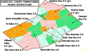
Here are the public school districts in Schuylkill County:
- Blue Mountain School District
- Hazleton Area School District (also in Luzerne and Carbon Counties)
- Mahanoy Area School District
- Minersville Area School District
- North Schuylkill School District (also in Columbia County)
- Panther Valley School District (also in Carbon County)
- Pine Grove Area School District
- Pottsville Area School District
- Saint Clair Area School District
- Schuylkill Haven Area School District
- Shenandoah Valley School District
- Tamaqua Area School District
- Tri-Valley School District
- Williams Valley School District (also in Dauphin County)
Communities in Schuylkill County
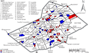
Schuylkill County has different types of communities: cities, boroughs, and townships.
City
- Pottsville (This is the county seat)
Boroughs
- Ashland (partly in Columbia County)
- Auburn
- Coaldale
- Cressona
- Deer Lake
- Frackville
- Gilberton
- Girardville
- Gordon
- Landingville
- Mahanoy City
- McAdoo
- Mechanicsville
- Middleport
- Minersville
- Mount Carbon
- New Philadelphia
- New Ringgold
- Orwigsburg
- Palo Alto
- Pine Grove
- Port Carbon
- Port Clinton
- Ringtown
- Schuylkill Haven
- Shenandoah
- St. Clair
- Tamaqua
- Tower City
- Tremont
Townships
- Barry
- Blythe
- Branch
- Butler
- Cass
- Delano
- East Brunswick
- East Norwegian
- East Union
- Eldred
- Foster
- Frailey
- Hegins
- Hubley
- Kline
- Mahanoy
- New Castle
- North Manheim
- North Union
- Norwegian
- Pine Grove
- Porter
- Reilly
- Rush
- Ryan
- Schuylkill
- South Manheim
- Tremont
- Union
- Upper Mahantongo
- Walker
- Washington
- Wayne
- West Brunswick
- West Mahanoy
- West Penn
Census-Designated Places (CDPs)
These are areas the U.S. Census Bureau defines for collecting data. They are not official towns.
- Altamont
- Beurys Lake
- Branchdale
- Brandonville
- Buck Run
- Cumbola
- Delano
- Donaldson
- Duncott
- Englewood
- Forestville
- Fountain Springs
- Friedensburg
- Grier City
- Heckscherville
- Hegins
- Hometown
- Kelayres
- Klingerstown
- Lake Wynonah
- Lavelle
- Locustdale
- Marlin
- McKeansburg
- Morea
- Muir
- New Boston
- Newtown
- Nuremberg
- Oneida
- Orwin
- Park Crest
- Ravine
- Reinerton
- Renningers
- Seltzer
- Shenandoah Heights
- Sheppton
- Summit Station
- Tuscarora
- Valley View
Other Unincorporated Communities
These are smaller communities that are not officially incorporated.
- Adamsdale
- Aucheys
- Andreas
- Barnesville
- Beuchler
- Blackwood (ghost town)
- Boston Run
- Brockton
- Brommerstown
- Brookside
- Clamtown
- Connerton
- Cressonville (ghost town)
- Drehersville
- Deturksville
- Exmoor
- Fearnot
- Frisbie
- Fountain
- Ginthers
- Glen Carbon
- Good Spring
- Haddock
- Hauto
- Hecla
- Irving
- Joliett
- Kepners
- Leibeyville
- Llewellyn
- Locust Valley
- Lofty
- Lorberry
- Mabel
- Mahoning Valley
- Mantzville
- Marstown
- Mary D
- Molino
- Moyers
- New Mines (located within Branchdale)
- Newkirk
- North Pine Grove
- Orwin
- Outwood
- Owl Creek
- Pitman
- Pleasant Valley
- Quakake
- Rauschs
- Reedsville
- Reevesdale
- Rene Mont
- Roedersville
- Rough and Ready
- Sacramento
- Seek
- Sheridan
- Snyders
- Silverton (ghost town)
- South Tamaqua
- Spring Glen
- Stanhope
- Steins
- Still Creek
- Stonemont
- Suedberg
- Tamanend
- Weishample
- Zenners
- Zion Grove
Largest Communities by Population (2010 Census)
This table shows the communities in Schuylkill County with the largest populations, based on the 2010 census.
† county seat
| Rank | City/Town/etc. | Municipal type | Population (2010 Census) |
|---|---|---|---|
| 1 | † Pottsville | City | 14,324 |
| 2 | Tamaqua | Borough | 7,107 |
| 3 | Schuylkill Haven | Borough | 5,437 |
| 4 | Shenandoah | Borough | 5,071 |
| 5 | Minersville | Borough | 4,397 |
| 6 | Mahanoy City | Borough | 4,162 |
| 7 | Frackville | Borough | 3,805 |
| 8 | Orwigsburg | Borough | 3,099 |
| 9 | St. Clair | Borough | 3,004 |
| 10 | Ashland (partially in Columbia County) | Borough | 2,817 |
| 11 | Lake Wynonah | CDP | 2,640 |
| 12 | McAdoo | Borough | 2,300 |
| 13 | Coaldale | Borough | 2,281 |
| 14 | Pine Grove | Borough | 2,186 |
| 15 | Port Carbon | Borough | 1,889 |
| 16 | Tremont | Borough | 1,752 |
| 17 | Valley View | CDP | 1,683 |
| 18 | Cressona | Borough | 1,651 |
| 19 | Girardville | Borough | 1,519 |
| 20 | Hometown | CDP | 1,349 |
| 21 | Tower City | Borough | 1,346 |
| 22 | Shenandoah Heights | CDP | 1,233 |
| 23 | New Philadelphia | Borough | 1,085 |
| 24 | Palo Alto | Borough | 1,032 |
| 25 | Tuscarora | CDP | 980 |
| 26 | Friedensburg | CDP | 858 |
| 27 | Ringtown | Borough | 818 |
| 28 | Hegins | CDP | 812 |
| 29 | Gilberton | Borough | 769 |
| 30 | Gordon | Borough | 763 |
| 31 | Lavelle | CDP | 742 |
| 32 | Auburn | Borough | 741 |
| 33 | Deer Lake | Borough | 687 |
| 34 | Ravine | CDP | 662 |
| 35 | Marlin | CDP | 661 |
| 36 | Altamont | CDP | 602 |
| 37 | Renningers | CDP | 574 |
| 38 | Park Crest | CDP | 542 |
| 39 | Kelayres | CDP | 533 |
| 40 | Englewood | CDP | 532 |
| 41 | Mechanicsville | Borough | 457 |
| 42 | Muir | CDP | 451 |
| 43 | Cumbola | CDP | 443 |
| 44 | Forestville | CDP | 435 |
| 45 | Nuremberg (partially in Luzerne County) | CDP | 434 |
| 46 | Reinerton | CDP | 424 |
| 47 | Middleport | Borough | 405 |
| 48 | Branchdale | CDP | 388 |
| 49 | Seltzer | CDP | 350 |
| 50 | Delano | CDP | 342 |
| 51 | Donaldson | CDP | 328 |
| 52 | Port Clinton | Borough | 326 |
| 53 | Orwin | CDP | 314 |
| 54 | Fountain Springs | CDP | 278 |
| 55 | New Ringgold | Borough | 276 |
| 56 | Newtown | CDP | 243 |
| 57 | Grier City | CDP | 241 |
| 58 | Sheppton | CDP | 239 |
| 59 | Heckscherville | CDP | 220 |
| 60 | Oneida | CDP | 200 |
| 61 | Brandonville | CDP | 197 |
| 62 | Locustdale (partially in Columbia County) | CDP | 177 |
| 63 | Buck Run | CDP | 176 |
| 64 | Summit Station | CDP | 174 |
| 65 | McKeansburg | CDP | 163 |
| 66 | Landingville | Borough | 159 |
| 67 | Klingerstown | CDP | 127 |
| 68 | Beurys Lake | CDP | 124 |
| 69 | Mount Carbon | Borough | 91 |
Famous People from Schuylkill County
Many notable people have connections to Schuylkill County:
- Muhammad Ali, a famous boxing champion, had a training camp in Deer Lake.
- Gary Becker, an economist who won the Nobel Prize.
- Les Brown and Tommy Dorsey, famous jazz musicians and band leaders.
- Walter Ciszek, a Roman Catholic priest and author who survived a prison camp.
- David Horst, a former professional soccer player.
- John E. Jones III, a former U.S. federal judge.
- George Joulwan, a former top military commander in Europe.
- Danny Litwhiler, a former Major League Baseball player.
- Molly Maguires, a group of Irish miners who had conflicts with mining companies in the 1800s.
- John O'Hara, a well-known short story writer and novelist.
- Conrad Richter, a novelist who won the Pulitzer Prize and National Book Award.
- Victor Schertzinger, a musician, film director, and composer.
- John Walson, a pioneer in cable television.
See also
 In Spanish: Condado de Schuylkill para niños
 | Jessica Watkins |
 | Robert Henry Lawrence Jr. |
 | Mae Jemison |
 | Sian Proctor |
 | Guion Bluford |


