
Port Carbon, Pennsylvania facts for kids
Quick facts for kids
Port Carbon, Pennsylvania
|
|
|---|---|
|
Borough
|
|

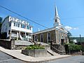
Pike Street in Port Carbon
|
|

Location of Port Carbon in Schuylkill County, Pennsylvania.
|
|

Port Carbon, Pennsylvania
Location in Pennsylvania

Port Carbon, Pennsylvania
Location in the United States
|
|
| Country | United States |
| State | Pennsylvania |
| County | Schuylkill |
| Settled | 1826 |
| Incorporated | 1852 |
| Government | |
| • Type | Borough Council |
| Area | |
| • Total | 0.75 sq mi (1.95 km2) |
| • Land | 0.75 sq mi (1.95 km2) |
| • Water | 0.00 sq mi (0.00 km2) |
| Population
(2020)
|
|
| • Total | 1,806 |
| • Density | 2,395.23/sq mi (924.60/km2) |
| Time zone | UTC-5 (Eastern (EST)) |
| • Summer (DST) | UTC-4 (EDT) |
| Zip code |
17965
|
| Area code(s) | 570 |
| FIPS code | 42-62128 |
Port Carbon is a small town, called a borough, in Schuylkill County, Pennsylvania. It's about two miles (3 km) northeast of Pottsville. This area is famous for coal mining, and in the past, it also had many ironworks.
In 1900, about 2,168 people lived here. By 2020, the population was 1,815.
Contents
Where is Port Carbon?
Port Carbon is located at 40°41′50″N 76°10′0″W / 40.69722°N 76.16667°W.
The United States Census Bureau says the borough covers about 0.8 square miles (1.95 square kilometers) of land. There is no water area within its borders.
Who Lives in Port Carbon?
| Historical population | |||
|---|---|---|---|
| Census | Pop. | %± | |
| 1830 | 900 | — | |
| 1840 | 912 | 1.3% | |
| 1850 | 2,142 | 134.9% | |
| 1860 | 1,904 | −11.1% | |
| 1870 | 2,251 | 18.2% | |
| 1880 | 2,346 | 4.2% | |
| 1890 | 1,976 | −15.8% | |
| 1900 | 2,168 | 9.7% | |
| 1910 | 2,678 | 23.5% | |
| 1920 | 2,882 | 7.6% | |
| 1930 | 3,225 | 11.9% | |
| 1940 | 3,279 | 1.7% | |
| 1950 | 3,024 | −7.8% | |
| 1960 | 2,775 | −8.2% | |
| 1970 | 2,717 | −2.1% | |
| 1980 | 2,576 | −5.2% | |
| 1990 | 2,134 | −17.2% | |
| 2000 | 2,019 | −5.4% | |
| 2010 | 1,889 | −6.4% | |
| 2020 | 1,815 | −3.9% | |
| 2021 (est.) | 1,815 | −3.9% | |
| Sources: | |||
As of 2022, about 1,748 people lived in Port Carbon. There were about 798 households.
The population density was about 2,318 people per square mile (895 people per square kilometer).
Most people in Port Carbon are White (92.7%). There are also Black or African American (2.7%), Asian (0.5%), and other races (2.2%). About 1.9% of people are from two or more races. About 2.3% of the population is Hispanic or Latino.
Age Groups
- About 18.3% of the people are under 18 years old.
- About 23.8% are 65 years or older.
- The average age in Port Carbon is about 48.4 years.
Family Life
- About 21.9% of households have children under 18 living with them.
- About 42.0% of households have seniors (65 or older) living with them.
- Many households are married couples living together (48.9%).
Ancestry
People in Port Carbon come from many different backgrounds. The largest groups are:
- German (19.6%)
- Irish (18.4%)
- Polish (11.6%)
- Italian (9.6%)
- Lithuanian (5.4%)
- Slovak (4.9%)
- Ukrainian (3.4%)
Port Carbon's History
Port Carbon was started in 1826 by Abraham Pott. His father, John Pott, founded the nearby town of Pottsville in 1806.
This town was very important for coal transportation. It was the location of the very first lock on the Schuylkill Canal. This canal was used to move coal from the mines in the area all the way to Philadelphia.
An important local businessman named Robert Allison bought the first commercially made car, which was a Winton.
Famous People from Port Carbon
- Peggy Maley, a former actress.
Gallery
-
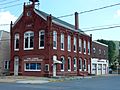
Port Carbon Borough Hall
-
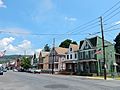
Pike Street
-
Public library
-
Port Carbon Senior Citizens Center
-
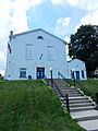
St. Stephen's Catholic Church


See also
 In Spanish: Port Carbon para niños
