Pottsville, Pennsylvania facts for kids
Quick facts for kids
Pottsville
|
|||
|---|---|---|---|
|
City
|
|||
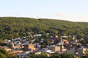
Pottsville skyline in May 2019
|
|||
|
|||
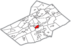
Location of Pottsville in Schuylkill County, Pennsylvania
|
|||
| Country | United States | ||
| State | Pennsylvania | ||
| County | Schuylkill | ||
| Mayor | Mark J. Atkinson | ||
| Founded | 1806, by John Pott | ||
| Established as a Village | 1819 | ||
| Incorporated as a Borough | February 19, 1828 | ||
| Chartered as a City | March 22, 1911 | ||
| Area | |||
| • Total | 4.17 sq mi (10.79 km2) | ||
| • Land | 4.17 sq mi (10.79 km2) | ||
| • Water | 0.00 sq mi (0.00 km2) | ||
| Elevation | 659 ft (200.9 m) | ||
| Population
(2020)
|
|||
| • Total | 13,346 | ||
| • Density | 3,203.55/sq mi (1,237.01/km2) | ||
| Time zone | UTC−5 (EST) | ||
| • Summer (DST) | UTC−4 (EDT) | ||
| ZIP Code |
17901
|
||
| Area codes | 570 and 272 | ||
| FIPS code | 42-62432 | ||
Pottsville is a city in Pennsylvania, United States. It is the main city of Schuylkill County. In 2020, about 13,346 people lived there. Pottsville is located on the west bank of the Schuylkill River. It is about 52 miles (84 km) south of Wilkes-Barre. The city is part of Pennsylvania's Coal Region, known for its rich history in coal mining.
Pottsville is also about 47.4 miles (76.3 km) west of Allentown. It is 96.6 miles (155.5 km) northwest of Philadelphia. New York City is about 135 miles (217 km) to the west.
Contents
- Exploring Pottsville's Past
- Pottsville's Landscape and Weather
- People of Pottsville
- Exploring Pottsville's Neighborhoods and Parks
- Interesting Places to Visit
- Sports in Pottsville
- Media and Communication
- Getting Around Pottsville
- Healthcare in Pottsville
- Schools and Learning
- Places of Worship
- Famous People from Pottsville
- See also
Exploring Pottsville's Past
Early Beginnings and Coal Discovery
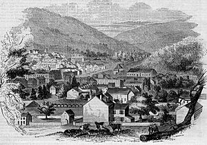
The land where Pottsville now stands was once part of a large grant from King Charles II to William Penn. Over time, this area became part of different counties. Eventually, it became part of Schuylkill County.
The history of coal in Pottsville began in 1790. A hunter named Necho Allen discovered a coal seam. Legend says his campfire accidentally lit up an exposed coal deposit. By 1795, people were already using this coal in a special furnace on the Schuylkill River.
Growth in the 1800s
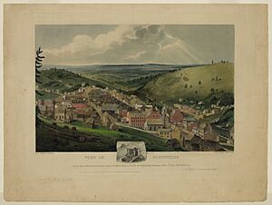
In 1806, John Pott bought the furnace and the land. He is known as the founder of Pottsville. The town was officially planned in 1816. It became a village in 1819 and a borough in 1828.
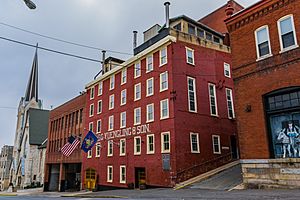
In 1829, a company called D.G. Yuengling & Son started a brewery. It is now the oldest brewery in the United States. In 1851, Pottsville became the county seat of Schuylkill County. This meant it became the center for local government.
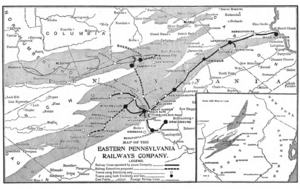
The Philadelphia and Reading Coal and Iron Company became a major coal company. It owned many coal lands in Pennsylvania. This company was very important until the coal industry declined after World War II.
Pottsville also had a small textile industry. This was because of its location along the Schuylkill River. The Phillips Van Heusen company started here in 1881. Moses Phillips and his wife made shirts for local coal miners. Many textile companies, including Van Heusen, moved away in the late 1970s.
Pottsville in the 1900s
During Prohibition in the United States, making and selling alcohol was against the law. The Yuengling brewery had to stop making regular beer. Instead, they made "near beer" and other drinks. The owner, Frank Yuengling, also opened a dairy. This helped the company survive during that time.
When Prohibition ended, Yuengling started making beer again. They even sent a truckload of beer to the White House to thank President Franklin D. Roosevelt. Today, Yuengling is still a family-owned business. It is one of the largest American-owned breweries.
Pottsville officially became a city on March 22, 1911.
The city was home to an NFL team called the Pottsville Maroons. They played from 1925 to 1928. The Maroons had great seasons in 1925 and 1926. There was a disagreement about who won the 1925 NFL championship. The team later moved to Boston.
Many traveling performers and entertainers visited Pottsville in the early to mid-1900s. Famous comedians Laurel and Hardy even made a film where they tried to reach Pottsville. During World War II, soldiers training nearby were not allowed to visit certain places in Pottsville.
Pottsville Today: The 21st Century
In 2007, the city improved its main street, Centre Street. In 2011, Pottsville opened a large transportation center. This center helps people travel around the county by bus. It also serves long-distance bus companies like Greyhound.
Several important buildings in Pottsville are listed on the National Register of Historic Places. These include the Pottsville Downtown Historic District, Cloud Home, and the D.G. Yuengling and Son Brewing Complex.
Pottsville's Landscape and Weather
City Layout and Natural Features
Pottsville is located at 40°41′06″N 76°12′10″W / 40.685058°N 76.202747°W. The city covers about 4.20 square miles (10.79 km2) of land.
Several waterways flow through Pottsville. The Schuylkill River runs along the southern part of the city. The West Branch of the Schuylkill River forms much of the western border. Smaller creeks, like Norwegian Creek, also flow through the city.
Like the ancient city of Rome, Pottsville is built on seven hills. These hills include Lawton's Hill, Greenwood Hill, and Bunker Hill.
The Pottsville Formation is a special type of rock found here. It includes coal, sandstone, and other rocks. This formation is named after the town.
Local Climate
Pottsville has a climate with warm summers and cold winters. The highest temperature ever recorded was 104°F (40°C) in 2011. The lowest was -19°F (-28°C) in 1994. January is usually the coldest month, and July is the warmest.
| Weather chart for Pottsville, Pennsylvania | |||||||||||||||||||||||||||||||||||||||||||||||
|---|---|---|---|---|---|---|---|---|---|---|---|---|---|---|---|---|---|---|---|---|---|---|---|---|---|---|---|---|---|---|---|---|---|---|---|---|---|---|---|---|---|---|---|---|---|---|---|
| J | F | M | A | M | J | J | A | S | O | N | D | ||||||||||||||||||||||||||||||||||||
|
3.1
37
24
|
2.8
42
26
|
3.5
49
34
|
3.6
62
43
|
4.4
74
52
|
4.9
82
62
|
4.5
86
67
|
4.1
83
65
|
4.4
77
56
|
4
66
45
|
3.8
53
37
|
3.6
43
29
|
||||||||||||||||||||||||||||||||||||
| temperatures in °F precipitation totals in inches source: The Weather Channel |
|||||||||||||||||||||||||||||||||||||||||||||||
|
Metric conversion
|
|||||||||||||||||||||||||||||||||||||||||||||||
People of Pottsville
| Historical population | |||
|---|---|---|---|
| Census | Pop. | %± | |
| 1830 | 2,464 | — | |
| 1840 | 4,345 | 76.3% | |
| 1850 | 7,515 | 73.0% | |
| 1860 | 9,444 | 25.7% | |
| 1870 | 12,384 | 31.1% | |
| 1880 | 13,253 | 7.0% | |
| 1890 | 14,117 | 6.5% | |
| 1900 | 15,710 | 11.3% | |
| 1910 | 20,236 | 28.8% | |
| 1920 | 21,876 | 8.1% | |
| 1930 | 24,300 | 11.1% | |
| 1940 | 24,530 | 0.9% | |
| 1950 | 23,640 | −3.6% | |
| 1960 | 21,659 | −8.4% | |
| 1970 | 19,715 | −9.0% | |
| 1980 | 18,195 | −7.7% | |
| 1990 | 16,603 | −8.7% | |
| 2000 | 15,549 | −6.3% | |
| 2010 | 14,324 | −7.9% | |
| 2020 | 13,346 | −6.8% | |
| Sources: | |||
In 2020, Pottsville had a population of 13,346 people. The city has seen its population change over the years. In 2000, there were about 15,549 people living in Pottsville. Most residents were White, with smaller groups of African American, Asian, and Native American people. About 1.22% of the population identified as Hispanic or Latino.
The city is home to many families and individuals. About 22.6% of the population was under 18 years old in 2000. The median age was 40 years.
Exploring Pottsville's Neighborhoods and Parks
City Areas
Pottsville is divided into different areas. The main intersection of Norwegian and Centre Streets helps define North, South, East, and West.
Some of the neighborhoods include:
- Center City (Downtown) – The main area with Centre Street and Market Street.
- Yorkville – Located on the west side of the city. Yorkville used to be a separate town.
- Quinntown – Along West Market Street.
- Lawton's Hill – East of Route 61.
- Greenwood Hill – East of Route 61, south of East Norwegian Street.
- Jalappa – North of Route 61 and east of Centre Street.
- Fishbach – West of Jalappa.
- Forest Hills – A residential area south of Mount Carbon.
- Bunker Hill – South of Mahantongo Street.
- Morrisville – South Centre Street.
- Guinea Hill – A residential area north of West Arch Street.
- Cottage Hill – North of West End Avenue.
- Mount Hope – North of Laurel Boulevard.
Parks and Recreation Areas
Pottsville has many parks and places for fun activities:
- Rotary Park – One of the largest parks, with a Little League field and a basketball court.
- Railway Park – Located in the Yorkville section. It was home to a Little League team that went to the World Series in 1997.
- General George Joulwan East Side Park – Built on a hillside, it has basketball courts and a skate park.
- Henry Clay Park – A small park on South Second Street with a monument and a nice view.
- John F. Kennedy Memorial Recreation Complex – The city's main park with basketball, tennis, and volleyball courts. It also has a community pool and a walking path.
- Yuengling Park – A peaceful spot with natural fountains, grass, and flowers.
- Bunker Hill Playground – A playground with updated equipment.
- Barefield Outdoor Recreation Complex – A 3-acre (1.2 ha) complex with a basketball court, horseshoe pits, and a sand volleyball court.
- Other Playgrounds – Many smaller playgrounds are located throughout the city for kids to enjoy.
Interesting Places to Visit
Pottsville has several interesting places:
- Schuylkill County Courthouse – You can take tours here.
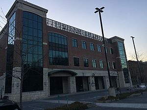
- Pottsville City Hall - The center of city government.
- Henry Clay Monument – A historical monument.
- Garfield Square Monuments – Located at North Fifth and West Market Streets.
- D.G. Yuengling & Son Brewery – You can take tours to see how beer is made.
- Jerry's Classic Cars Museum – A museum with many old cars.
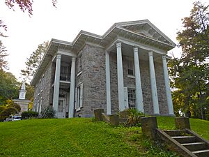
- Yuengling Mansion, Schuylkill County Council for the Arts - A beautiful historic home.
- Schuylkill County Historical Society – Learn about the history of the county.
- Jewish Museum of Eastern Pennsylvania – A museum about Jewish history in the area.
- Garfield Diner – A classic diner at Garfield Square.
- Veterans' Memorial Stadium – Home of the Pottsville Crimson Tide Football team.
- John O'Hara House – The home of a famous author.
- Pottsville Skatepark – A place for skateboarding.
- JFK Memorial Pool – A community swimming pool.
- Sovereign Majestic Theater – A place for performing arts.
- Pilger Ruh Brewing - A local brewery.
- Pressed Coffee and Books - A coffee shop and bookstore.
Sports in Pottsville
Pottsville once had a professional football team called the Pottsville Maroons. They played in the National Football League from 1925 to 1929.
The city also has a strong tradition in Little League Baseball. The Pottsville Area Little League was formed by combining two older leagues. One of these, Railway Park Little League, represented the United States Eastern Region in the 1997 Little League World Series.
Media and Communication
Newspapers
The Republican Herald is the daily newspaper for Pottsville.
Broadcast Media
Local television channels from the Scranton/Wilkes-Barre area serve Pottsville. These include WNEP-TV 16 (ABC), WYOU-TV 22 (CBS), WBRE-TV 28 (NBC), WVIA-TV 44 (PBS), and WOLF-TV 56 (FOX). Two radio stations, WAVT-FM 101.9-FM and WPPA 1360-AM 105.9-FM, broadcast from Pottsville.
Communications
Dial telephone service came to Pottsville on August 30, 1956. The city has added more phone exchanges since then.
Getting Around Pottsville
Pottsville has a small airport for general aviation called Schuylkill County Airport (ZER).
Since 2011, bus services have been available at the Union Station Intermodal Transit Center. The Schuylkill Transportation System offers bus routes throughout the county. Long-distance bus companies like Greyhound and Trailways also use this center.
Two major highways, Pennsylvania Route 61 and U.S. Route 209, meet in Pottsville. Passenger train service to Philadelphia ended on July 29, 1981.
Healthcare in Pottsville
Lehigh Valley Hospital–Schuylkill is a hospital system in Pottsville. It was formed by combining two community hospitals. This medical center is a Level III trauma center, meaning it can handle serious injuries. In 2016, it became part of the Lehigh Valley Health Network.
Schools and Learning
Public and Private Education
Pottsville has several schools:
- Pottsville Area School District, which includes Pottsville Area High School, D.H.H. Lengel Middle School, and John S. Clarke Elementary Center.
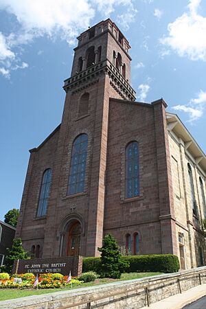
- Assumption BVM – A school part of the Roman Catholic Diocese of Allentown.
- Gillingham Charter School – A public charter school.
- Literacy Council for Schuylkill County – Helps people improve reading and writing skills.
- Joseph F McCloskey School of Nursing at Schuylkill Health – A nursing school.
- Nativity BVM High School – Also part of the Roman Catholic Diocese of Allentown.
- Perception Training Center.
- Pottsville Free Public Library – A place to read and learn.
Colleges and Universities
- Alvernia University Schuylkill Satellite Campus.
- Penn State Schuylkill, located in nearby Schuylkill Haven, Pennsylvania.
Places of Worship
Famous People from Pottsville
- Gary Becker, a Nobel Prize-winning economist.
- Stan Bergstein, a harness racing expert.
- Rudine Sims Bishop, an educator known for multicultural literature.
- Travis Blankenhorn, a Major League Baseball player.
- Megan Brennan, a former United States Postmaster General.
- Ralph E. Brock, the first Black forester in the United States.
- Antonio Buehler, a civil rights leader.
- Ronald Caravan, a clarinet player.
- George Cowie, a Wisconsin politician.
- Crobot, a band.
- Jim Detterline, an American mountaineer.
- Pat Flannery, a men's basketball coach.
- Jan Fortune, a Florida state legislator.
- Anna M. Hammer, a philanthropist.
- John E. Jones III, a federal judge.
- George Joulwan, a high-ranking military general.
- Guy Kratzer, a Pennsylvania State Senator.
- Peggy Maley, an actress.
- Jen Manion, a professor and author.
- Muffet McGraw, a women's basketball coach.
- Chris Nabholz, a baseball player.
- James Nagle, a Civil War general.
- Arthur C. Neville, a mayor of Green Bay, Wisconsin.
- J. C. Neville, a Wisconsin politician.
- John O'Hara, a famous author.
- Ralph Peters, an author and retired U.S. Army officer.
- Henry Pleasants, an engineer and Civil War general.
- Lance Rautzhan, a Major League Baseball pitcher.
- Howie Smith, a musician and educator.
- Matt Wachter, a musician.
- Bill Walsh, an author and editor.
- Jude Wanniski, an editor and economic advisor.
- Benedict Churchill, a bishop.
See also
 In Spanish: Pottsville (Pensilvania) para niños
 | Misty Copeland |
 | Raven Wilkinson |
 | Debra Austin |
 | Aesha Ash |


