Shamokin (village) facts for kids
Quick facts for kids
Shamokin or Otzinachson
Schahamokink
|
|
|---|---|
|
Historic Native American village
|
|
| Etymology: Unami: Shahë-Mokink "place of crawfish" or Iroquoian languages: Otzinachson "The Demon's Den" | |
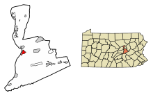
Former location of Shamokin, present-day site of Sunbury, Pennsylvania
|
|
| State | Pennsylvania |
| Present-day Community | Sunbury, Pennsylvania |
| Founded | before 1711 |
| Abandoned | May, 1756 |
| Population | |
| • Estimate
(1745)
|
300-400 |
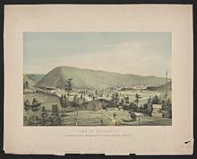
Shamokin was a busy Native American village. It was located on the Susquehanna River in what is now Sunbury and Shamokin Dam, Pennsylvania. This historic village is different from the modern town of Shamokin, Pennsylvania, which is further east.
Shamokin was a place where many different Native American groups lived together. It was important for trade and later became a center for missionaries. During the French and Indian War, it was used as a base for attacks on English settlements. The Lenape people burned and left the village in May 1756. A few months later, Fort Augusta was built right where Shamokin used to be.
Contents
What's in a Name?
The name "Shamokin" likely comes from the Lenape word Schahamokink or Shahëmokink. This means "place of crawfish." It might also be related to Shackamaxon, meaning "place to make a chief."
The Iroquois people called the area Otzinachson. This name meant "The Demon's Den." They believed evil spirits lived in a large cave nearby.
A Village Grows
People have lived in the Shamokin area for a very long time. Stone tools and pottery found there are between 1,500 and 9,000 years old. A village definitely existed by 1711.
In 1728, Delaware Indians moved to Shamokin. They had been forced to leave their lands in the Tulpehocken Creek Valley. More Delaware Indians came after 1737. They lost their land in the Walking Purchase, a large land deal. The Six Nations told them to move to Shamokin or Wyomink.
Shamokin became home to many groups. These included Iroquois from the north, and Shawnee and Lenape moving away from growing white settlements. Some Saponi and Tutelo people from Virginia also lived there.
Busy Trading Post
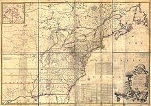
From 1727 to 1756, Shamokin was one of the biggest and most important Native American settlements in Pennsylvania. Many traders set up posts there. They were known as "the Shamokin Traders." They traded furs and skins with the Native Americans.
Important Leaders
In 1736, many Iroquois chiefs visited Shamokin. They wanted to show their friendship and power over the Delaware people. The Delaware were key suppliers of furs for trade.
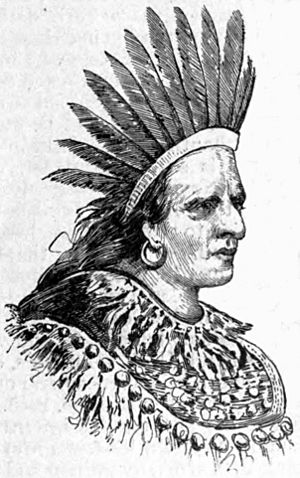
The Oneida chief Shikellamy moved to Shamokin in 1737. He represented the Iroquois and oversaw the Lenape people's affairs. He was a very important leader. Shikellamy died in Shamokin in 1748. After he passed away, some Delaware people left and started a new village.
Moravian Missionaries Arrive
In 1742, Count Nicolaus von Zinzendorf visited Shamokin. He was a leader of the Moravian Church. He met with Shikellamy, who had become a Christian. The Count hoped Shikellamy could help convert other Native Americans.
Shikellamy allowed the Moravians to build a mission in Shamokin. He helped them build homes and allowed them to stay in his own home. He was a great friend to the Moravians.
Blacksmith Shop for the Community
The Moravian mission started in 1747. Its main purpose was to have a blacksmith shop. This shop served the Iroquois and other tribes like the Delaware, Tutelo, Conoy, and Shawnee. Shikellamy wanted the blacksmith to work for free for the Five Nations. Other Native American customers paid with animal skins.
The first blacksmith, Anton Schmidt, arrived in July 1747. Everyone was very happy to see him. The mission was carefully run. Trading was mostly limited to skins and furs.
French and Indian War Begins
The French and Indian War brought fighting to the area. For a while, the Delaware people in Shamokin tried to stay neutral. But after a big battle in 1755, some Delaware Indians from Shamokin joined the war against Pennsylvania and the English.
In October 1755, Lenape Indians attacked a town called Penns Creek, not far from Shamokin. This caused a lot of fear. A settler named John Harris Jr. went to Shamokin to see what was happening. He found many Lenape painted in black. They advised him to leave quickly. Harris and his men were later attacked on their way back.
After another attack on a Moravian mission, the missionaries in Shamokin left in November 1755. They were afraid for their lives. By March 1756, many settlers had been killed or captured. People left their homes and moved to safer areas.
Shamokin is Abandoned
On April 14, 1756, Pennsylvania officially declared war on the Delaware Nation. The leaders of Shamokin decided to burn their village. The people moved to another community. A scouting party visited the site in June and found it empty.
Fort Augusta is Built
After Shamokin was abandoned, Governor Robert Hunter Morris ordered a fort to be built there. Fort Augusta was started in June 1756. It was finished by late August 1756.
Fort Augusta was the largest British fort in Pennsylvania. It had strong earthen walls and wooden defenses. It housed many soldiers and became an important military base.
Digging Up the Past
Archaeologists explored the Shamokin site in 1978 and 1979. They found many things from the fort's construction and removal. Below that, they found remains of the Shamokin village. Even older prehistoric items were discovered.
They found stone tools, spear points, and pottery from thousands of years ago. They also found items from the 1700s, like gunflints, musket balls, and broken glass. Parts of a wall, a trench, and a dry moat were found. Evidence of the Moravian blacksmith shop was also uncovered, including burned animal bones, gun parts, and metal fragments.
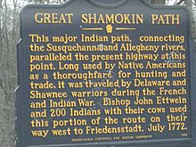
The Great Shamokin Path
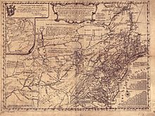
The Great Shamokin Path was a major Native American trail. It started at Shamokin and went north and west along the Susquehanna River. It then continued west to other villages.
Pennsylvania had many well-used trails because traveling by canoe was hard. Eleven major Indian paths led into Shamokin. These trails were usually flat and direct. They followed high ground to avoid floods.
 | Sharif Bey |
 | Hale Woodruff |
 | Richmond Barthé |
 | Purvis Young |


