Shamokin Dam, Pennsylvania facts for kids
Quick facts for kids
Shamokin Dam, Pennsylvania
|
||
|---|---|---|
|
Borough
|
||

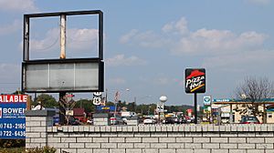
Development along US Route 11/15 in Shamokin Dam
|
||
|
||

Location of Shamokin Dam in Snyder County, Pennsylvania.
|
||
| Country | United States | |
| State | Pennsylvania | |
| County | Snyder | |
| Area | ||
| • Total | 1.88 sq mi (4.88 km2) | |
| • Land | 1.84 sq mi (4.78 km2) | |
| • Water | 0.04 sq mi (0.10 km2) | |
| Elevation
(center of borough)
|
499 ft (152 m) | |
| Highest elevation
(hill in northern part of borough)
|
780 ft (240 m) | |
| Lowest elevation
(Susquehanna River)
|
418 ft (127 m) | |
| Population
(2020)
|
||
| • Total | 1,652 | |
| • Density | 895.39/sq mi (345.77/km2) | |
| Time zone | Eastern (EST) | |
| • Summer (DST) | EDT | |
| ZIP Code |
17876
|
|
| Area code(s) | 570 and 272 | |
| FIPS code | 42-69616 | |
Shamokin Dam is a borough in Snyder County, Pennsylvania, United States. In 2020, about 1,647 people lived there.
The name "Shamokin" comes from a Native American language. It means "place of eels." The borough's name also comes from a 10-foot-tall dam. This dam was built across the Susquehanna River in the 1800s.
The dam helped steamboat ferries carry goods and people. These ferries traveled between Shamokin Dam and Sunbury. They ran from 1772 until 1907. The dam also supplied water to a canal system. This canal was on the western side of the river. Ice destroyed the dam in March 1904. Shamokin Dam is different from the city of Shamokin, Pennsylvania. That city is about 14 miles east.
Contents
Exploring Shamokin Dam's Location
Shamokin Dam is about 1.9 square miles (4.88 square kilometers) in total area. Most of this area is land. Only a small part is water.
The borough is on the western bank of the Susquehanna River. It is just south of where the river's west and north branches meet. Other nearby places include Hummels Wharf and Monroe Township. U.S. Route 15 also runs through the area.
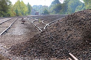
The Norfolk Southern Railway tracks pass through the borough. They run between Old Trail Road and the Susquehanna River.
Small creeks flow through Shamokin Dam. They all drain into the Susquehanna River. Sometimes, low areas near the river flood. These areas are where the old canal used to be.
For many years, Shamokin Dam shared a ZIP code with Selinsgrove. This caused confusion for deliveries and emergency services. To fix this, Shamokin Dam got its own unique ZIP code, 17876. This helped with mail and local taxes.
A Look at Shamokin Dam's Past
Pennsylvania was once home to many Native American tribes. In the 1600s, the Iroquois Confederacy was powerful here. This group included the Mohawk, Onondaga, Cayuga, Seneca, and Oneida tribes. They used the area for hunting. Other tribes like the Delaware and Shawnee also lived here.
In the early 1700s, many Delaware Indians moved to this area. They had lost their land in the "Walking Purchase." The Iroquois Confederacy told them to move to places on the Susquehanna River. One of these places was near present-day Sunbury and Shamokin Dam.
From 1727 to 1756, the village of Shamokin was very important. It was one of the largest Native American settlements in Pennsylvania. In 1745, a missionary named David Brainerd visited. He said the village had 300 Native Americans. Half were Delaware, and the rest were Seneca and Tutelo.
In 1754, much of the land west of the Susquehanna was sold to Pennsylvania. However, Shamokin was kept by the Six Nations. They wanted it for their own people. This created a safe area for friendly Delaware Indians.
The French and Indian War brought fighting to the region. The Delaware Indians in Shamokin tried to stay neutral at first. But after a terrible event in 1755, they joined the war against Pennsylvania. Fort Augusta was built in 1756 at Shamokin. You can learn more about this early history in Shamokin (village).
Shikellamy, an Oneida chief, helped talk with white settlers. In 1754, he worked with Conrad Weiser. They agreed that the Blue Mountains would be the border for Native American lands. But many Native Americans felt cheated by the treaty. Conflicts happened, and eventually, white settlers pushed the native peoples out.
German settlers were among the first Europeans here. Their influence is still seen today. Groups like the Amish and Mennonites live in the area.
Shamokin Dam was started by George Keen in 1745. It was first called Keensville. Many early residents worked on the canal or as fishermen. Restaurants and hotels served these workers and travelers. A lock for the Pennsylvania Canal was on the riverbank. Most businesses were related to transportation and the canal.
In 1907, a toll bridge was finished. It connected Shamokin Dam to Sunbury. The bridge cost $150,000 to build. A person lived in a house on the bridge to collect tolls. The bridge was used by people walking, buggies, and cars.
Who Lives in Shamokin Dam?
| Historical population | |||
|---|---|---|---|
| Census | Pop. | %± | |
| 1880 | 307 | — | |
| 1930 | 738 | — | |
| 1940 | 764 | 3.5% | |
| 1950 | 730 | −4.5% | |
| 1960 | 1,093 | 49.7% | |
| 1970 | 1,562 | 42.9% | |
| 1980 | 1,622 | 3.8% | |
| 1990 | 1,690 | 4.2% | |
| 2000 | 1,502 | −11.1% | |
| 2010 | 1,686 | 12.3% | |
| 2020 | 1,647 | −2.3% | |
| 2021 (est.) | 1,636 | −3.0% | |
| Sources: | |||
In 2000, there were 1,502 people living in Shamokin Dam. There were 688 households. Most people were White (97.94%). A small number were African American, Native American, or Asian.
About 23% of households had children under 18. Most households (53.9%) were married couples. About 33.7% of households were single people. Many people aged 65 or older lived alone.
The average age in the borough was 46 years. About 19.8% of the population was under 18. About 28.7% were 65 or older.
Local Economy and Transportation
The Sunbury power plant was built in 1949. It started working in 1953. This plant is on the Susquehanna River in Shamokin Dam. It sells power to Pennsylvania's electricity market. The plant has been sold to different companies over the years.
U.S. Routes 11 and 15 go through the borough. These highways are important for travel in the region.
Fun Places and Parks
Shamokin Dam has several parks for everyone to enjoy:
- Weller Field is a baseball field. It was named in 1990 after Dr. Carl A. Weller. He served on the borough council. The park also has a dog park with separate areas for large and small dogs. You can find restrooms, benches, and playground equipment here. There is also a walking trail.
- Attig Park has a playground and a picnic area. It is named after Charles Attig, Jr., a police officer.
- Fabridam Park features the Adam T. Bower Memorial Dam. It is near the Veterans Memorial Bridge. This park has a picnic shelter and playground equipment. You can also explore the woods. It is next to the Susquehanna River. This makes it a great spot for kayaking, canoeing, and fishing.
- Jack Treas Park is named after a former mayor. It has restrooms and two large picnic areas with kitchens. There is also a basketball court, playground equipment, and open space for games.
Cemeteries
- Orchard Hills Cemetery is behind the Orchard Hill Shopping Center. It used to be called West Side Cemetery.
- Hartman's Family Cemetery is on Old Trail Road. It is near the power plant entrance.
- Schreiner's Cemetery is on Eleventh Ave. and Stetler Ave. It is next to the Susquehanna Valley Baptist Church.
Emergency Services
The Shamokin Dam Police Department is in the Borough Office complex. They have full-time and part-time officers.
The Shamokin Dam Volunteer Fire Department is at 3343 North Old Trail. For ambulance service, the Americus Community Ambulance Service from Sunbury helps Shamokin Dam. Always call 911 for any emergency. The closest hospital is Evangelical Community Hospital in Lewisburg.
See also
 In Spanish: Shamokin Dam para niños
 | Bessie Coleman |
 | Spann Watson |
 | Jill E. Brown |
 | Sherman W. White |


