
Auburn, Pennsylvania facts for kids
Quick facts for kids
Auburn, Pennsylvania
|
|
|---|---|
|
Borough
|
|
.jpg)
A church in Auburn, Pennsylvania in October 2011
|
|

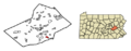
Location of Auburn in Schuylkill County, Pennsylvania
|
|

Auburn, Pennsylvania
Location in Pennsylvania

Auburn, Pennsylvania
Location in the United States
|
|
| Country | United States |
| State | Pennsylvania |
| County | Schuylkill |
| Incorporated | 1857 |
| Government | |
| • Type | Borough Council |
| Area | |
| • Total | 1.67 sq mi (4.34 km2) |
| • Land | 1.62 sq mi (4.20 km2) |
| • Water | 0.05 sq mi (0.13 km2) |
| Elevation | 479 ft (146 m) |
| Population
(2020)
|
|
| • Total | 660 |
| • Density | 406.65/sq mi (156.97/km2) |
| Time zone | UTC-5 (Eastern (EST)) |
| • Summer (DST) | UTC-4 (EDT) |
| ZIP Code |
17922
|
| Area codes | 570 and 272 |
| FIPS code | 42-03488 |
Auburn is a small town, also known as a borough, located in Schuylkill County, Pennsylvania, United States. In 2020, about 663 people lived there.
Contents
History of Auburn
How Auburn Started
The area where Auburn is now was once called the "Scotchman's Lock." The very first house in Auburn was built in the late 1830s. A boatman named Samuel Moyer built it and also ran a store.
Growth and Development
In 1842, the Philadelphia and Reading Railroad came to the area. This was a big step for the town. At that time, the official name was changed to "Auburn." The town officially became a borough in 1857.
Later in 1857, another railroad, the Susquehanna and Schuylkill Railroad, also reached Auburn. The first post office opened in Auburn in 1846. The first school was also set up in 1846, helping kids in the area learn and grow.
Geography of Auburn
Where is Auburn Located?
Auburn is found at coordinates 40°35′45″N 76°5′34″W / 40.59583°N 76.09278°W. This means it's in a specific spot on the map. The borough covers a total area of about 1.7 square miles (4.34 square kilometers). Most of this area is land, with a small part being water.
Landscape and Features
The land in Auburn is quite varied. The northern parts have steep hills, while the southern parts have gentler hills. Much of Auburn is covered by forests. You can also find some homes and farms there.
The Schuylkill River flows right through Auburn. This river is an important natural feature. Pennsylvania Route 895 is a main road that serves the borough, making it easy to travel in and out of Auburn.
People of Auburn
Population Changes Over Time
The number of people living in Auburn has changed over the years. Here's a look at the population from different census records:
| Historical population | |||
|---|---|---|---|
| Census | Pop. | %± | |
| 1860 | 527 | — | |
| 1870 | 511 | −3.0% | |
| 1880 | 740 | 44.8% | |
| 1890 | 880 | 18.9% | |
| 1900 | 845 | −4.0% | |
| 1910 | 921 | 9.0% | |
| 1920 | 977 | 6.1% | |
| 1930 | 1,170 | 19.8% | |
| 1940 | 978 | −16.4% | |
| 1950 | 994 | 1.6% | |
| 1960 | 936 | −5.8% | |
| 1970 | 895 | −4.4% | |
| 1980 | 999 | 11.6% | |
| 1990 | 913 | −8.6% | |
| 2000 | 839 | −8.1% | |
| 2010 | 741 | −11.7% | |
| 2020 | 663 | −10.5% | |
| 2021 (est.) | 663 | −10.5% | |
| Sources: | |||
Who Lives in Auburn?
According to the 2000 census, there were 839 people living in Auburn. There were 325 households, which are groups of people living together in one home. The average household had about 2 to 3 people.
The population includes people of all ages. About a quarter of the people were under 18 years old. The median age was 38 years, meaning half the people were younger than 38 and half were older.
Most people in Auburn are White. A small number of people are African American or Asian, or from two or more racial backgrounds.
How People Live
In 2000, the average income for a household in Auburn was about $36,905 per year. For families, the average income was around $40,833. A small percentage of families and people lived below the poverty line, which means they had lower incomes.
Images for kids
-
Location of Auburn in Schuylkill County, Pennsylvania
See also
 In Spanish: Auburn (Pensilvania) para niños
