
Forty Fort, Pennsylvania facts for kids
Quick facts for kids
Forty Fort, Pennsylvania
|
|
|---|---|
|
Borough
|
|

Forty Fort Borough Hall
|
|

Location of Forty Fort in Luzerne County, Pennsylvania
|
|

Forty Fort, Pennsylvania
Location in Pennsylvania

Forty Fort, Pennsylvania
Location in the United States
|
|
| Country | United States |
| State | Pennsylvania |
| County | Luzerne |
| Settled | 1778 |
| Incorporated | 1887 |
| Government | |
| • Body | Borough Council |
| Area | |
| • Total | 1.52 sq mi (3.93 km2) |
| • Land | 1.30 sq mi (3.38 km2) |
| • Water | 0.21 sq mi (0.55 km2) |
| Population
(2020)
|
|
| • Total | 4,239 |
| • Density | 3,248.28/sq mi (1,253.71/km2) |
| Time zone | UTC−5 (Eastern (EST)) |
| • Summer (DST) | UTC−4 (EDT) |
| Zip code |
18704
|
| Area code(s) | 570 |
| FIPS code | 42-26880 |
Forty Fort is a small town, called a borough, located in Luzerne County, Pennsylvania, United States. In 2020, about 4,233 people lived there. Forty Fort is surrounded by other towns like Wyoming to the north and Kingston to the south. The Wilkes-Barre Wyoming Valley Airport and the Wyoming Seminary Lower School are both found in this borough.
Contents
History of Forty Fort
Early Settlers and the Revolutionary War
The name "Forty Fort" comes from an important event in its past. In 1770, about forty settlers from Westmoreland County, Connecticut, built a fort along the Susquehanna River. This was before the American Revolutionary War began.
At that time, both Connecticut and Pennsylvania claimed this land. This disagreement led to some conflicts known as the Pennamite–Yankee Wars. After the Revolutionary War, the United States government decided that the land belonged to Pennsylvania.
During the Revolutionary War, a group of soldiers loyal to Britain (called Loyalists) and Haudenosaunee warriors arrived in the Wyoming Valley. This happened on June 30, 1778. Two nearby forts, Fort Wintermoot and Fort Jenkins, quickly gave up. However, the people inside Forty Fort refused to surrender.
On July 3, about 300 American fighters, known as Patriots, marched out from Forty Fort. They fought in a battle called the Battle of Wyoming, also known as the Wyoming Massacre. Sadly, about 300 Americans were killed in this fight.
The next morning, July 4, the remaining American fighters agreed to surrender Forty Fort. The Loyalist leader let them go, as long as they promised not to fight anymore. No one living in the fort was hurt after the surrender. In 1900, a large stone monument was placed in Forty Fort to show where the original fort likely stood.
After the Revolutionary War
After the war, Forty Fort continued to grow. The Nathan Denison House was built around 1790. The Forty Fort Meetinghouse, a historic church, was built between 1806 and 1808. It is located in the borough's cemetery.
Forty Fort officially became a borough in 1887. Later, the Wyoming Seminary opened its Lower School here. A part of the Wilkes-Barre Wyoming Valley Airport also became part of the borough.
Dealing with Floods
Forty Fort is located near the Susquehanna River. In June 1972, a big storm called Hurricane Agnes caused the river to flood. A part of the levee (a protective wall) around Forty Fort broke. This caused a lot of damage to the town and nearby areas.
The Forty Fort Cemetery was also badly affected. Over 2,000 caskets were washed away by the floodwaters. The bodies that were found later were buried together in a special grave. A monument marks the damage from the 1972 flood.
In September 2011, another storm, Tropical Storm Lee, brought heavy rains. The levee system was tested again. This time, the levee held strong! The town was saved from the kind of disaster it experienced in 1972.
-
US 11 in Forty Fort (around 1940)


.jpg)
Geography of Forty Fort
Forty Fort is on the western side of the Susquehanna River. It is just north of the city of Wilkes-Barre. The borough covers about 1.52 square miles (3.93 square kilometers). Most of this area is land, but about 0.21 square miles (0.55 square kilometers) is water.
Forty Fort is built on a floodplain, which is flat land near a river that can flood. Because of this, the town has a special levee system to protect it. As mentioned before, this levee system has been very important in protecting the town from floods.
Population and People
| Historical population | |||
|---|---|---|---|
| Census | Pop. | %± | |
| 1880 | 478 | — | |
| 1890 | 1,031 | 115.7% | |
| 1900 | 1,557 | 51.0% | |
| 1910 | 2,353 | 51.1% | |
| 1920 | 3,389 | 44.0% | |
| 1930 | 6,224 | 83.7% | |
| 1940 | 6,293 | 1.1% | |
| 1950 | 6,173 | −1.9% | |
| 1960 | 6,431 | 4.2% | |
| 1970 | 6,114 | −4.9% | |
| 1980 | 5,590 | −8.6% | |
| 1990 | 5,049 | −9.7% | |
| 2000 | 4,579 | −9.3% | |
| 2010 | 4,214 | −8.0% | |
| 2020 | 4,233 | 0.5% | |
| 2021 (est.) | 4,225 | 0.3% | |
| Sources: | |||
In 2000, there were 4,579 people living in Forty Fort. Most of the people were White (98.47%). About 25.7% of households had children under 18 living with them. The average age of people in the borough was 42 years old.
Education in Forty Fort
Forty Fort is part of the Wyoming Valley West School District. There are three schools located within the borough:
- Dana Street Elementary Center: This is a public elementary school.
- Wyoming Seminary Lower School: This is a private school for students from pre-kindergarten up to eighth grade.
- Apple Tree Nursery and Primary School: This is another private school.
Transportation and Roads

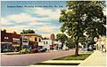
U.S. Route 11, also known as Wyoming Avenue, is a main road that goes through Forty Fort. PA 309 also passes through the southern part of the borough.
The southern edge of the Wilkes-Barre Wyoming Valley Airport is in Forty Fort. This airport is used mostly by smaller, private planes. The rest of the airport is in the neighboring town of Wyoming.
See also
 In Spanish: Forty Fort para niños
