Panther Creek (Little Schuylkill River tributary) facts for kids
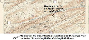
Panther Creek is a small river in Pennsylvania, USA. It flows west and is a branch of the Little Schuylkill River. This creek starts near Lansford, Pennsylvania in a low area between three mountains: Mount Pisgah, Nesquehoning Mountain, and Pisgah Mountain. These mountains run along both sides of the creek as it flows from east to west.
Quick facts for kids Panther Creek |
|
|---|---|
 |
|
| Physical characteristics | |
| Main source | Over the Lehigh Valley drainage divide due west of Palmerton, Pennsylvania below Mount Pisgah (below the join of Pisgah Ridge with Nesquehoning Mountain and Mauch Chunk Mountain). |
| River mouth | Little Schuylkill River at Tamaqua, Pennsylvania 40°47′46″N 75°57′58″W / 40.79600°N 75.96613°W |
| Length | ca. 8 mi (13 km) |
| West Branch Schuylkill River | |
| West Branch | |
| River | |
|
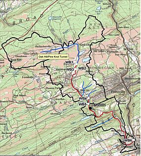
Topographic map of West Branch Schuylkill River watershed. The black line denotes the watershed boundary.
|
|
| Country | United States |
|---|---|
| State | Pennsylvania |
| Counties | Schuylkill |
| Tributaries | |
| - left | Dyer Run, Wagner Run, Wheeler Creek, Beaver Creek (Pennsylvania) |
| - right | Indian Run, Panther Creek |
| Cities | Buck Run, Glen Dower, Minersville, Pottsville, Cressona, Schuylkill Haven |
| Source | |
| - location | Buck Run, Pennsylvania, Schuylkill County, Pennsylvania |
| - elevation | 1,200 ft (366 m) |
| - coordinates | 40°42′45″N 76°18′27″W / 40.71250°N 76.30750°W |
| Mouth | Schuylkill River |
| - location | Schuylkill Haven, Pennsylvania, Schuylkill County, Pennsylvania |
| - elevation | 600 ft (183 m) |
| - coordinates | 40°38′3″N 76°10′51″W / 40.63417°N 76.18083°W |
| Length | 13 mi (21 km) |
| Basin | 21 sq mi (54 km²) |
Contents
History of Panther Creek Valley
The valley where Panther Creek flows has a very important history. It was mostly owned by a company called the Lehigh Coal & Navigation Company. This company was very important for coal mining.
Coal Mining and Railroads
The company built the Panther Creek Railroad. This railroad went from Lansford, Pennsylvania to Tamaqua, Pennsylvania. They also built the Hauto Tunnel. These were used to move coal from the many coal mines and coal processing plants in the area.
It was an easier way to transport coal than going over the mountains. Before this, coal was moved to Jim Thorpe, Pennsylvania (then called Mauch Chunk). From there, it went to the Lehigh Canal using the Mauch Chunk Switchback Railway. This railway was one of the oldest in North America. It was also the first "gravity" and "switchback" railroad. A gravity railroad uses gravity to move cars downhill. A switchback railroad uses zig-zag tracks to climb steep hills.
First Coal Discoveries
The coal found in this valley was some of the first to be mined by any company. Mining started with coal found right on the surface. This led to the founding of towns like Summit Hill, Pennsylvania, then Lansford in Carbon County, Pennsylvania. Later, towns like Coaldale and Tamaqua in Schuylkill County, Pennsylvania were also founded downstream.
Panther Creek Today
Today, a new version of the Lehigh Coal and Navigation Company still mines coal in the Panther Creek valley. This company still owns the rights to all the minerals underground.
 | Chris Smalls |
 | Fred Hampton |
 | Ralph Abernathy |


