Nesquehoning Mountain facts for kids
Quick facts for kids Nesquehoning Mountain |
|
|---|---|
| Nesquehoning Ridge | |
| Highest point | |
| Peak | Lat/Lng:405000N 0755457W (Unknown Tamaqua? Knob) |
| Elevation | 1,535 ft (468 m) |
| Dimensions | |
| Length | 25 mi (40 km) east-west |
| Width | 1–2 km (0.62–1.24 mi) north-south |
| Geography | |
| Country | United States |
| Geology | |
| Orogeny | Appalachian Mountains |
| Age of rock | Silurian |
| Type of rock | Tuscarora Formation and Shawangunk Formation; sedimentary |
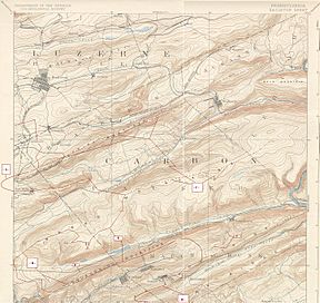
Nesquehoning Mountain or Nesquehoning Ridge is a mountain ridge in Pennsylvania, United States. It is about 15 to 17 miles (24 to 27 km) long. This ridge is special because it holds coal and acts as a drainage divide. This means it separates the water flowing into the Lehigh Valley to the north from the water flowing into the Schuylkill River valley to the south.
The mountain is part of the Ridge-and-Valley Appalachians. These mountains generally run from west-southwest to east-northeast. Nesquehoning Mountain sits above a deep valley carved by Nesquehoning Creek. It is across from Broad Mountain. Near the Lehigh River, Nesquehoning Mountain joins with Pisgah Ridge to form Mount Pisgah. This area is close to the Pocono Mountains and was once called "The Switzerland of America." Nesquehoning Creek, which starts on this mountain, flows into the Lehigh River.
Where the Water Flows
Nesquehoning Creek starts in two places. One is a forest on the slopes of Broad Mountain, high up at over 1,360 feet (410 m). The other is near a low point called a saddle pass, which connects to Broad Mountain. This pass is near Tamaqua and the Little Schuylkill River.
The creek flows south for about 2 miles (3.2 km). Then it turns northeast and flows into Greenwood Lake. After that, it goes into Lake Hauto. The creek continues northeast through a narrow valley. It flows past a deep cut in the land, which US 209 now follows. This road climbs up to the base of Mount Pisgah. Finally, Nesquehoning Creek meets the Lehigh River.
History and the Area Around the Mountain
Nesquehoning Mountain and Broad Mountain have very steep, forested slopes. The main roads, US 209 and PA 93, climb up these valleys. The route along Nesquehoning Creek was once just a path for mules. It became a proper highway much later.
The valley of Nesquehoning Creek has some homes and businesses. Towns like Nesquehoning and Hometown are located here. In 1830, a company called Lehigh Coal & Navigation Company started mining coal in the Room Run valley. They built a special railroad called a "self-acting plane" to move the coal. This was like a small train that used gravity to go down a slope. It carried coal 2 miles (3.2 km) to the company's Lehigh Canal.
Much of the land in this valley has been changed by coal mining. Most of the mining happened on the higher, less steep parts of the mountain. This was especially true in the Panther Creek Valley. When it rains, much of the water from these mining areas stays in old mining pits. Not much water from the Nesquehoning Creek side flows into the creek itself. One exception was a mine that became the Lehigh and Susquehanna Railroad's Hauto Tunnel in 1872.
 | Delilah Pierce |
 | Gordon Parks |
 | Augusta Savage |
 | Charles Ethan Porter |


