
Image: Scotts Bluff National Monument geologic map
Size of this preview: 653 × 600 pixels. Other resolutions: 261 × 240 pixels | 897 × 824 pixels.
Original image (897 × 824 pixels, file size: 203 KB, MIME type: image/jpeg)
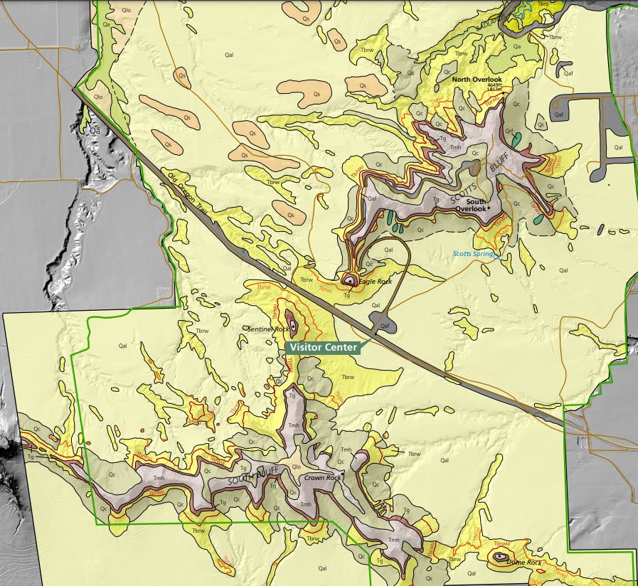
Description: Scotts Bluff National Monument geologic map, where Tbro and Tbrw are the Orella and Whitney Members of the Brule Formation respectively, Tg is the Gering Formation, Tmh are the Monroe-Harrison Formations, and Qal is alluvium
Title: Scotts Bluff National Monument geologic map
Credit: Geologic Map of Scotts Bluff National Park, US Dept. of the Interior, National Park Service, https://www.nps.gov/articles/nps-geodiversity-atlas-scotts-bluff-national-monument.htm
Author: US Department of the Interior National Park Service
Usage Terms: Public domain
License: Public domain
Attribution Required?: No
Image usage
The following page links to this image:

All content from Kiddle encyclopedia articles (including the article images and facts) can be freely used under Attribution-ShareAlike license, unless stated otherwise.