
Image: Scrope1833PopulationMap
Size of this preview: 800 × 513 pixels. Other resolutions: 320 × 205 pixels | 1,506 × 966 pixels.
Original image (1,506 × 966 pixels, file size: 301 KB, MIME type: image/jpeg)
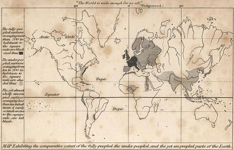
Description: A map of population density, from an 1833 book by George Poulett Scrope on Political Economy. The cartographer is not credited. Obtained from a public domain scan at archive.org
Usage Terms: Public domain
Image usage
The following page links to this image:

All content from Kiddle encyclopedia articles (including the article images and facts) can be freely used under Attribution-ShareAlike license, unless stated otherwise.