
Image: Seattle map - Sanborn Perris 1893 - U. District v3
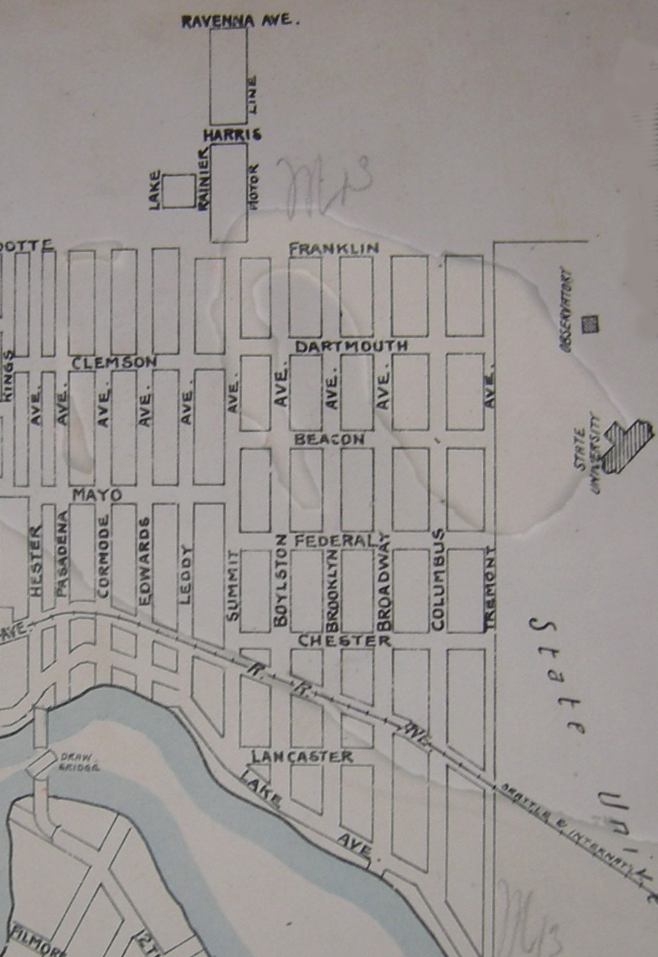
Description: Part of key map, Seattle, Washington 1893 Volume 2, Sanborn-Perris Map Co. Limited, New York, (1893). Shows Brooklyn (now the University District) before the street names were changed. The observatory at upper right (on the University of Washington Campus) remains in the same place. What was then "Brooklyn" is now 12th Avenue NE: see Paul Dorpat, Seattle Neighborhoods: University District -- Thumbnail History, HistoryLink, June 18, 2001. Wyandotte (a name only partly visible on this map) and Franklin Streets are now 45th Street. Part of Pasadena Avenue (or something near it) remains as Pasadena Place. Further commentary can be found at Image:Seattle map - Sanborn Perris 1893 - U. District v2.jpg. This is an image of a plastic-covered document: some reflections and also some shadow.
Title: Seattle map - Sanborn Perris 1893 - U. District v3
Credit: Key map, Seattle, Washington 1893 Volume 2, Sanborn-Perris Map Co. Limited, New York, (1893)
Author: Sanborn-Perris Map Co. Limited
Permission: PD-US
Usage Terms: Public domain
License: Public domain
Attribution Required?: No
Image usage
The following page links to this image:
