
Image: Second world war europe 1941-1942 map en
Size of this preview: 654 × 600 pixels. Other resolutions: 262 × 240 pixels | 1,090 × 1,000 pixels.
Original image (1,090 × 1,000 pixels, file size: 214 KB, MIME type: image/png)
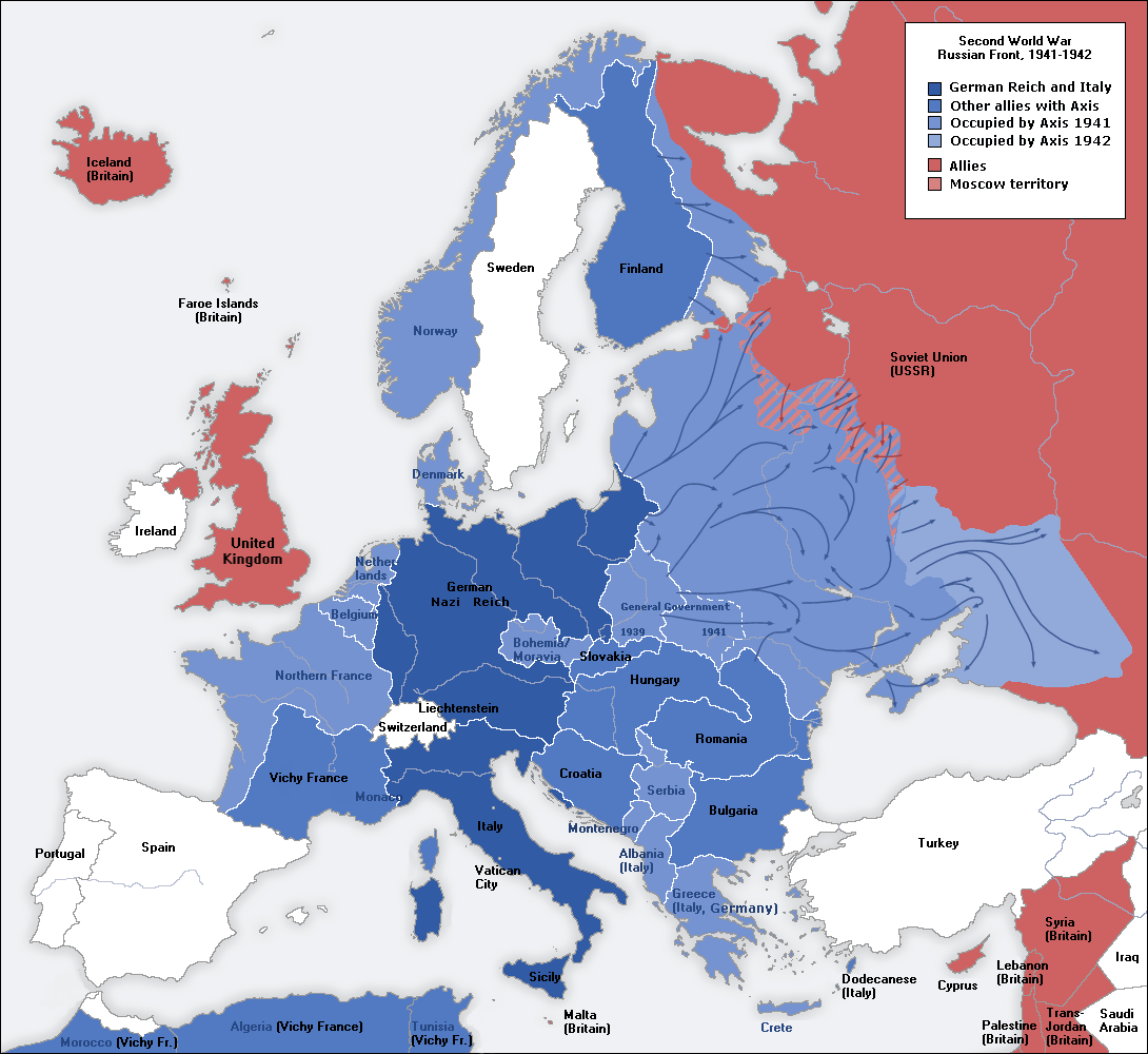
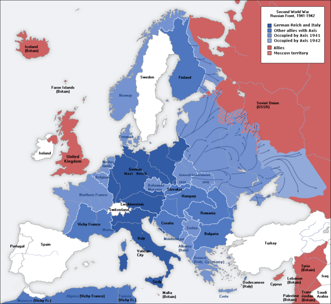
Description: A map of German front of the Second World War circa 1941-1942.
Title: Second world war europe 1941-1942 map en
Credit: This file was derived from: Second world war europe 1941-1942 map de.png
Author: Original Author: User:San Jose Derivative Author: User:ArmadniGeneral
Permission: This image is a translation of the original, created and released under the terms of the GNU Free Documentation License.
Usage Terms: Creative Commons Attribution-Share Alike 3.0
License: CC-BY-SA-3.0
License Link: http://creativecommons.org/licenses/by-sa/3.0/
Attribution Required?: Yes
Image usage
The following page links to this image:

All content from Kiddle encyclopedia articles (including the article images and facts) can be freely used under Attribution-ShareAlike license, unless stated otherwise.