
Image: Secunda etas mundi = - Norman B. Leventhal Map Center at the BPL

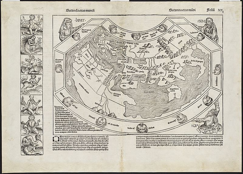
Description: Zoom into this map at maps.bpl.org. Author: Schedel, Hartmann Publisher: Anton Koberger Date: [12 July 1493] Scale: Scale not given. Call Number: G3200 1493.S3 Although published just as news of Christopher Columbuss discoveries was beginning to spread, this was the last noteworthy world map to be produced without any indication of the New World. This depiction of the Old World was fanciful, and unlike earlier Ptolemaic maps, contained little detail. The text and wood cut illustrations, including this world map, which appeared in the Nuremberg Chronicle, were an amalgam of legend, fancy, and tradition interspersed with occasional scientific fact. For example the world map is supported by three biblical figures Ham, Shem, and Japhet while the marginal panel consists of exotic figures believed to exist in foreign lands.
Title: Secunda etas mundi = - Norman B. Leventhal Map Center at the BPL
Credit: Secunda etas mundi =
Author: http://maps.bpl.org
Usage Terms: Creative Commons Attribution 2.0
License: CC BY 2.0
License Link: https://creativecommons.org/licenses/by/2.0
Attribution Required?: Yes
Image usage
The following page links to this image:
