
Image: Shomron map

Size of this preview: 431 × 599 pixels. Other resolutions: 173 × 240 pixels | 554 × 770 pixels.
Original image (554 × 770 pixels, file size: 41 KB, MIME type: image/png)
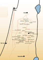
Description: A map of Jewish settlements in the Shomron regional council on the West Bank.
Title: Shomron map
Credit: Own work
Author: Appleville
Usage Terms: Public domain
License: Public domain
Attribution Required?: No
Image usage
The following page links to this image:

All content from Kiddle encyclopedia articles (including the article images and facts) can be freely used under Attribution-ShareAlike license, unless stated otherwise.