
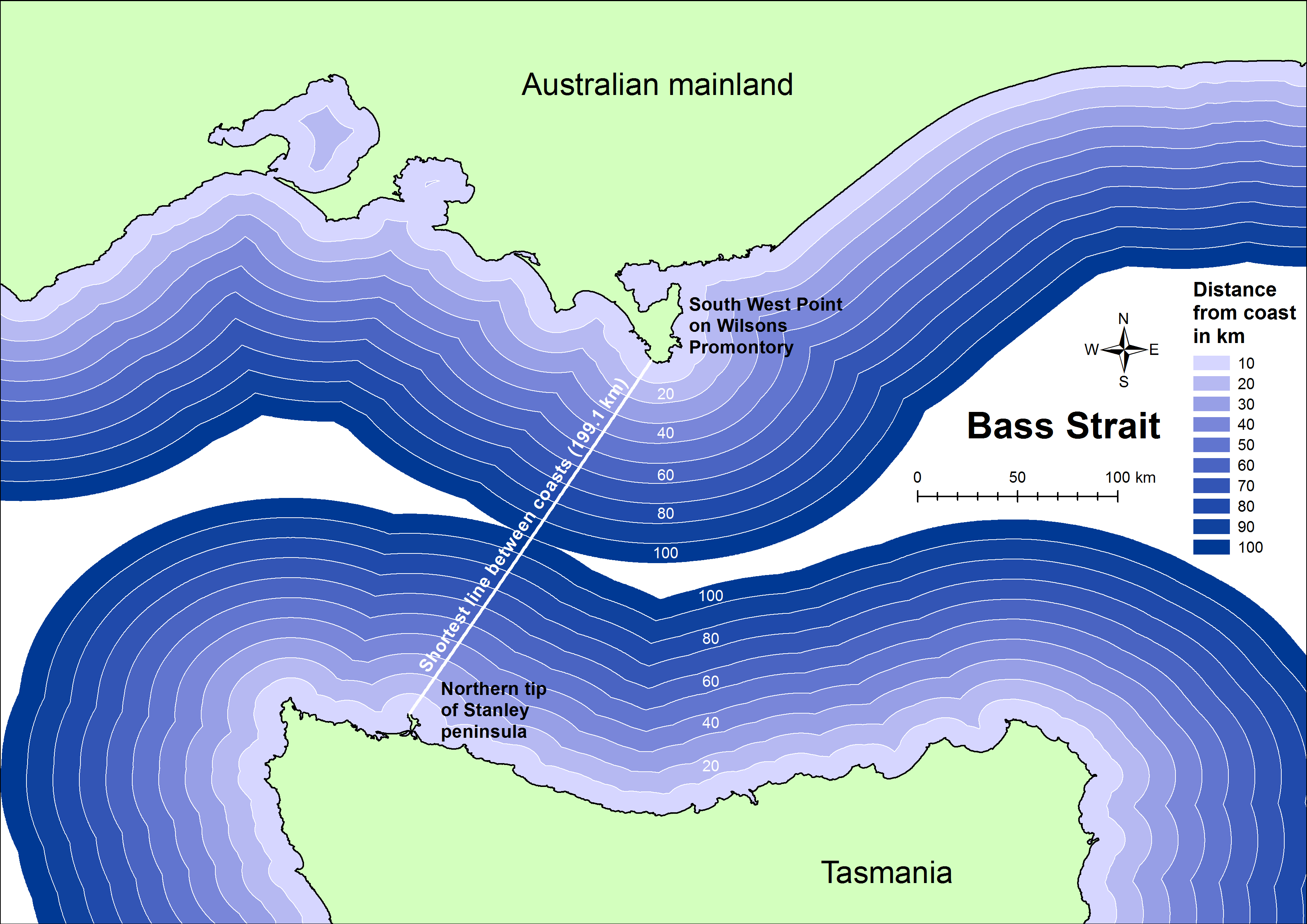
Image: Shortest distance between coasts of Bass Strait
Description: A map demonstrating the shortest distance between the coasts of Bass Strait, i.e. between the Australian and Tasmanian mainlands. Created using ESRI ArcMap 10.2. The two landing points are (determined with ArcMap's Near tool): -39.1258,146.34619 ("South West Point" on Wilsons Promontory) -40.71249,145.2605 (The unnamed northern tip of the peninsula that also hosts Stanley) The distance between the two points is 199.126 kilometres (ArcMap Near tool calculation, online reference). Coastline data: Geoscience Australia's GEODATA COAST 100K 2004 dataset. 1:100,000 scale. Released under Creative Commons Attribution 4.0 International Licence.
Title: Shortest distance between coasts of Bass Strait
Credit: Own work
Author: Christallkeks
Usage Terms: Creative Commons Attribution-Share Alike 4.0
License: CC BY-SA 4.0
License Link: http://creativecommons.org/licenses/by-sa/4.0
Attribution Required?: Yes
Image usage
The following page links to this image:
