
Image: Sievert-sigle
No higher resolution available.
Sievert-sigle.png (700 × 517 pixels, file size: 287 KB, MIME type: image/png)
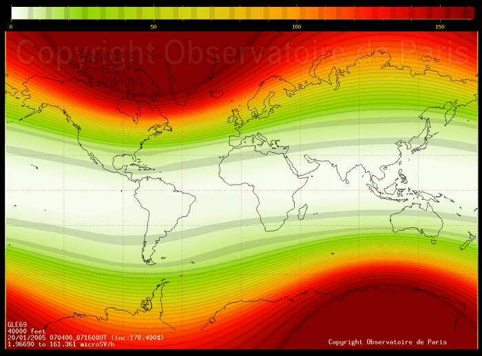
Description: World map of the estimated hourly radiation dose at 40000 feet during jan 20th 2005 ground level event maximum.
Title: Sievert-sigle
Credit: Observatoire de Paris
Author: N. Fuller
Usage Terms: Creative Commons Attribution 2.5
License: CC BY 2.5
License Link: http://creativecommons.org/licenses/by/2.5
Attribution Required?: Yes
Image usage
The following page links to this image:

All content from Kiddle encyclopedia articles (including the article images and facts) can be freely used under Attribution-ShareAlike license, unless stated otherwise.