
Image: Skirmish at Mill Point WV Step 2
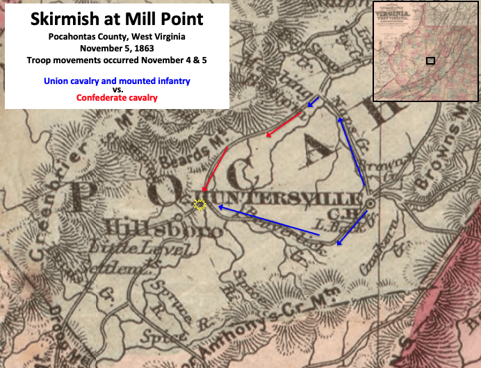
Description: The map shows Union and Confederate troop movements leading to a skirmish at Mill Point, West Virginia, on November 5, 1863. Additional troops for both sides fought on the next day 11 miles (18 km) south in the Battle of Droop Mountain. Schoonmaker took the southern route for the Union. Oley took the west-then-south route. Arnett took the CSA route (red).
Title: Skirmish at Mill Point WV Step 2
Credit: This is two portions of an 1876 map created by G.W. & C.B. Colton & Co. The entire map can be found in the Library of Congress here, and shows Virginia and West Virginia. Text box and arrows etc. were added by TwoScarsUp based on description in the book Last Sleep - the Battle of Droop Mountain by Terry Lowry.
Author: G.W. & C.B. Colton published map in 1876, modifications by TwoScarsUp in 2020
Usage Terms: Public domain
License: Public domain
Attribution Required?: No
Image usage
The following page links to this image:
