
Image: Sleaford-Map-1891-Simplified

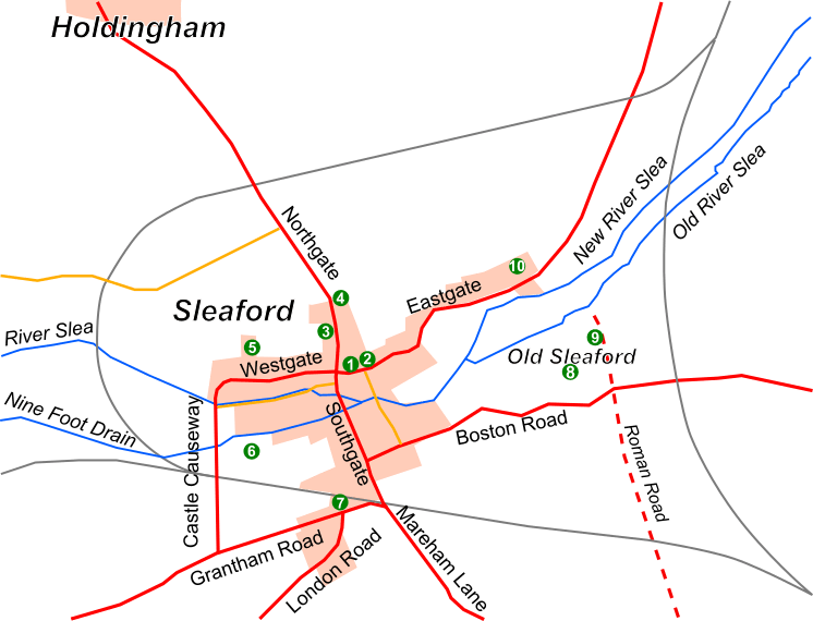
Description: A map of Sleaford, Lincolnshire, as it was in 1891, showing the main roads (solid red), lesser roads (solid yellow-orange), built-up area (pink), rivers (solid blue), railways (solid grey), historic roads (dashed red) and sites of interest (green circles, numbered). The map is derived from the 1891 Ordnance Survey (1:10,560) map of the area. Key: (1) Market Place, (2) St Denys' Church, (3) Manor House, (4) Carre's Grammar School, (5) Westholme House, (6) Castle, (7) Station, (8) Old Place, (9) the remains of St Giles's Church, and (10) the Union workhouse.
Title: Sleaford-Map-1891-Simplified
Credit: Created by me in Inkscape, based on the 1891 Ordnance Survey map of the town: [1] and [2]. Previously published: NA
Author: Noswall59
Usage Terms: Creative Commons Attribution-Share Alike 3.0
License: CC BY-SA 3.0
License Link: http://creativecommons.org/licenses/by-sa/3.0
Attribution Required?: Yes
Image usage
The following page links to this image:
