
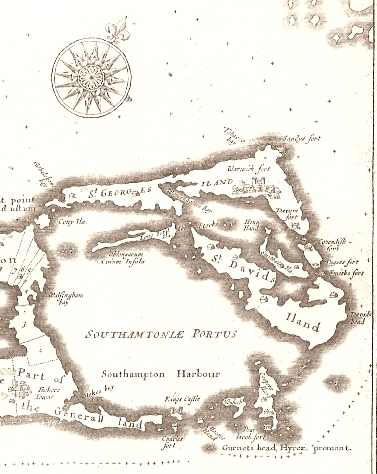
Image: Somers Isles Map by John Speed 1676 - Parish of St George
Description: Detail from a map of the Somers Isles, by John Speed, 1676. The area shown is St. George's Parish, originally the Common, General, or King's land, which means it was not part of the area exploited by the Somers Isles Company. The Parish included the South-East part of the Main Island (or Bermuda, or Great Bermuda), as well as St. George's and St. David's Islands, the small islands (Castle Islands) at the south of Castle Harbour (known as Southampton Harbour, until renamed due to the presence of the fortifications on those islets), and various other neighbouring islands. The shape of this area would change radically when the US Army began construction of an air base, Kindley Field, in 1941.
Title: Somers Isles Map by John Speed 1676 - Parish of St George
Credit: This file was derived from: Somers Isles Map - John Speed 1676.jpg
Author: John Speed
Usage Terms: Public domain
License: Public domain
Attribution Required?: No
Image usage
The following 5 pages link to this image:
