
Image: South Dakota general map 2
Size of this preview: 800 × 543 pixels. Other resolutions: 320 × 217 pixels | 2,254 × 1,531 pixels.
Original image (2,254 × 1,531 pixels, file size: 3.71 MB, MIME type: image/png)
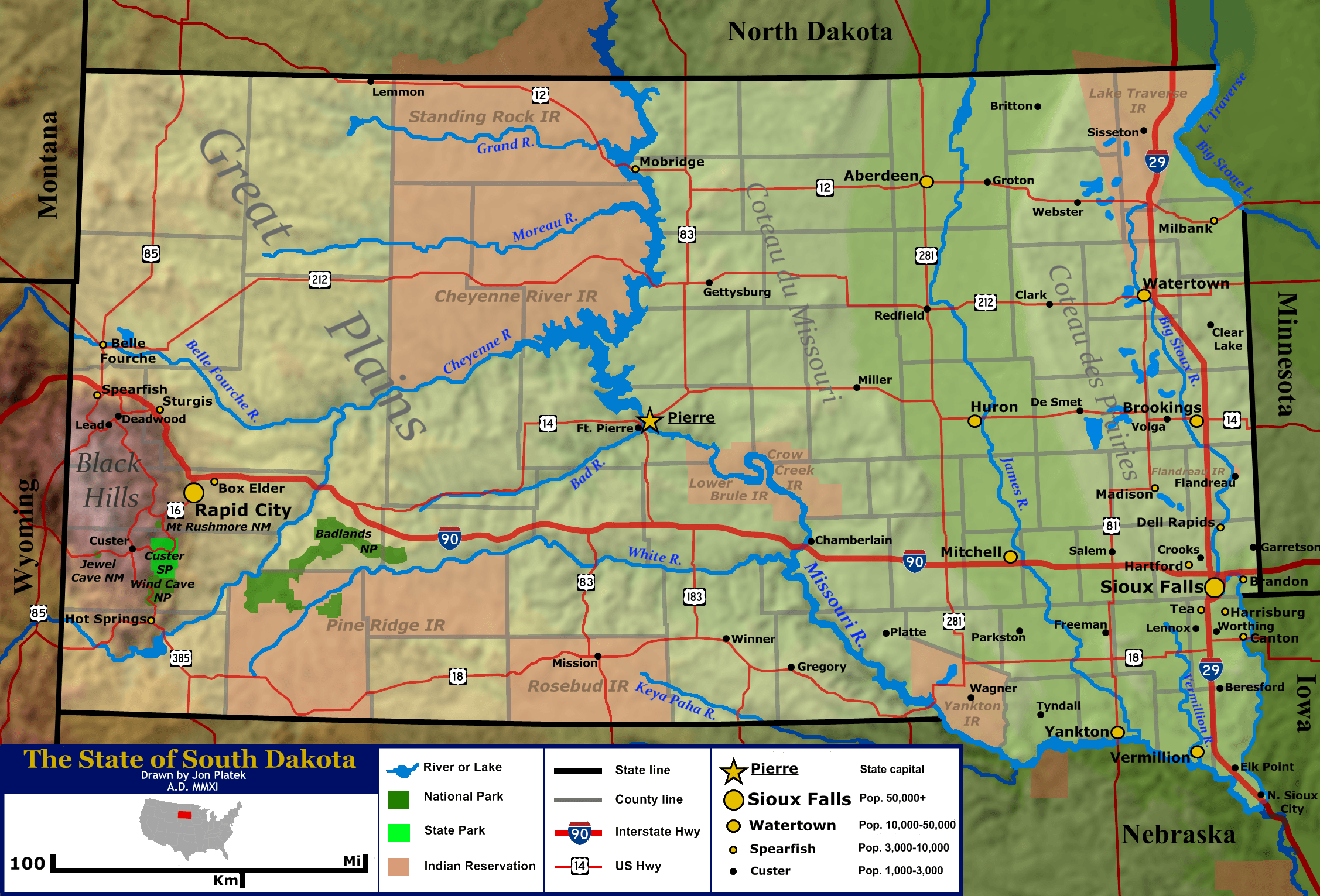
Description: General map of the US state of South Dakota. Shown are the state's topography, major cities and roads, boundaries, and bodies of water.
Title: South Dakota general map 2
Credit: Base topography map is from the public domain National Atlas, as were several layers used as reference points. Highway shields were by User:SPUI and released to the public domain. US locator map was by User:Theshibboleth. All other work was done by the uploader.
Author: Jon Platek.
Usage Terms: Creative Commons Attribution-Share Alike 3.0
License: CC BY-SA 3.0
License Link: http://creativecommons.org/licenses/by-sa/3.0
Attribution Required?: Yes
Image usage
The following 2 pages link to this image:

All content from Kiddle encyclopedia articles (including the article images and facts) can be freely used under Attribution-ShareAlike license, unless stated otherwise.