
Image: South Florida Satellite Image Map

Size of this preview: 380 × 599 pixels. Other resolutions: 152 × 240 pixels | 2,715 × 4,277 pixels.
Original image (2,715 × 4,277 pixels, file size: 2.91 MB, MIME type: image/jpeg)
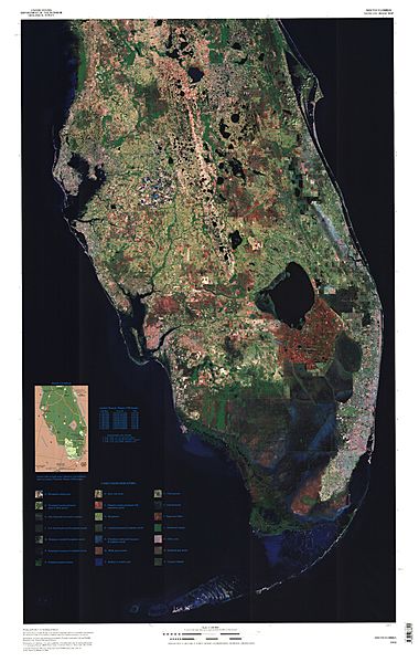
Description: Satellite image of the lower Florida peninsula. The darkened portion south of Lake Okeechobee is the Everglades.
Title: South Florida Satellite Image Map
Credit: http://education.usgs.gov/common/lessons/map_mysteries.html
Author: US Geological Survey
Permission: Public domain
Usage Terms: Public domain
License: Public domain
Attribution Required?: No
Image usage
The following page links to this image:

All content from Kiddle encyclopedia articles (including the article images and facts) can be freely used under Attribution-ShareAlike license, unless stated otherwise.