
Image: Southease Swing Bridge - geograph.org.uk - 1092218
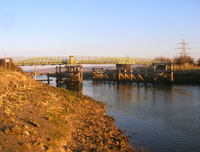
Description: Southease Swing Bridge Viewed from the western bank. Prior to a bridge the original crossing was further to the south at Stocks Ferry until a bridge was added when the river was straightened sometime between 1790 and 1810. This bridge was replaced by the swing bridge in the 1880s to allow navigation up to Asham Wharf and Lewes. The cement works which used Asham Wharf closed in 1967 and since then no large water-borne traffic has needed to sail up river and consequently the bridge has not been opened since though the mechanism still exists should there be a need to. The bridge itself carried traffic from the western to eastern side of the valley though this route too has been blocked up with minimal vehicular traffic crossing to use Southease station or gain private access to Itford Farm. However, the bridge is well used by walkers carrying the South Downs Way across the Ouse valley as well as connecting with footpaths on either side of the river between Newhaven and Lewes.
Title: Southease Swing Bridge - geograph.org.uk - 1092218
Credit: From geograph.org.uk
Author: Simon Carey
Usage Terms: Creative Commons Attribution-Share Alike 2.0
License: CC BY-SA 2.0
License Link: https://creativecommons.org/licenses/by-sa/2.0
Attribution Required?: Yes
Image usage
The following page links to this image:
