
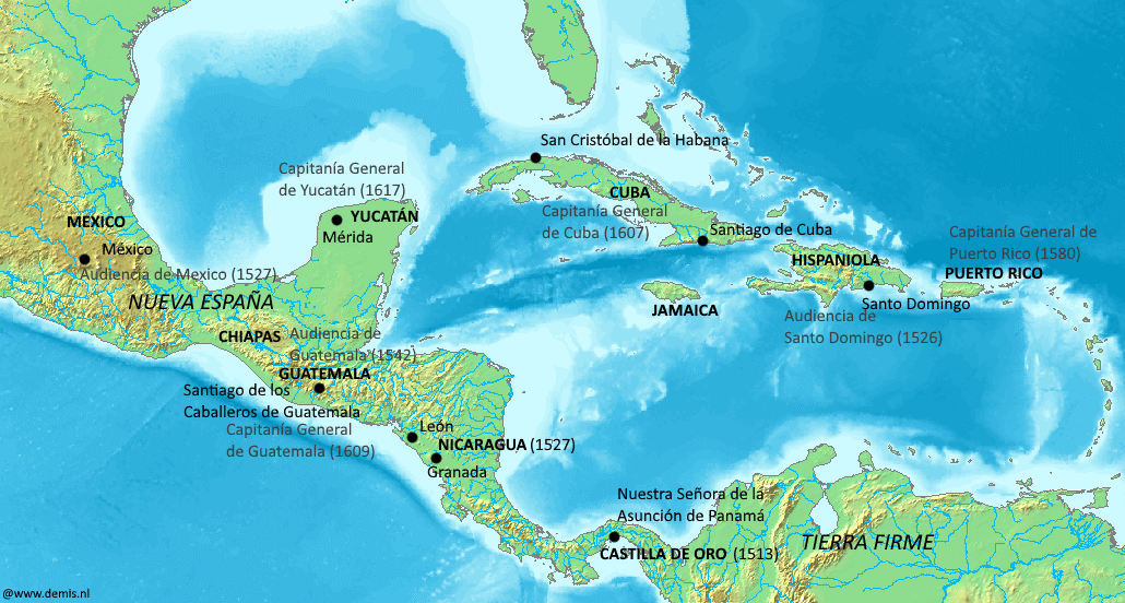
Image: Spanish jurisdictions 16th-17th centuries, Caribbean and Gulf of Mexico
Size of this preview: 800 × 429 pixels. Other resolutions: 320 × 171 pixels | 1,030 × 552 pixels.
Original image (1,030 × 552 pixels, file size: 198 KB, MIME type: image/png)
Description: Spanish provinces, audiencias and captaincies general in the Caribbean and Gulf of Mexico, in the 16th to 17th centuries.
Title: Spanish jurisdictions 16th-17th centuries, Caribbean and Gulf of Mexico
Credit: Own work. Base map public domain, from demis.nl, see here for confirmation of public domain status.
Author: Simon Burchell
Usage Terms: Creative Commons Attribution-Share Alike 4.0
License: CC BY-SA 4.0
License Link: https://creativecommons.org/licenses/by-sa/4.0
Attribution Required?: Yes
Image usage
The following page links to this image:

All content from Kiddle encyclopedia articles (including the article images and facts) can be freely used under Attribution-ShareAlike license, unless stated otherwise.