
Image: Spring Creek Park Map 1
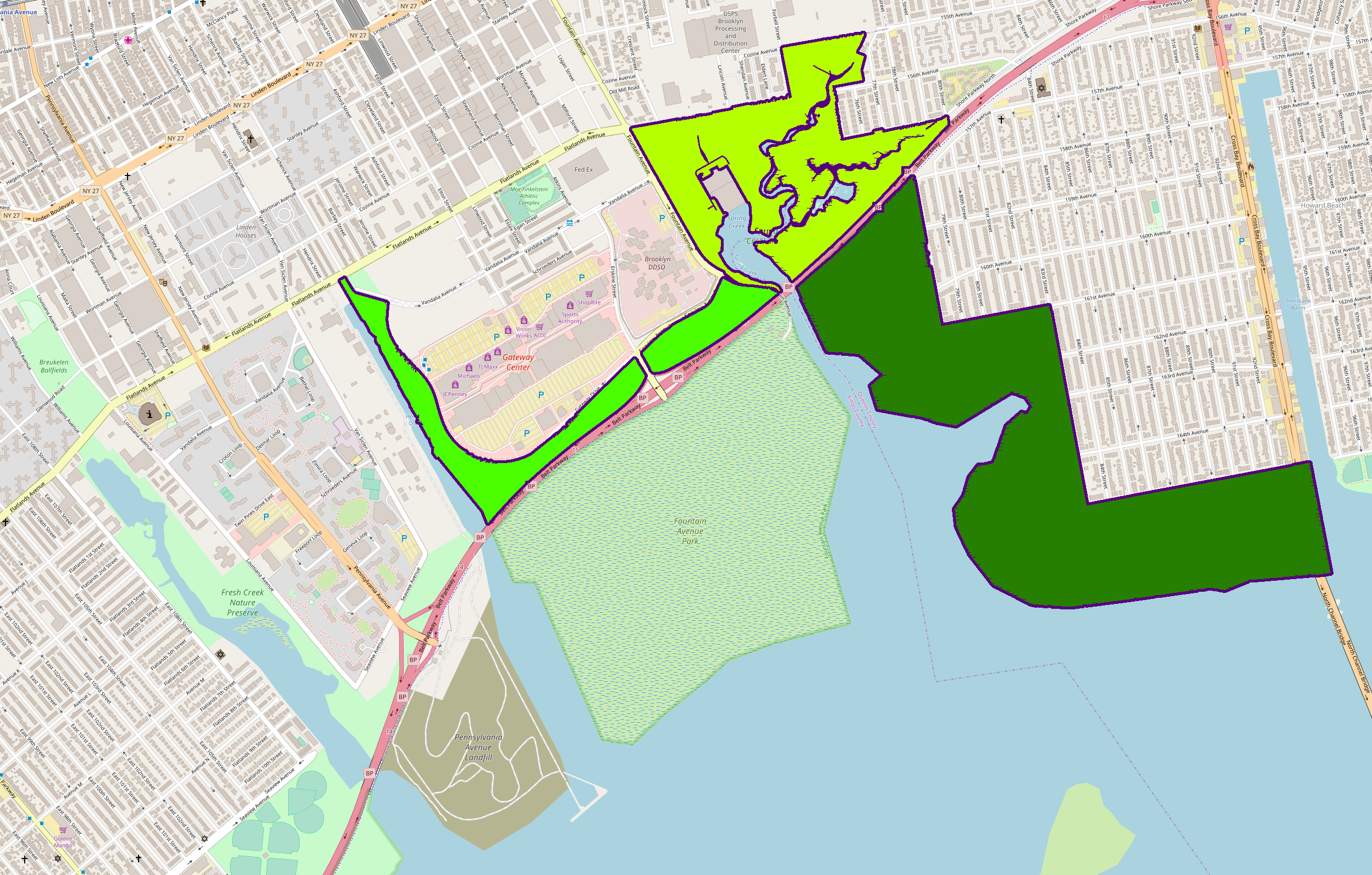
Description: A map of Spring Creek, Brooklyn and Howard Beach, Queens. Highlighted in green are the sections of Spring Creek Park. The dark green section, also the southernmost and easternmost section, is located entirely in Howard Beach and known as Spring Creek South. It was created from a former landfill. Because it lies south of the Belt Parkway, it is part of the Gateway National Recreation Area of the National Parks Service. The yellow-green or central section is called Spring Creek North, and is managed by the New York City Department of Parks and Recreation. It is located at the former mouth of Spring Creek (the park namesake) on the Brooklyn-Queens border. A water treatment plant (gray) is located in this section. The bright green or western section is also managed by NYC Parks, and straddles the Gateway Center mall in Spring Creek. It was created by the mall developers in the 2000s, and is the only section of the park that is regularly accessible to the public.
Title: Spring Creek Park Map 1
Credit: openstreetmap.org
Author: OpenStreetMap (map data) User:Tdorante10 (highlighting)
Usage Terms: Creative Commons Attribution-Share Alike 2.0
License: CC BY-SA 2.0
License Link: https://creativecommons.org/licenses/by-sa/2.0
Attribution Required?: Yes
Image usage
The following page links to this image:
