Spring Creek Park facts for kids
Quick facts for kids Spring Creek Park |
|
|---|---|
 |
|
| Type | Public park |
| Location | Spring Creek, Brooklyn and Howard Beach, Queens, New York |
| Operated by | New York City Department of Parks and Recreation, National Park Service |
Spring Creek Park is a public park located along the Jamaica Bay shoreline in New York City. It sits between the neighborhoods of Howard Beach, Queens, and Spring Creek, Brooklyn. This park was created on land that used to be marshland, which was filled in. Most of the park is a natural area, with only some parts open for people to visit and enjoy.
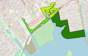
Spring Creek Park has three main sections. These sections surround Spring Creek itself and other smaller waterways. The southern part, called Spring Creek South, is in Queens. It is mostly marsh and forest on the Howard Beach shoreline. Spring Creek North is a fenced-off area north of the Belt Parkway. It is located right on the border between Brooklyn and Queens. A third section of the park was built around the Gateway Center shopping mall in Brooklyn. The southern part of the park is managed by the National Park Service as part of the Gateway National Recreation Area. The northern and Gateway Center parts are managed by the New York City Department of Parks and Recreation.
A park along Spring Creek was first suggested in 1930. It was decided that the park would be built on filled-in land because it was mostly marsh. Spring Creek Park was approved in 1942, and work to fill the land began in 1949. Temporary sites for waste disposal were used here until the South Shore Incinerator was finished in 1954. The southern part of Spring Creek Park became part of the Gateway National Recreation Area in 1974. In the 1990s, the northern section of the park grew larger. In 2003, extra parkland was added when the Gateway Center mall was built. The Shirley Chisholm State Park opened nearby in 2019.
Contents
What Does Spring Creek Park Look Like?
Spring Creek Park is on the northern coast of Jamaica Bay. It stretches from Cross Bay Boulevard in Howard Beach to the Fresh Creek Basin near Starrett City. Most of the park is next to or south of the Shore Parkway, which is part of the Belt Parkway. A small part of the park goes north to Stanley Avenue.
Exploring Spring Creek South
This part of the park is in Howard Beach. It is bordered by the Belt Parkway to the north and Jamaica Bay to the south. Cross Bay Boulevard is to the east. This area is called "Spring Creek South." The federal National Park Service manages it.
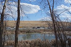
Much of this area used to be a city waste site. Today, you can find forests, grasslands, and marshes here. There are two paths for walking through this part of the park. Local people sometimes call this area "the Weeds" or "the Baja" because it has lots of plants and feels far away. It can also have brush fires if the weather is very dry. Since it is part of a national park, everyone can visit this area.
Discovering Spring Creek North
This second part of the park is north of the Belt Parkway. It is along the Brooklyn-Queens border. This section has parts of Spring Creek and a smaller creek called Ralph's Creek. The New York City Department of Parks and Recreation manages this area. It is known as "Spring Creek North" or the "Spring Creek Park Preserve."
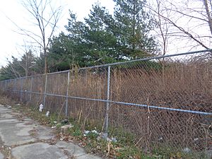
The Parks Department calls this area a "Forever Wild" nature preserve. This means it is not open to the public. Because of this, the area is surrounded by chain-link fencing. The Parks Department says this is the "largest undeveloped salt marsh" in northern Jamaica Bay. It is home to many birds and land animals.
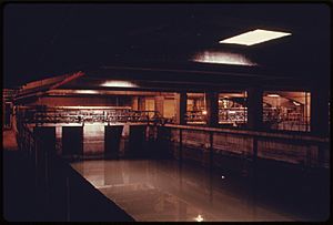
Even though it is "Forever Wild," Spring Creek North has two large waste facilities. A water treatment plant is in this section. There is also an old incinerator, which is now used for cleaning and composting. These areas were also used for waste in the past.
The Gateway Center Parkland
The third part of the park is west of the Belt Parkway. It is along the southern and western edges of the Gateway Center shopping mall. The Parks Department also manages this section. It was built in 2003 when the Gateway Center was developed. This area has about 47 acres (19 hectares) of parkland. About 31 acres (13 hectares) are open to the public.
This section has wetlands that were built by people. These wetlands help filter rainwater that runs off from the mall's parking lot. The water then flows into Hendrix Creek or into the wetlands along the parkway.
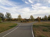
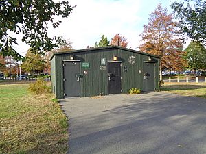
This part of the park also has a cricket pitch called the Roy Sweeney Cricket Oval. It is the first park field in New York City made just for cricket. It was named after Roy Sweeney, who started a cricket group in 1986. A bike and running path goes through the park. There is also a public restroom near the cricket oval, which was finished in 2013.
Nearby Parks and Transportation
Two other areas that were once part of the park are now the Pennsylvania Avenue and Fountain Avenue Landfills. These old landfills became the Shirley Chisholm State Park in 2018. This new state park opened in 2019.
You can reach the park by bus. The B13, B83, B84, Q8 bus routes serve the Brooklyn parts of the park. The Q21, Q41 and Q52, Q53 bus routes serve the Howard Beach parts. The closest subway stations are New Lots Avenue and Howard Beach–JFK Airport.
How Spring Creek Park Was Made
Long ago, during the Ice Ages, huge sheets of ice moved across North America. They created hills and valleys. A large ridge, called a moraine, formed across the middle of Long Island. Streams like Spring Creek flowed south from this ridge towards Jamaica Bay. Spring Creek later became the border between Brooklyn and Queens.
In the early 1900s, the area that is now Spring Creek Park was mostly marshland. The Howard Beach area was also undeveloped wetlands.
Building the Park and Filling the Land
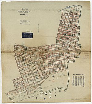
In 1930, a group called the New York Park Association suggested building a park at Spring Creek. They said it was the "last opportunity in Brooklyn for a new park of substantial size." It was decided that the swampy land would need to be filled in. Robert Moses, a famous city planner, planned to create several parks on wetlands by filling them with city waste.
In 1942, the Spring Creek Park project was approved. By 1948, parts of the park in Brooklyn were being filled. A "Super Dump" was approved in 1948 to fill the land in Howard Beach. This dump would operate until the South Shore Incinerator was built. The landfill work began in 1949. The goal was to raise the land by about 16 feet (5 meters). People liked the project because it helped get rid of waste and improved the area.
At Spring Creek, waste from water treatment plants was mixed with sand to create new soil for plants. This was called "Operation Sludge." The South Shore Incinerator opened in 1954. Robert Moses planned for Spring Creek Park to include a new beach and boat area. The filling of the Queens section of the park was finished between 1956 and 1958. This work changed the land and plants in the area a lot.
Growing the Park
In 1969, a plan was made to create the Gateway National Recreation Area. This national park would include many sites around New York Harbor and Jamaica Bay. In 1971, people wanted Spring Creek Park to be part of this new national park. They hoped it would stop John F. Kennedy International Airport from expanding into the area.
The law creating the Gateway National Recreation Area was signed in 1972. In 1974, the Howard Beach section of Spring Creek Park officially became part of the Gateway Area.
The Spring Creek water treatment plant opened in 1974. In the 1990s, more land north of the Belt Parkway was added to Spring Creek Park North. In 2001, more land, including the old incinerator site, was added. A composting facility opened there in 2001. After the Gateway Center mall opened in 2002, more parkland was built around the mall, opening in 2003. A comfort station (restroom) for the cricket field was designed in 2007 and finished in 2013.
After Hurricane Sandy in 2012, plans were made to restore the wetlands in Spring Creek Park. These wetlands help protect Howard Beach and other neighborhoods from storm surges.
In 2018, Governor Andrew Cuomo announced plans for the Shirley Chisholm State Park. This new state park would be next to the old landfill sites near Spring Creek Park. The first part of this park opened in 2019.
Around 2018, small amounts of radium were found in the Howard Beach section of Spring Creek Park. This was found during work on a restoration project. It is believed the radium came from when the area was used as a landfill. Park officials are working to address this.
 | Chris Smalls |
 | Fred Hampton |
 | Ralph Abernathy |


