
Image: St Michaels 1813 War v2
Size of this preview: 695 × 600 pixels. Other resolutions: 278 × 240 pixels | 854 × 737 pixels.
Original image (854 × 737 pixels, file size: 541 KB, MIME type: image/png)
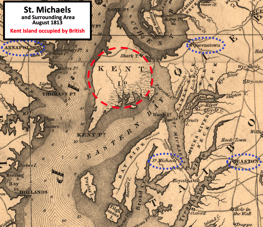
Description: This is an 1841 map used to illustrate the situation for St. Michaels in August 1813 during the War of 1812. The British occupied Kent Island, and targeted Queenstown, St. Michaels, and Easton. After the first attack of St. Michaels and an attack on Queenstown, they landed northwest of St. Michaels and attacked again.
Title: St Michaels 1813 War v2
Credit: This is a crop of a Map of Maryland published in 1841, from the U.S. Library of Congress found here.
Author: Fielding Lucas Jr. (1781-1854) with label and circles added by TwoScarsUp
Usage Terms: Public domain
License: Public domain
Attribution Required?: No
Image usage
The following page links to this image:

All content from Kiddle encyclopedia articles (including the article images and facts) can be freely used under Attribution-ShareAlike license, unless stated otherwise.